|
Al-Zarah
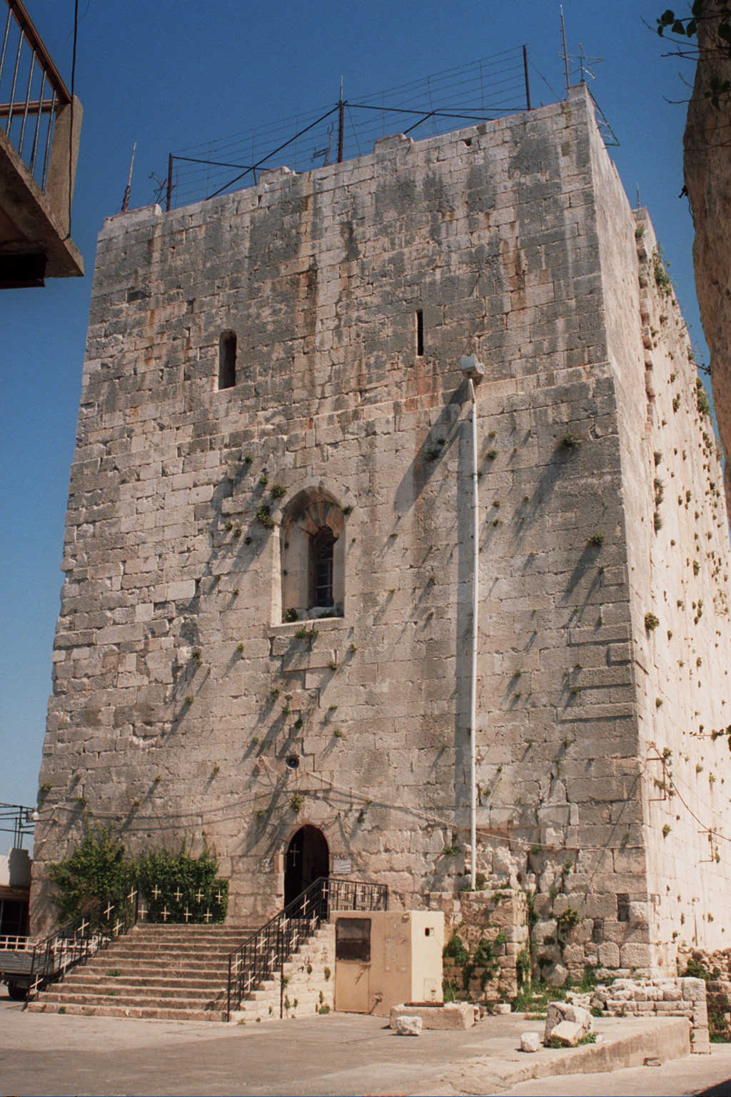
Al-Zarah ( ar, الزارة, al-Zārah, also spelled Zara) is a village in northwestern Syria, administratively part of the Homs Governorate, located west of Homs. Nearby localities include district center Talkalakh to the south, Aridah to the southeast, Hadidah to the east, al-Husn and Anaz to the northeast, Zweitinah to the north, Tell Hawsh to the northwest, Naarah to the west and Halat to the southwest. According to the Syria Central Bureau of Statistics (CBS), al-Zarah had a population of 4,336 in the 2004 census. It is second largest locality in the Talkalakh ''nahiyah'' ("subdistrict") which consists of 40 localities with a collective population of 62,069 in 2004.General Census of Population and Housing 2004 [...More Info...] [...Related Items...] OR: [Wikipedia] [Google] [Baidu] |
Governorates Of Syria
Syria is a unitary state, but for administrative purposes, it is divided into fourteen governorates, also called provinces or counties in English (Arabic ''muḥāfaẓāt'', singular '' muḥāfaẓah''). The governorates are divided into sixty-five districts (''manāṭiq'', singular '' minṭaqah''), which are further divided into subdistricts (''nawāḥī'', singular '' nāḥiyah''). The ''nawāḥī'' contain villages, which are the smallest administrative units. Each governorate is headed by a governor, appointed by the president, subject to cabinet approval. The governor is responsible for administration, health, social services, education, tourism, public works, transportation, domestic trade, agriculture, industry, civil defense, and maintenance of law and order in the governorate. The minister of local administration works closely with each governor to coordinate and supervise local development projects. The governor is assisted by a provincial council, all of who ... [...More Info...] [...Related Items...] OR: [Wikipedia] [Google] [Baidu] |
Tartus
) , settlement_type = City , image_skyline = , imagesize = , image_caption = Tartus corniche Port of Tartus • Tartus beach and boulevard Cathedral of Our Lady of Tortosa • Al-Assad Stadium Citadel of Tartus , image_seal = Emblem of Tartus.svg , seal_size = 60px , mapsize1 = TarusSeadefence.jpg , pushpin_map = Syria#Mediterranean east#Asia , pushpin_label_position = bottom , pushpin_mapsize = 250 , pushpin_map_caption = Location in Syria , pushpin_relief = 1 , subdivision_type = Country , subdivision_name = , subdivision_type1 = Governorate , subdivision_name1 = Tartus Governorate , subdivision_type2 = District , subdivision_name2 = Tartus District , subdivision_type3 = Subdistrict , subdivision_name3 = Tartus Subdistrict , leader_title = Governor , leader_name = Abdel Halim Khalil , e ... [...More Info...] [...Related Items...] OR: [Wikipedia] [Google] [Baidu] |
Margat
Margat, also known as Marqab ( ar, قلعة المرقب, ''Qalaat al-Marqab'', lit=Castle of the Watchtower), is a castle near Baniyas, Syria, which was a Crusader fortress and one of the major strongholds of the Knights Hospitaller. It is located around from the Mediterranean coast and approximately south of Baniyas. The castle remained in a poor state of preservation until 2007 when some reconstruction and renovation began. Fortress History Margat is located on a hill formed by an extinct volcano high about above sea level on the road between Tripoli and Latakia, overlooking the Mediterranean Sea. According to Arab sources, the site of Margat Castle was first fortified in 1062 by Muslims who continued to hold it within the Christian Principality of Antioch in the aftermath of the First Crusade. When the Principality was defeated at the Battle of Harran in 1104, the Byzantine Empire took advantage of their weakness and captured Margat from the Muslims. A few years late ... [...More Info...] [...Related Items...] OR: [Wikipedia] [Google] [Baidu] |
Safita
Safita ( ar, صَافِيتَا '; phn, 𐤎𐤐𐤕𐤄, ''Sōpūte'') is a city in the Tartous Governorate, northwestern Syria, located to the southeast of Tartous and to the northwest of Krak des Chevaliers. It is situated on the tops of three hills and the valleys between them, in the Syrian Coastal Mountain Range. According to the Syria Central Bureau of Statistics (CBS), Safita had a population of 20,301 in the 2004 census. Geography Safita is situated at the southeastern end of the Syrian Coastal Mountain Range. It is southeast of the Mediterranean port city of Tartus and northwest of Homs. The average elevation of Safita is above sea level, while the Crusader fortress stands about . History Safita is located on a site where remains of the Phoenician settlement were discovered. The archaeological remains at the site of Tell Kazel were identified as the Phoenician city of Sumur mentioned in the Amarna letters. Crusader era Raymond IV, Count of Toulouse founde ... [...More Info...] [...Related Items...] OR: [Wikipedia] [Google] [Baidu] |
Krak Des Chevaliers
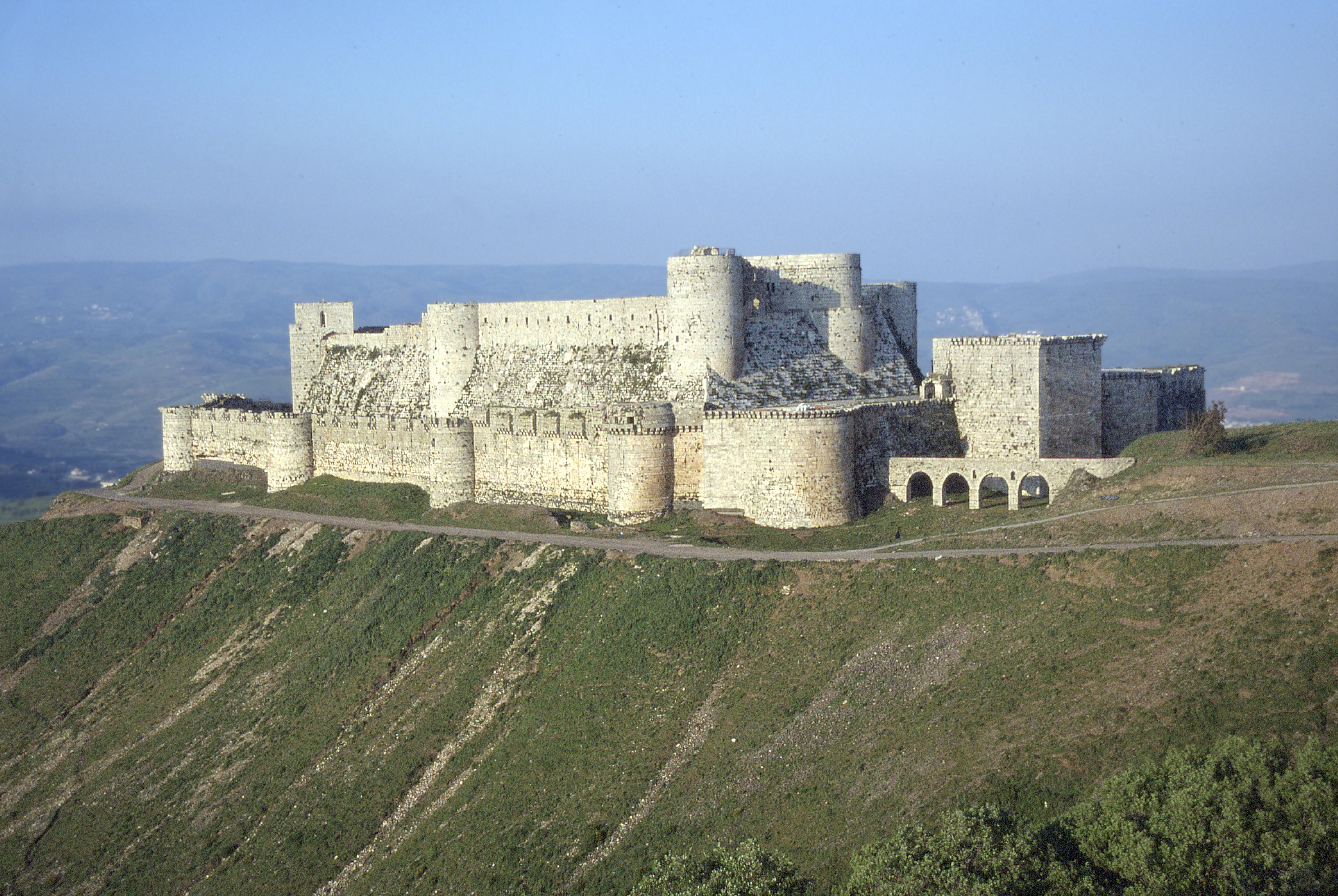
Krak des Chevaliers, ar, قلعة الحصن, Qalʿat al-Ḥiṣn also called Hisn al-Akrad ( ar, حصن الأكراد, Ḥiṣn al-Akrād, rtl=yes, ) and formerly Crac de l'Ospital; Krak des Chevaliers or Crac des Chevaliers (), is a medieval castle in Syria and one of the most important preserved medieval castles in the world. The site was first inhabited in the 11th century by Kurdish troops garrisoned there by the Mirdasids. In 1142 it was given by Raymond II, Count of Tripoli, to the order of the Knights Hospitaller. It remained in their possession until it fell in 1271. The Hospitallers began rebuilding the castle in the 1140s and were finished by 1170 when an earthquake damaged the castle. The order controlled a number of castles along the border of the County of Tripoli, a state founded after the First Crusade. Krak des Chevaliers was among the most important, and acted as a center of administration as well as a military base. After a second phase of building w ... [...More Info...] [...Related Items...] OR: [Wikipedia] [Google] [Baidu] |
County Of Tripoli
The County of Tripoli (1102–1289) was the last of the Crusader states. It was founded in the Levant in the modern-day region of Tripoli, northern Lebanon and parts of western Syria which supported an indigenous population of Christians, Druze and Muslims. When the Frankish Crusaders – mostly southern French forces – captured the region in 1109, Bertrand of Toulouse became the first count of Tripoli as a vassal of King Baldwin I of Jerusalem. From that time, the rule of the county was decided not strictly by inheritance but by factors such as military force (external and civil war), favour and negotiation. In 1289 the County of Tripoli fell to Sultan Qalawun of the Muslim Mamluks of Cairo. The county was absorbed into Mamluk Egypt. Capture by Christian forces Raymond IV of Toulouse was one of the wealthiest and most powerful of the crusaders.Tyerman C"God's war – a new history of the crusades"Harvard University Press. February, 2009. Even so, after the Firs ... [...More Info...] [...Related Items...] OR: [Wikipedia] [Google] [Baidu] |
Homs Gap
The Homs Gap ( ar, فتحة حمص) (also called the Akkar Gap and known in Arabic as al-Buqay'a) is a relatively flat passage in the Orontes River Valley of southern Syria. Nicknamed the "gateway to Syria," the gap separates the An-Nusayriyah Mountains and Jabal Zawiya from the Lebanon and Anti-Lebanon Mountains. The small Nahr al-Kabir river runs down the Gap to the Syrian coast to the Mediterranean Sea. For hundreds of years, traders and invaders have found the Homs Gap an important route from the coast to the country's interior and to other parts of Asia because it "provides the easiest access between the Mediterranean coast and the Syrian interior." The gap is also the only large crossing open year-round across the mountain ranges. Today, the highway and railroad in Homs to the Lebanese port of Tripoli run through the gap. A pipeline carrying oil also runs through the gap. In addition, the Krak des Chevaliers castle is in the Homs Gap. The castle was built in 1031 AD to ... [...More Info...] [...Related Items...] OR: [Wikipedia] [Google] [Baidu] |
Crusader States
The Crusader States, also known as Outremer, were four Catholic realms in the Middle East that lasted from 1098 to 1291. These feudal polities were created by the Latin Catholic leaders of the First Crusade through conquest and political intrigue. The four states were the County of Edessa (10981150), the Principality of Antioch (10981287), the County of Tripoli (11021289), and the Kingdom of Jerusalem (10991291). The Kingdom of Jerusalem covered what is now Israel and Palestine, the West Bank, the Gaza Strip, and adjacent areas. The other northern states covered what are now Syria, south-eastern Turkey, and Lebanon. The description "Crusader states" can be misleading, as from 1130 very few of the Frankish population were crusaders. The term Outremer, used by medieval and modern writers as a synonym, is derived from the French for ''overseas''. In 1098, the armed pilgrimage to Jerusalem passed through Syria. The crusader Baldwin of Boulogne replaced the Greek Orthodox ... [...More Info...] [...Related Items...] OR: [Wikipedia] [Google] [Baidu] |
Roman Syria
Roman Syria was an early Roman province annexed to the Roman Republic in 64 BC by Pompey in the Third Mithridatic War following the defeat of King of Armenia Tigranes the Great. Following the partition of the Herodian Kingdom of Judea into tetrarchies in 6 AD, it was gradually absorbed into Roman provinces, with Roman Syria annexing Iturea and Trachonitis. Provincia Syria Syria was annexed to the Roman Republic in 64 BC, when Pompey the Great had the Seleucid king Antiochus XIII Asiaticus executed and deposed his successor Philip II Philoromaeus. Pompey appointed Marcus Aemilius Scaurus to the post of Proconsul of Syria. Following the fall of the Roman Republic and its transformation into the Roman Empire, Syria became a Roman imperial province, governed by a Legate. During the early empire, the Roman army in Syria accounted for three legions with auxiliaries who defended the border with Parthia. In 6 AD Emperor Augustus deposed the ethnarch Herod Archelaus and un ... [...More Info...] [...Related Items...] OR: [Wikipedia] [Google] [Baidu] |
Eli Smith
Eli Smith (born September 13, 1801, in Northford, Connecticut, to Eli and Polly (Whitney) Smith, and died January 11, 1857, in Beirut, Lebanon) was an American Protestant missionary and scholar. He graduated from Yale College in 1821 and from Andover Theological Seminary in 1826. He worked in Malta until 1829, then in company with H. G. O. Dwight traveled through Armenia and Georgia to Persia. They published their observations, ''Missionary Researches in Armenia'', in 1833 in two volumes. Eli Smith settled in Beirut in 1833. Along with Edward Robinson, he made two trips to the Holy Land in 1838 and 1852, acting as an interpreter for Robinson in his quest to identify and record biblical place names in Palestine, which was subsequently published in Robinson's '' Biblical Researches in Palestine''. He is known for bringing the first printing press with Arabic type to Syria Syria ( ar, سُورِيَا or سُورِيَة, translit=Sūriyā), officially the Syrian Arab ... [...More Info...] [...Related Items...] OR: [Wikipedia] [Google] [Baidu] |
Syrian Turkmens
Syrian Turkmen, also referred to as Syrian Turkomans, Turkish Syrians, or simply Syrian Turks or Turks of Syria, ( ar, تركمان سوريا; tr, Suriye Türkmenleri or ) are Syrian citizens of Turkish origin who mainly trace their roots to Anatolia (i.e. modern Turkey). Turkish-speaking Syrian Turkmen make up the third largest ethnic group in the country, after the Arabs and Kurds respectively. The majority of Syrian Turkmen are the descendants of migrants who arrived in Syria during Ottoman rule (1516–1918);. however, there are also many Syrian Turkmen who are the descendants of earlier Turkish settlers that arrived during the Seljuk (1037–1194) and Mamluk (1250–1517) periods. Some estimates indicate that if Arabized Turkmen (i.e. those who no longer speak their main language) are taken into account, then they form the second largest group in the country.. The majority of Syrian Turkmen are Sunni Muslims. Syrian Turkmen share common genealogical and linguistic ti ... [...More Info...] [...Related Items...] OR: [Wikipedia] [Google] [Baidu] |


