|
Afon Marlais, Pembrokeshire
The Afon Marlais is a right-bank tributary of the River Tâf in Pembrokeshire, West Wales. It flows through the Vale of Lampeter to join the Tâf just west of Whitland. Its length is approximately . The name derives from the Welsh 'marw glais' and signifies a 'stagnant stream'. Course An indication of the source of the river comes from Ordnance Survey maps which show, a short distance east of Redstone Cross (a junction of the A40 and the B4313 roads), a place called Blaenmarlais in the community of Narberth at . In its first kilometre, the Marlais, flowing in a roughly easterly direction, then southeasterly, is joined by an unnamed left bank tributary before running under the A478 at Pant-y-gorphwys, then another left bank tributary and two right bank tributaries before turning east, then northeast meandering along Lampeter Vale where it is joined by numerous further tributaries, to pass under the A40 again at Pont Fadog. Approximately 500m further, it joins the Tâf at . For ... [...More Info...] [...Related Items...] OR: [Wikipedia] [Google] [Baidu] |
River Tâf
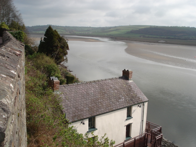
The River Taf ( cy, Afon Taf) is a river in West Wales. It rises in the Preseli Hills, Pembrokeshire, and continues through Carmarthenshire to Laugharne. It is one of the three rivers to enter the sea on the east side of Carmarthen Bay. The other two are the River Gwendraeth and River Tywi. Course The River Taf is about from Crymych to Ginst Point, of which about is tidal.The Journal of Conchology 1979 p 7 "CARMARTHEN BAY. Three large estuaries, the Gwendraeth, Afon Tywi and Afon Taf enter the sea on the east side of Carmarthen Bay and these rivers contribute to deposits of muddy shores. Water drains from high ground above the village of Crymych in Pembrokeshire, and at one time flowed at ground level across the main Cardigan–Tenby road ( A478) before falling to the level of the Whitland and Cardigan Railway station Crymmych Arms (Great Western Railway) where on the UK Ordnance Survey map of 1866 it is shown as the source of the Taf. The stream fulfills its description ... [...More Info...] [...Related Items...] OR: [Wikipedia] [Google] [Baidu] |
Pembrokeshire
Pembrokeshire ( ; cy, Sir Benfro ) is a county in the south-west of Wales. It is bordered by Carmarthenshire to the east, Ceredigion to the northeast, and the rest by sea. The county is home to Pembrokeshire Coast National Park. The Park occupies more than a third of the area of the county and includes the Preseli Hills in the north as well as the Pembrokeshire Coast Path. Historically, mining and fishing were important activities, while industry nowadays is focused on agriculture (86 per cent of land use), oil and gas, and tourism; Pembrokeshire's beaches have won many awards. The county has a diverse geography with a wide range of geological features, habitats and wildlife. Its prehistory and modern history have been extensively studied, from tribal occupation, through Roman times, to Welsh, Irish, Norman, English, Scandinavian and Flemish influences. Pembrokeshire County Council's headquarters are in the county town of Haverfordwest. The council has a majority of In ... [...More Info...] [...Related Items...] OR: [Wikipedia] [Google] [Baidu] |
Wales
Wales ( cy, Cymru ) is a country that is part of the United Kingdom. It is bordered by England to the east, the Irish Sea to the north and west, the Celtic Sea to the south west and the Bristol Channel to the south. It had a population in 2021 of 3,107,500 and has a total area of . Wales has over of coastline and is largely mountainous with its higher peaks in the north and central areas, including Snowdon (), its highest summit. The country lies within the north temperate zone and has a changeable, maritime climate. The capital and largest city is Cardiff. Welsh national identity emerged among the Celtic Britons after the Roman withdrawal from Britain in the 5th century, and Wales was formed as a kingdom under Gruffydd ap Llywelyn in 1055. Wales is regarded as one of the Celtic nations. The conquest of Wales by Edward I of England was completed by 1283, though Owain Glyndŵr led the Welsh Revolt against English rule in the early 15th century, and briefly re-establis ... [...More Info...] [...Related Items...] OR: [Wikipedia] [Google] [Baidu] |
Whitland
Whitland (Welsh: , lit. "Old White House", or ''Hendy-gwyn ar Daf'', "Old White House on the River Tâf", from the medieval ''Ty Gwyn ar Daf'') is both a town and a community in Carmarthenshire, Wales. Description The Whitland community is bordered by the communities of: Henllanfallteg; Llanboidy; and Eglwyscummin, all being in Carmarthenshire; and by Lampeter Velfrey and Llanddewi Velfrey in Pembrokeshire. According to the 2011 census the population was 1,792. Despite losing its dairy and remaining high street bank, Whitland has an estimated 125 small businesses as well as Whitland Engineering, which services the dairy industry and in 2019 employed 90 people. History Traditionally, Whitland is seen as the site of an assembly of lawyers and churchmen, sometimes described as the first Welsh parliament, called in 930 by King Hywel Dda to codify the native Welsh laws. Whitland takes its name from its medieval Cistercian abbey. The monastery pre-dates Tintern but now i ... [...More Info...] [...Related Items...] OR: [Wikipedia] [Google] [Baidu] |
Ordnance Survey
Ordnance Survey (OS) is the national mapping agency for Great Britain. The agency's name indicates its original military purpose (see ordnance and surveying), which was to map Scotland in the wake of the Jacobite rising of 1745. There was also a more general and nationwide need in light of the potential threat of invasion during the Napoleonic Wars. Since 1 April 2015 Ordnance Survey has operated as Ordnance Survey Ltd, a government-owned company, 100% in public ownership. The Ordnance Survey Board remains accountable to the Secretary of State for Business, Energy and Industrial Strategy. It was also a member of the Public Data Group. Paper maps for walkers represent only 5% of the company's annual revenue. It produces digital map data, online route planning and sharing services and mobile apps, plus many other location-based products for business, government and consumers. Ordnance Survey mapping is usually classified as either " large-scale" (in other words, more detaile ... [...More Info...] [...Related Items...] OR: [Wikipedia] [Google] [Baidu] |
Welsh Language
Welsh ( or ) is a Celtic language of the Brittonic subgroup that is native to the Welsh people. Welsh is spoken natively in Wales, by some in England, and in Y Wladfa (the Welsh colony in Chubut Province, Argentina). Historically, it has also been known in English as "British", "Cambrian", "Cambric" and "Cymric". The Welsh Language (Wales) Measure 2011 gave the Welsh language official status in Wales. Both the Welsh and English languages are ''de jure'' official languages of the Welsh Parliament, the Senedd. According to the 2021 census, the Welsh-speaking population of Wales aged three or older was 17.8% (538,300 people) and nearly three quarters of the population in Wales said they had no Welsh language skills. Other estimates suggest that 29.7% (899,500) of people aged three or older in Wales could speak Welsh in June 2022. Almost half of all Welsh speakers consider themselves fluent Welsh speakers and 21 per cent are able to speak a fair amount of Welsh. The Wels ... [...More Info...] [...Related Items...] OR: [Wikipedia] [Google] [Baidu] |
A40 Road
A4 most often refers to: *A4 paper, a paper size defined by the ISO 216 standard, measuring 210 × 297 mm A4 and variants may also refer to: Science and mathematics * British NVC community A4 (''Hydrocharis morsus-ranae - Stratiotes aloides'' community), one type of Aquatic communities in the British National Vegetation Classification system * Combretastatin A-4, a stilbenoid chemical compound * ''A''4, the alternating group on four elements * A4, a type of stainless steel, as defined by ISO 3506, equivalent to SAE steel grade 316L * Subfamily A4, a rhodopsin-like receptors subfamily Medicine * ATC code A04 ''Antiemetics and antinauseants'', a subgroup of the Anatomical Therapeutic Chemical Classification System * Lipoxin A4, a lipoxin * Androstenedione, an androgen steroid hormone Transportation Aeronautics and astronautics * "A-4 Helldiver", the civil version of the Curtiss Falcon an attack aircraft manufactured by Curtiss Aircraft Company * Douglas A-4 Sky ... [...More Info...] [...Related Items...] OR: [Wikipedia] [Google] [Baidu] |
Community (Wales)
A community ( cy, cymuned) is a division of land in Wales that forms the lowest tier of local government in Wales. Welsh communities are analogous to civil parishes in England. There are 878 communities in Wales. History Until 1974 Wales was divided into civil parishes. These were abolished by section 20 (6) of the Local Government Act 1972, and replaced by communities by section 27 of the same Act. The principal areas of Wales are divided entirely into communities. Unlike in England, where unparished areas exist, no part of Wales is outside a community, even in urban areas. Most, but not all, communities are administered by community councils, which are equivalent to English parish councils in terms of their powers and the way they operate. Welsh community councils may call themselves town councils unilaterally and may have city status granted by the Crown. In Wales, all town councils are community councils. There are now three communities with city status: Bangor, St ... [...More Info...] [...Related Items...] OR: [Wikipedia] [Google] [Baidu] |
Narberth, Pembrokeshire
Narberth ( cy, Arberth) is both a town and a community in Pembrokeshire, Wales. It was founded around a Welsh court and later became a Norman stronghold on the Landsker Line. It became the headquarters of the hundred of Narberth. It was once a marcher borough. George Owen described it in 1603 as one of nine Pembrokeshire "boroughs in decay". In 2011, the population was 2,150, of which a third are Welsh-speaking. Narberth is close to the A40 trunk road and is on the A478. Narberth railway station is on the main line from Swansea. The community includes the village of Crinow. Etymology The Welsh name of the town, ', is a compound of ' "on, against" + ' "hedge" (cf. Perth in Scotland). The phrase ' "in Narberth" was rebracketed when borrowed into English, giving the present-day English name, Narberth. History In the Iron Age, there was a defended enclosure to the south of the current town centre on Camp Hill. Narberth was founded around a Welsh court, but later beca ... [...More Info...] [...Related Items...] OR: [Wikipedia] [Google] [Baidu] |
A478 Road
The A478 road is a major road in Wales. The route is from its junction with the A487 at Cardigan, Ceredigion, to Tenby, Pembrokeshire. It crosses the Preseli Hills and winds through farmland for almost all of its route. The road just touches the very west of Carmarthenshire. History A road between Cardigan and Narberth was recorded between 1536 and 1642. The 1555 Highways Act made parishes responsible for the roads that crossed them. Most were unsuitable for wheeled traffic. Turnpike trusts were set up in the late 18th and early 19th centuries to manage road maintenance; at least part of this road came under the Whitland Trust. However, by the mid-19th century, some trusts were badly managed or abused, exacerbating rural poverty and in part leading to the Rebecca riots in the 1840s, some of the earliest of which were on this road, particularly at Efailwen in the Cilymaenllwyd Community. The trusts were reformed in 1844. The northern two-thirds of the A478 was a drovers' road, ... [...More Info...] [...Related Items...] OR: [Wikipedia] [Google] [Baidu] |
Lampeter Velfrey
Lampeter Velfrey ( Welsh: ''Llanbedr Felfre'') is a community and parish in the county of Pembrokeshire, Wales, which lies 68.0 miles (109.4 km) from Cardiff and 196.0 miles (315.4 km) from London. In 2011 the population of the parish was 1,205, with 20.2 per cent of them able to speak Welsh. Besides Lampeter Velfrey village, other settlements in the community include Princes Gate, Ludchurch, Llan-mill, Melinau and Tavernspite. The old Medieval spelling was "Velfre" Governance An electoral ward of the same name exists. This ward stretches beyond the confines of Lampeter Velfrey with a total population of 1,598. History The parish was in the former Narberth Hundred, and appeared on a 1578 parish map as ''Llanbeder Velfray''. In the 1830s had a population of 984. Limestone was quarried locally for building and for lime. There was a parochial school in the 1800s. Local historian Geoffrey Morris was rector of Lampeter Velfrey parish until 2008 and wrote a history of the ... [...More Info...] [...Related Items...] OR: [Wikipedia] [Google] [Baidu] |
Llanddewi Velfrey
Llanddewi Velfrey or Llandewi Velfrey (also Llan-ddewi-vel-vre) ( cy, Llanddewi Efelffre) is a village, parish and community of Pembrokeshire in West Wales. Historically it was in the Narberth Hundred. The village is in Lampeter Vale, northeast of Narbeth along the A40. In 1831 it had a population of 710 people. In 2011 the population was 393. The village is situated in a rich and fertile vale, watered by the river Tâf, which separates the parish from that of Llangain in the county of Carmarthen. The lands are wholly enclosed and in a good state of cultivation, and the soil is eminently fertile. Landmarks St. David's Church and related buildings The church, dedicated to St. David, is remarkable for the simplicity of its architecture, and displays evident features of a very remote antiquity: an elegant mural tablet of white marble, to the memory of the late David Lewis, Esq., of Hênllan and his youngest daughter, which were put up in the chancel by his widow c.1830. There i ... [...More Info...] [...Related Items...] OR: [Wikipedia] [Google] [Baidu] |


