|
Azilal
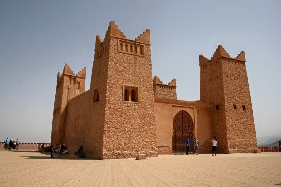
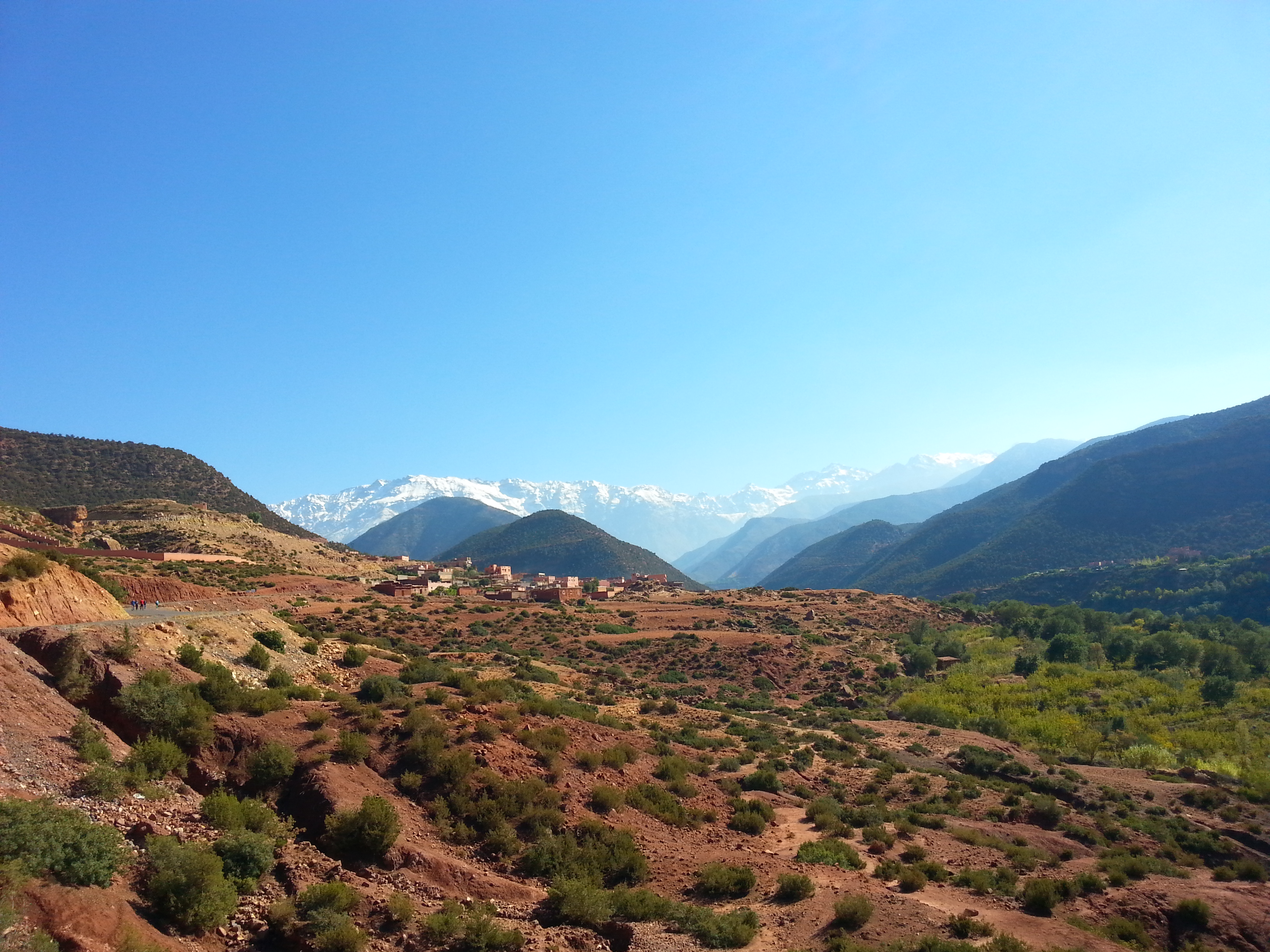
Azilal ( ber, ⴰⵣⵉⵍⴰⵍ, ar, أزيلال) is a provincial capital in central Morocco, in the Atlas Mountains. It is also the capital of the M'Goun Conservation Area and home to a unique dialect of Tamazight. History Azilal was originally a meeting place for various Amazigh tribes to gather and trade. During the French protectorate in Morocco, the town was occupied by colonial forces and used as an outpost to spread further into the mountains. A colonial quarter remains inhabited to this day by local Amazigh families. The quarter is located on a hill within Azilal's municipal boundary and is separated from the town by a colonial-era wall. Geography Given the rich geology of the surrounding mountains, Azilal is the capital of the M'Goun Conservation Area and home to the M'Goun Geopark Museum. Azilal has become a jumping-off point for tourists to visit various World Heritage Sites. The Ouzoud Falls, one of the most popular sites in the conservation area, is only 27 km awa ... [...More Info...] [...Related Items...] OR: [Wikipedia] [Google] [Baidu] |
Azilal Province
Azilal (in berber : ⴰⵣⵉⵍⴰⵍ) is a province in the Moroccan region of Béni Mellal-Khénifra. Its population in 2004 is 504,501. The major cities and towns are: * Afourar * Azilal * Ait Attab * Bzou * Demnate Demnate ( ar, دمنات; zgh, Demnat, ⴷⴻⵎⵏⴰⵜ) is a town in central Morocco, located at the foot of the high Atlas Mountains roughly 110 km east of Marrakech. The majority of the population speaks Berber; the local dialect is Tas ... * Foum Jamaa * Ouaouizeght Subdivisions The province is divided administratively into the following: References Azilal Province {{BéniMellalKhénifra-geo-stub ... [...More Info...] [...Related Items...] OR: [Wikipedia] [Google] [Baidu] |
Béni Mellal-Khénifra
Béni Mellal-Khénifra ( ar, بني ملال - خنيفرة, banī mallāl - ḵunayfira; ber, ⴰⵢⵜ ⵎⵍⵍⴰⵍ - ⵅⵏⵉⴼⵕⴰ, ayt mllal - xnifṛa) is one of the twelve regions of Morocco. It covers an area of 28,374 km2 and recorded a population of 2,520,776 in the 2014 Moroccan census. The capital of the region is Beni Mellal. Geography Béni Mellal-Khénifra is located in the interior of the country. It borders Rabat-Salé-Kénitra to the north, Fès-Meknès to the northeast, Drâa-Tafilalet to the southeast, Marrakesh-Safi to the southwest and Casablanca-Settat to the northwest. In the western and central part of the region is the productive Tadla plain irrigated by the Oum Er-Rbia River. This plain is bracketed by the High Atlas mountains which run through the southern and eastern parts of the region, and the foothills of the Middle Atlas to the north. History Béni Mellal-Khénifra was formed in September 2015 by adding Khouribga Province o ... [...More Info...] [...Related Items...] OR: [Wikipedia] [Google] [Baidu] |
Provinces Of Morocco
In Morocco, the 75 second-level administrative subdivisions are 13 prefectures and 62 provinces. They are subdivisions of the 12 regions of Morocco. Each prefecture or province is subdivided into arrondissements (only in prefectures of some metropolitan areas), municipalities (''communes'', sing. ''commune'') or urban municipalities (''communes urbaines'', sing. ''commune urbaine'') in other urban areas, and districts (''cercles'', sing. ''cercle'') in rural areas. The districts are subdivided into rural municipalities (''communes rurales'', sing. ''commune rural''). One prefecture (Casablanca) is also subdivided into ''préfectures d'arrondissements'' (sing. ''préfecture d'arrondissements''), similar to districts (''cercles'') except they are grouping a few arrondissements instead of rural municipalities. Note: The arrondissements and (urban) municipalities should probably be thought of as fourth-level subdivisions, on the same level as the rural municipalities, but they ar ... [...More Info...] [...Related Items...] OR: [Wikipedia] [Google] [Baidu] |
Ouzoud Falls
Ouzoud Falls ( Amazigh: ''Imuzzar n wuẓuḍ'', french: Cascades d'Ouzoud) is the collective name for several waterfalls that empty into the El-Abid River's (Arabic for "Slaves' River") gorge. This popular tourism destination is located near the Middle Atlas village of Tanaghmeilt, in the province of Azilal, 150 km northeast of Marrakech, Morocco. 'Ouzoud' means "the act of grinding grain" in Berber. This seems to be confirmed by the frequent mills in the region. The bottom of the falls is accessible through a shaded path of olive trees. At the summit of the falls, there are a dozen old small mills that are still in use. One can also follow a narrow and difficult track leading to the road of Beni Mellal. While descending the gorges from the "wadi el-Abid" in a canyon A canyon (from ; archaic British English spelling: ''cañon''), or gorge, is a deep cleft between escarpments or cliffs resulting from weathering and the erosion, erosive activity of a river over geolog ... [...More Info...] [...Related Items...] OR: [Wikipedia] [Google] [Baidu] |
High Atlas
High Atlas, also called the Grand Atlas ( ar, الأطلس الكبير, Al-Aṭlas al-Kabīr; french: Haut Atlas; shi, ⴰⴷⵔⴰⵔ ⵏ ⴷⵔⵏ ''Adrar n Dern''), is a mountain range in central Morocco, North Africa, the highest part of the Atlas Mountains. The High Atlas rises in the west at the Atlantic Ocean and stretches in an eastern direction to the Moroccan-Algerian border. At the Atlantic and to the southwest the range drops abruptly and makes an impressive transition to the coast and the Anti-Atlas range. To the north, in the direction of Marrakech, the range descends less abruptly. The range includes Jbel Toubkal, which at is the highest in the range and lies in Toubkal National Park. The range serves as a weather system barrier in Morocco running east–west and separating the Sahara from the Mediterranean and continental zones to the north and west. In the higher elevations of the massif, snow falls regularly, allowing winter sports. Snow lasts well into l ... [...More Info...] [...Related Items...] OR: [Wikipedia] [Google] [Baidu] |
M'Goun Conservation Area
The M'Goun Conservation Area ( ber, ⵎⴳⵓⵏ, ar, مكون) is a protected area and UNESCO Global Geopark in the Atlas Mountains of central Morocco. Sites The conservation area includes the following sites. * Bin el Ouidane Dam *Geopark Museum in Azilal * Imi-n-Ifri Formation *Ouzoud Falls *Zaouiat Ahansal Zaouiat Ahansal is a small town and rural commune in Azilal Province of the Tadla-Azilal region of Morocco. At the time of the 2004 census, the commune had a total population of 10435 people living in 1554 households. History The town was fou ... References Atlas Mountains Protected areas of Morocco {{Africa-mountain-stub ... [...More Info...] [...Related Items...] OR: [Wikipedia] [Google] [Baidu] |
Soufiane Bouftini
Soufiane Bouftini ( ar, سفيان بوفتيني) is a Moroccan professional footballer who plays for Al Wasl as a defender. Honors Club ; Hassania Agadir * Moroccan Throne Cup runner-up: 2019 ; Al Wasl Club Dubai - UAE 2022 International ; Morocco * African Nations Championship : 2020 References External links * 1994 births Living people Footballers from Casablanca Moroccan footballers Moroccan expatriate footballers Morocco international footballers Association football defenders Hassania Agadir players Al Ahli SC (Doha) players Botola players Qatar Stars League players 2020 African Nations Championship players Expatriate footballers in Qatar Moroccan expatriate sportspeople in Qatar Morocco A' international footballers {{Morocco-footy-defender-stub ... [...More Info...] [...Related Items...] OR: [Wikipedia] [Google] [Baidu] |
Regions Of Morocco
Regions are currently the highest administrative divisions in Morocco. Since 2015, Morocco officially administers 12 regions, including one ( Dakhla-Oued Ed-Dahab) that lies completely within the disputed territory of Western Sahara and two ( Laâyoune-Sakia El Hamra and Guelmim-Oued Noun) that lie partially within it. The regions are subdivided into a total of 75 second-level administrative divisions, which are prefectures and provinces. A region is governed by a directly elected regional council. The president of the council is responsible for carrying out the council's decisions. Prior to the 2011 constitutional reforms, this was the responsibility of the Wali, the representative of the central government appointed by the King, who now plays a supporting role in the administration of the region. Regions since 2015 On 3 January 2010, the Moroccan government established the Consultative Commission for the Regionalization (CCR), which aimed to decentralize power to the ... [...More Info...] [...Related Items...] OR: [Wikipedia] [Google] [Baidu] |
Morocco
Morocco (),, ) officially the Kingdom of Morocco, is the westernmost country in the Maghreb region of North Africa. It overlooks the Mediterranean Sea to the north and the Atlantic Ocean to the west, and has land borders with Algeria to the east, and the disputed territory of Western Sahara to the south. Mauritania lies to the south of Western Sahara. Morocco also claims the Spanish exclaves of Ceuta, Melilla and Peñón de Vélez de la Gomera, and several small Spanish-controlled islands off its coast. It spans an area of or , with a population of roughly 37 million. Its official and predominant religion is Islam, and the official languages are Arabic and Berber; the Moroccan dialect of Arabic and French are also widely spoken. Moroccan identity and culture is a mix of Arab, Berber, and European cultures. Its capital is Rabat, while its largest city is Casablanca. In a region inhabited since the Paleolithic Era over 300,000 years ago, the first Moroccan st ... [...More Info...] [...Related Items...] OR: [Wikipedia] [Google] [Baidu] |
Tamazight
The Berber languages, also known as the Amazigh languages or Tamazight,, ber, label= Tuareg Tifinagh, ⵜⵎⵣⵗⵜ, ) are a branch of the Afroasiatic language family. They comprise a group of closely related languages spoken by Berber communities, who are indigenous to North Africa.Hayward, Richard J., chapter ''Afroasiatic'' in Heine, Bernd & Nurse, Derek, editors, ''African Languages: An Introduction'' Cambridge 2000. . The languages were traditionally written with the ancient Libyco-Berber script, which now exists in the form of Tifinagh. Today, they may also be written in the Berber Latin alphabet or the Arabic script, with Latin being the most pervasive. Berber languages are spoken by large populations of Morocco, Algeria and Libya, by smaller populations of Tunisia, northern Mali, western and northern Niger, northern Burkina Faso and Mauritania and in the Siwa Oasis of Egypt. Large Berber-speaking migrant communities, today numbering about 4 million, have been l ... [...More Info...] [...Related Items...] OR: [Wikipedia] [Google] [Baidu] |
Amazigh
, image = File:Berber_flag.svg , caption = The Berber ethnic flag , population = 36 million , region1 = Morocco , pop1 = 14 million to 18 million , region2 = Algeria , pop2 = 9 million to ~13 million , region3 = Mauritania , pop3 = 2.9 million , region4 = Niger , pop4 = 2.6 million, Niger: 11% of 23.6 million , region5 = France , pop5 = 2 million , region6 = Mali , pop6 = 850,000 , region7 = Libya , pop7 = 600,000 , region8 = Belgium , pop8 = 500,000 (including descendants) , region9 = Netherlands , pop9 = 467,455 (including descendants) , region10 = Burkina Faso , pop10 = 406,271, Burkina Faso: 1.9% of 21.4 million , region11 = Egypt , pop11 = 23,000 or 1,826,580 , region12 = Tunisia , pop12 ... [...More Info...] [...Related Items...] OR: [Wikipedia] [Google] [Baidu] |
French Protectorate In Morocco
The French protectorate in Morocco (french: Protectorat français au Maroc; ar, الحماية الفرنسية في المغرب), also known as French Morocco, was the period of French colonial rule in Morocco between 1912 to 1956. The protectorate was officially established 30 March 1912, when Sultan Abd al-Hafid signed the Treaty of Fez, though the French military occupation of Morocco had begun with the invasion of Oujda and the bombardment of Casablanca in 1907. The French protectorate lasted until the dissolution of the Treaty of Fez on 2 March 1956, with the Franco-Moroccan Joint Declaration. Morocco's independence movement, described in Moroccan historiography as the Revolution of the King and the People, restored the exiled Mohammed V but it did not end French presence in Morocco. France preserved its influence in the country, including a right to station French troops and to have a say in Morocco's foreign policy. French settlers also maintained their rights a ... [...More Info...] [...Related Items...] OR: [Wikipedia] [Google] [Baidu] |


.jpg)