|
Air Kazakhstan
Air Kazakhstan, stylised as ''Air Kazakstan'' ( kk, Эйр Қазақстан / ), was an airline of Kazakhstan which later became its national carrier after bankrupt Kazakhstan Airlines was shut down. It was headquartered in Almaty. History The airline was established in 1991 as Kazakhstan Airways but changed to Air Kazakhstan on 10 March 1997 (spelled as "Air Kazakhstan" until 2001). It ceased operations on 29 February 2004, after accumulating heavy debts, and was declared bankrupt in April 2004 by the court in Almaty. Air Astana succeeded Air Kazakhstan as the country's flag carrier. Destinations When it shut down, Air Kazakhstan was serving the following locations: Fleet Western jets: *Airbus A310-300 *Boeing 737-200 Soviet Jets: *Antonov An-24 * Antonov An-24B *Antonov An-24RV *Antonov An-26 *Antonov An-30 *Antonov An-30A *Antonov An-30B *Ilyushin Il-18 *Ilyushin Il-76 * Ilyushin Il-76T *Ilyushin Il-86 *Tupolev Tu-134 * Tupolev Tu-134A *Tupolev Tu-154 * Tupolev ... [...More Info...] [...Related Items...] OR: [Wikipedia] [Google] [Baidu] |
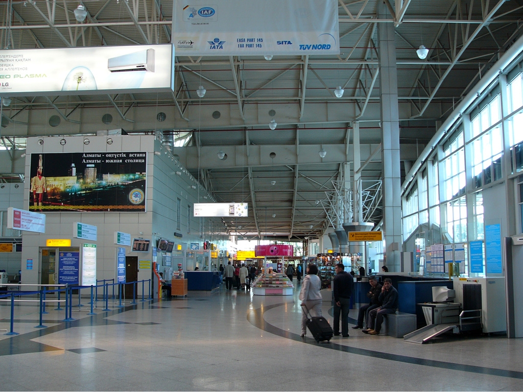
Almaty International Airport
Almaty International Airport ( kk, Halyqaralyq Almaty Äuejaiy) is a major international airport northeast of Almaty, the largest city and commercial capital of Kazakhstan. It is the busiest airport in Kazakhstan, accounting for 6.42 million passengers in 2019. Owners and management The airport is registered under name of "JSC Almaty International Airport", which is owned by Turkish airport company TAV Airports Holding, as well as many other airports available worldwide. History Early years The airport was built in 1935 for use by small civil and military aircraft. Up to 1990, it was the part of Kazakh Department of Civil Aviation, and then reorganized into "Alma-Ata Airport" in 1991. Since 1993, it has run as an independent business unit. In 1994, it was reorganized into OJSC "Almaty Airport" and later renamed to JSC Almaty International Airport. The supersonic transport (SST) Tupolev Tu-144 began service on 26 December 1975, flying mail and freight between Moscow a ... [...More Info...] [...Related Items...] OR: [Wikipedia] [Google] [Baidu] |
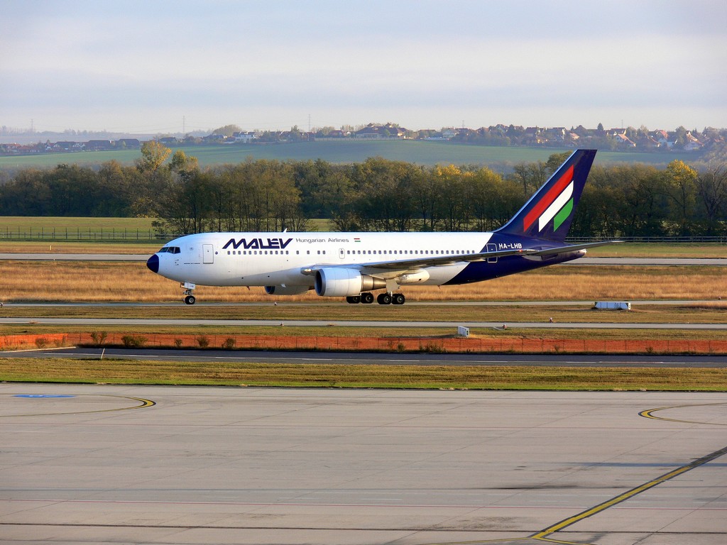
Budapest International Airport
Budapest Ferenc Liszt International Airport ( hu, Budapest Liszt Ferenc Nemzetközi Repülőtér) , formerly known as ''Budapest Ferihegy International Airport'' and still commonly called just ''Ferihegy'', is the international airport serving the Hungarian capital city of Budapest. It is by far the largest of the country's four commercial airports, ahead of Debrecen and Hévíz–Balaton. The airport is located southeast of the center of Budapest (bordering Pest county) and was renamed in 2011 in honour of the most famous Hungarian composer Franz Liszt ( hu, Liszt Ferenc) on the occasion of the 200th anniversary of his birth. It offers international connections primarily within Europe, but also to Africa, to the Middle East, to North America and to the Far East. In 2019, the airport handled 16.2 million passengers. The airport is the headquarters and primary hub for Wizz Air and base for Ryanair. In 2012 it experienced a significant drop in aircraft movements and handled c ... [...More Info...] [...Related Items...] OR: [Wikipedia] [Google] [Baidu] |
Kostanay
Kostanay ( kz, Қостанай, Qostanai ) is a city located on the Tobol River in northern Kazakhstan. It was known as Nikolayevsk (russian: Николаевск) until 1895 and then as Kustanay (russian: Кустанай) until 1997. Kostanay is the administrative center of the Kostanay Region. As of 24 March 2022, the city's governor is Marat Zhundubayev. History Kostanay was founded by Russian settlers in 1879 and named Nikolaevsk, in honor of Tsar Nicholas II. In 1888, the town had more than 3,000 inhabitants involved in the building of a mill and a brewery, which are still operational. In 1893, Kustanay was granted city status. The Red Army took control in 1918 and changed the city's name to Kustanay. The Kustanay Region was established in 1936 with its administrative center in Kustanay. Six years after fall of Soviet Union, Kazakhstan renamed it to Kostanay. In 2009, the city population was Geographic location The city is located in the steppe zone in the north of the ... [...More Info...] [...Related Items...] OR: [Wikipedia] [Google] [Baidu] |
Sary-Arka Airport
Sary-Arka Airport ( kk, Saryarqa äuejaiy) is the airport of Karagandy, Kazakhstan. It is located southeast of the city. History The airport was built in 1934, on a site at the edge of the city centre, and moved further out to its current location in 1944. The old terminal building on Shturman Street still stands, now occupied by a market for car parts. In 1980 it underwent major reconstruction, including the construction of a new terminal building and modernization of the runway. This made the landing of heavier aircraft possible and opened the door to many new destinations in the Soviet Union. In 1992, the airport was granted international status. It has become an independent joint stock company after separation from JSC "Karagandaavia" in 1997. It is not related to Saryarka – Steppe and Lakes of Northern Kazakhstan on the World Heritage List. Sary-Akra Airport is home to the 610th Air Base of the Armed Forces of the Republic of Kazakhstan, one of four fast jet bases in ... [...More Info...] [...Related Items...] OR: [Wikipedia] [Google] [Baidu] |
Karaganda
Karaganda or Qaraghandy ( kk, Қарағанды/Qarağandy, ; russian: Караганда, ) is the capital of Karaganda Region in the Republic of Kazakhstan. It is the fourth most populous city in Kazakhstan, behind Almaty (Alma-Ata), Astana and Shymkent. Population: 497,777 (2020 Estimate); Karaganda is approximately 230 km south-east of Kazakhstan's capital Astana. In the 1940s up to 70% of the city's inhabitants were ethnic Germans. Most of the ethnic Germans were Soviet Volga Germans who were collectively deported to Siberia and Kazakhstan on Stalin's order when Hitler invaded Soviet-annexed eastern Poland and the Soviet Union proper in 1941. Until the 1950s, many of these deportees were interned in labor camps, often simply because they were of German descent. The population of Karaganda fell by 14% from 1989 to 1999 following the dissolution of the Soviet Union; it was once Kazakhstan's second-largest city after Almaty. Over 100,000 people have since emigrated t ... [...More Info...] [...Related Items...] OR: [Wikipedia] [Google] [Baidu] |
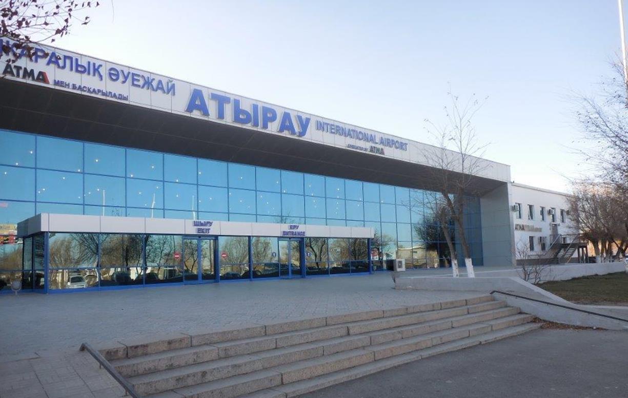
Atyrau Airport
ATMA Atyrau Airport ( kk, Atyrau Halyqaralyq Äuejaiy) is an airport located northwest of Atyrau, Kazakhstan. It is the lowest international commercial airport in the world at below sea level. History ATMA obtained the operational rights of ATMA Atyrau Airport when the airport was privatized as a build and operate model in 1994. ATMA is a joint company between Mağdenli Yer Hizmetleri and Atyrau Regional Administration with both parties having a 50% share. It is the only airport in Atyrau and one of the thirteen international airports in Kazakhstan. The region is crucial for Kazakhstan's economy as it is very close to oil exploration sites and platforms on the Caspian Sea. The city is the base town for many oil and construction companies. In 2007, ATMA completed the construction of the new terminal building and a new longer runway. Enclosing a total area of , the new terminal can serve 600 passengers per hour. Passengers can also benefit from the modernized CIP and VIP l ... [...More Info...] [...Related Items...] OR: [Wikipedia] [Google] [Baidu] |
Atyrau
Atyrau ( kk, Атырау, ', ; russian: Атырау, ), known until 1991 as Guryev (russian: Гурьев, ), is a city in Kazakhstan and the capital of Atyrau Region. Atyrau is a transcontinental city, at the mouth of the Ural River on the Caspian Sea, between Europe and Asia, west of Almaty and east of the Russian city of Astrakhan. Atyrau is famous for its oil and gas industries. It has a population of 355,117 as of 2020. It is predominantly made up of Kazakhs, the minorities being Russians, Koreans, Tatars and Uzbeks. History The wooden fort at the mouth of the Yaik River was founded in 1645 as ''Nizhny Yaitzky gorodok'' (literally, ''Lower Yaik Fort'') by the Russian trader Gury Nazarov, a native of Yaroslavl, who specialized in trade with Khiva and Bukhara. The fort was plundered by the Yaik Cossacks, leading the Guriev family to rebuild it in stone (1647–62). Tsar Alexis sent a garrison of Streltsy to protect the fort from Cossack incursions. Despite these effor ... [...More Info...] [...Related Items...] OR: [Wikipedia] [Google] [Baidu] |
Astana International Airport
Nursultan Nazarbayev International Airport ( kk, Халықаралық Нұрсұлтан Назарбаев әуежайы, Halyqaralyq Nūrsūltan Nazarbaev Äuejaiy, ; russian: Международный аэропорт Нурсултан Назарбаев), formerly Astana International Airport, is an international airport in the Akmola Region of Kazakhstan. It is the primary international airport serving Astana, the capital city of Kazakhstan. The airport is the second-busiest international air passenger gateway into Central Asia (after Almaty International Airport), the 13th busiest airport in the Post-Soviet states and the second-busiest airport in terms of passenger traffic in Kazakhstan, with 5,099,391 passengers in 2019. It is located in the Yesil administrative subdivision of Astana, south-east of the city centre. The airport features two passenger terminals and one runway as well as cargo and maintenance facilities. Terminal 2 was designed by the late Japanese ... [...More Info...] [...Related Items...] OR: [Wikipedia] [Google] [Baidu] |
Astana
Astana, previously known as Akmolinsk, Tselinograd, Akmola, and most recently Nur-Sultan, is the capital city of Kazakhstan. The city lies on the banks of the Ishim River in the north-central part of Kazakhstan, within the Akmola Region, though administered as a city with special status separately from the rest of the region. A 2020 official estimate reported a population of 1,136,008 within the city limits, making it the second-largest city in the country, after Almaty, which had been the capital until 1997. The city became the capital of Kazakhstan in 1997; since then it has grown and developed economically into one of the most modern cities in Central Asia. In 2021, the government selected Astana as one of the 10 priority destinations for tourist development. Modern Astana is a planned city, following the process of other planned capitals. After it became the capital of Kazakhstan, the city dramatically changed its shape. The city's master-plan was designed by Japanese a ... [...More Info...] [...Related Items...] OR: [Wikipedia] [Google] [Baidu] |
Aktau Airport
Aktau International Airport ( kk, Halyqaralyq Aqtau Äuejaiy), formerly Shevchenko-Central, is an international airport in Mangystau Region, Kazakhstan. It is the primary international airport serving Aktau. The airport is the eighth-busiest international air passenger gateway into Central Asia, the 50th-busiest airport in the Post-Soviet states, the fourth-busiest airport in Kazakhstan. Aktau International Airport is located northwest of the city of Aktau. The airport features one passenger terminal and one runway. It serves as a focus city for SCAT Airlines. The airport is served year-round by Aeroflot, Air Astana, SCAT Airlines, Qazaq Air and on a seasonal basis by Belavia and Sunday Airlines. The facility opened in as Shevchenko-Central and was commonly known as Shevchenko Airport (the airport's current IATA code, SCO, is derived from the city's previous name of Shevchenko). Overview In November 1996 the joint stock company Aktau International Airport was established. ... [...More Info...] [...Related Items...] OR: [Wikipedia] [Google] [Baidu] |
Aktau
Aktau ( kk, Aqtau, Ақтау , russian: Актау) is a city in Kazakhstan, located on the eastern shore of the Caspian Sea. Its current name means "white mountain" in Kazakh, which may be due to its cliffs that overlook the Caspian. From 1964 to 1991, the city was known as Shevchenko. Its former name was given due to the Taras Shevchenko, eponymous Ukrainian poet's period of exile in the area. It is located on the Mangyshlak Peninsula and is the capital of the Mangystau Region. Aktau is known for its unique city block, block house numbering, address system. Almost no streets in Aktau have names; instead, addresses generally consist of three numbers: the district number (also known as micro-region/micro-district/block), the building number, and the apartment number. This is because Aktau was originally planned as a camp for the workers of the oil industry. History The territory of what is now Aktau was once inhabited by ancient tribes of Scythians. Archeological finds in the area ... [...More Info...] [...Related Items...] OR: [Wikipedia] [Google] [Baidu] |
Tel Aviv International Airport
Ben Gurion International Airport, ; ar, مطار بن غوريون الدولي , commonly known by the Hebrew-language acronym (), is the main international airport of Israel. Situated on the northern outskirts of the city of Lod, it is the busiest airport in the country. It is located to the northwest of Jerusalem and to the southeast of Tel Aviv. Until 1973, it was known as Lod Airport, whereafter it was renamed in honour of David Ben-Gurion, the first Israeli prime minister. The airport serves as a hub for El Al, Israir Airlines, Arkia, and Sun d'Or, and is managed by the Israel Airports Authority. In 2019, Ben Gurion Airport handled 24.8 million passengers. It is considered to be among the five best airports in the Middle East due to its passenger experience and its high level of security; while it has been the target of several terrorist attacks, no attempt to hijack a plane departing from Ben Gurion Airport has ever succeeded. The airport holds extreme strategic imp ... [...More Info...] [...Related Items...] OR: [Wikipedia] [Google] [Baidu] |


%2C_satellite_image_2017-07-24.jpg)
