|
Aborrebjerg
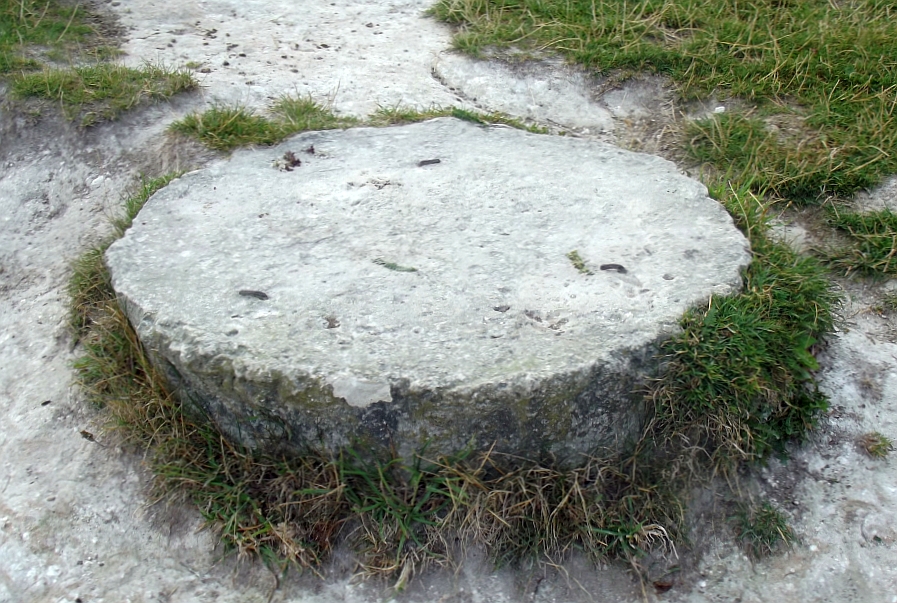
Aborrebjerg is a hill on the Danish island of Møn. Geography The hill stands at and is the highest point in Møn island and the eighth in Denmark, very close to Møns Klint. Aborrebjerg is mainly covered by wood and shrubs like junipers; behind it some ponds are located. The summit is marked with a circular stone. Geology As well as the neighbouring cliffs Aborrebjerg bedrock is chalk, which originated during the Cretaceous and was later lifted to its present location by tectonic movements following the ice ages. Access to the summit The can be easily reached through a waymarked foothpath. From the summit there is a good view. With good weather looking west both Farøbroerne and Queen Alexandrine Bridge can be seen, while looking north one can see up to Stevns. See also * Møllehøj * List of hills and mountains in Denmark This is a list of hills and mountains in Denmark. Hills in Denmark This table lists only hills in the country of Denmark, excluding Danish te ... [...More Info...] [...Related Items...] OR: [Wikipedia] [Google] [Baidu] |
Møns Klint
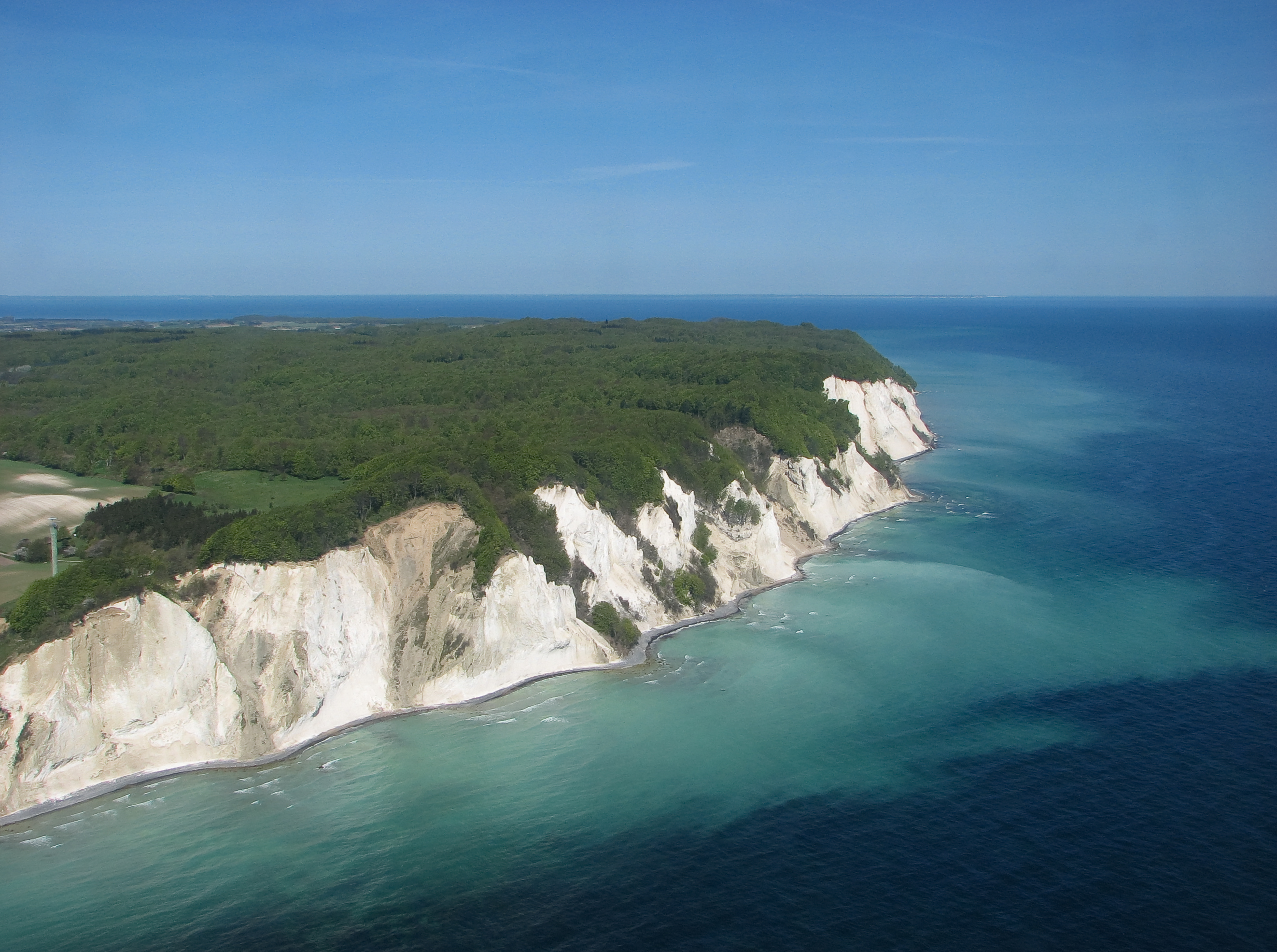
Møns Klint is a 6 km stretch of limestone and chalk cliffs along the eastern coast of the Danish island of Møn in the Baltic Sea. Some of the cliffs fall a sheer 120 m to the sea below. The highest cliff is , which is 128 m above sea level. The area around Møns Klint consists of woodlands, pastures, ponds and steep hills, including '' Aborrebjerg'' which, with a height of 143 m, is one of the highest points in Denmark. The cliffs and adjacent park are now protected as a nature reserve. Møns Klint receives around 250,000 visitors a year. There are clearly marked paths for walkers, riders and cyclists. The path along the cliff tops leads to steps down to the shore in several locations. On 29 May 2007, close to the cliff tops, the GeoCenter Møns Klint was opened by Queen Margrethe. The geological museum with interactive computer displays and a variety of attractions for children traces the geological prehistory of Denmark and the formation of the chalk cliffs. The museu ... [...More Info...] [...Related Items...] OR: [Wikipedia] [Google] [Baidu] |
List Of Hills And Mountains In Denmark ...
This is a list of hills and mountains in Denmark. Hills in Denmark This table lists only hills in the country of Denmark, excluding Danish territories (Faroe Islands and Greenland). The listing only considers natural formations. Mountains in Danish territories * Gunnbjørn, Greenland, 3700 m. Highest mountain in the Kingdom of Denmark. References {{List of mountains in Europe Denmark Hills Denmark ) , song = ( en, "King Christian stood by the lofty mast") , song_type = National and royal anthem , image_map = EU-Denmark.svg , map_caption = , subdivision_type = Sovereign state , subdivision_name = Kingdom of Denmark , establishe ... [...More Info...] [...Related Items...] OR: [Wikipedia] [Google] [Baidu] |
Møn
Møn () is an island in south-eastern Denmark. Until 1 January 2007, it was a municipality in its own right but it is now part of the municipality of Vordingborg, after merging with the former municipalities of Langebæk, Præstø, and Vordingborg. This has created a municipality with an area of and a total population of 46,307 (2005). It belongs to the Region Sjælland ("Zealand Region"). Møn is one of Denmark's most popular destinations for tourists with its white chalk cliffs, countryside, sandy beaches and the market town of Stege. In June 2017, UNESCO designated Møn as Denmark's first biosphere reserve, consisting of "a series of islands and islets in the southern Baltic Sea, over approximately 45,118 hectares (131,890 acres). Its landscapes include woodlands, grasslands, meadows, wetlands, coastal areas, ponds and steep hills." Location Møn is located just off the south-eastern tip of Zealand from which it is separated by the waters of the ''Hølen'' strait betwe ... [...More Info...] [...Related Items...] OR: [Wikipedia] [Google] [Baidu] |
Denmark
) , song = ( en, "King Christian stood by the lofty mast") , song_type = National and royal anthem , image_map = EU-Denmark.svg , map_caption = , subdivision_type = Sovereign state , subdivision_name = Kingdom of Denmark , established_title = Consolidation , established_date = 8th century , established_title2 = Christianization , established_date2 = 965 , established_title3 = , established_date3 = 5 June 1849 , established_title4 = Faroese home rule , established_date4 = 24 March 1948 , established_title5 = EEC accession , established_date5 = 1 January 1973 , established_title6 = Greenlandic home rule , established_date6 = 1 May 1979 , official_languages = Danish , languages_type = Regional languages , languages_sub = yes , languages = GermanGerman is recognised as a protected minority language in the South Jutland area of Denmark. , demonym = , capital = Copenhagen , largest_city = capital , coordinates = , ethnic_groups = , ethnic_gro ... [...More Info...] [...Related Items...] OR: [Wikipedia] [Google] [Baidu] |
Chalk
Chalk is a soft, white, porous, sedimentary carbonate rock. It is a form of limestone composed of the mineral calcite and originally formed deep under the sea by the compression of microscopic plankton that had settled to the sea floor. Chalk is common throughout Western Europe, where deposits underlie parts of France, and steep cliffs are often seen where they meet the sea in places such as the Dover cliffs on the Kent coast of the English Channel. Chalk is mined for use in industry, such as for quicklime, bricks and builder's putty, and in agriculture, for raising pH in soils with high acidity. It is also used for " blackboard chalk" for writing and drawing on various types of surfaces, although these can also be manufactured from other carbonate-based minerals, or gypsum. Description Chalk is a fine-textured, earthy type of limestone distinguished by its light color, softness, and high porosity. It is composed mostly of tiny fragments of the calcite shells or sk ... [...More Info...] [...Related Items...] OR: [Wikipedia] [Google] [Baidu] |
Juniper
Junipers are coniferous trees and shrubs in the genus ''Juniperus'' () of the cypress family Cupressaceae. Depending on the taxonomy, between 50 and 67 species of junipers are widely distributed throughout the Northern Hemisphere, from the Arctic, south to tropical Africa, throughout parts of western, central and southern Asia, east to eastern Tibet in the Old World, and in the mountains of Central America. The highest-known juniper forest occurs at an altitude of in southeastern Tibet and the northern Himalayas, creating one of the highest tree lines on earth. Description Junipers vary in size and shape from tall trees, tall, to columnar or low-spreading shrubs with long, trailing branches. They are evergreen with needle-like and/or scale-like leaves. They can be either monoecious or dioecious. The female seed cones are very distinctive, with fleshy, fruit-like coalescing scales which fuse together to form a berrylike structure ( galbulus), long, with one to 12 u ... [...More Info...] [...Related Items...] OR: [Wikipedia] [Google] [Baidu] |
Cretaceous
The Cretaceous ( ) is a geological period that lasted from about 145 to 66 million years ago (Mya). It is the third and final period of the Mesozoic Era, as well as the longest. At around 79 million years, it is the longest geological period of the entire Phanerozoic. The name is derived from the Latin ''creta'', " chalk", which is abundant in the latter half of the period. It is usually abbreviated K, for its German translation ''Kreide''. The Cretaceous was a period with a relatively warm climate, resulting in high eustatic sea levels that created numerous shallow inland seas. These oceans and seas were populated with now-extinct marine reptiles, ammonites, and rudists, while dinosaurs continued to dominate on land. The world was ice free, and forests extended to the poles. During this time, new groups of mammals and birds appeared. During the Early Cretaceous, flowering plants appeared and began to rapidly diversify, becoming the dominant group of plants across the Ear ... [...More Info...] [...Related Items...] OR: [Wikipedia] [Google] [Baidu] |
Tectonic
Tectonics (; ) are the processes that control the structure and properties of the Earth's crust and its evolution through time. These include the processes of mountain building, the growth and behavior of the strong, old cores of continents known as cratons, and the ways in which the relatively rigid plates that constitute the Earth's outer shell interact with each other. Tectonics also provide a framework for understanding the earthquake and volcanic belts that directly affect much of the global population. Tectonic studies are important as guides for economic geologists searching for fossil fuels and ore deposits of metallic and nonmetallic resources. An understanding of tectonic principles is essential to geomorphologists to explain erosion patterns and other Earth surface features. Main types of tectonic regime Extensional tectonics Extensional tectonics is associated with the stretching and thinning of the crust or the lithosphere. This type of tectonics is fou ... [...More Info...] [...Related Items...] OR: [Wikipedia] [Google] [Baidu] |
Ice Ages
An ice age is a long period of reduction in the temperature of Earth's surface and atmosphere, resulting in the presence or expansion of continental and polar ice sheets and alpine glaciers. Earth's climate alternates between ice ages and greenhouse periods, during which there are no glaciers on the planet. Earth is currently in the Quaternary glaciation. Individual pulses of cold climate within an ice age are termed ''glacial periods'' (or, alternatively, ''glacials, glaciations, glacial stages, stadials, stades'', or colloquially, ''ice ages''), and intermittent warm periods within an ice age are called ''interglacials'' or ''interstadials''. In glaciology, ''ice age'' implies the presence of extensive ice sheets in both northern and southern hemispheres. By this definition, Earth is currently in an interglacial period—the Holocene. The amount of anthropogenic greenhouse gases emitted into Earth's oceans and atmosphere is predicted to prevent the next glacial period for the ... [...More Info...] [...Related Items...] OR: [Wikipedia] [Google] [Baidu] |


%2C_Western_Negev%2C_Israel.jpg)


