|
2006 Pingtung Earthquake
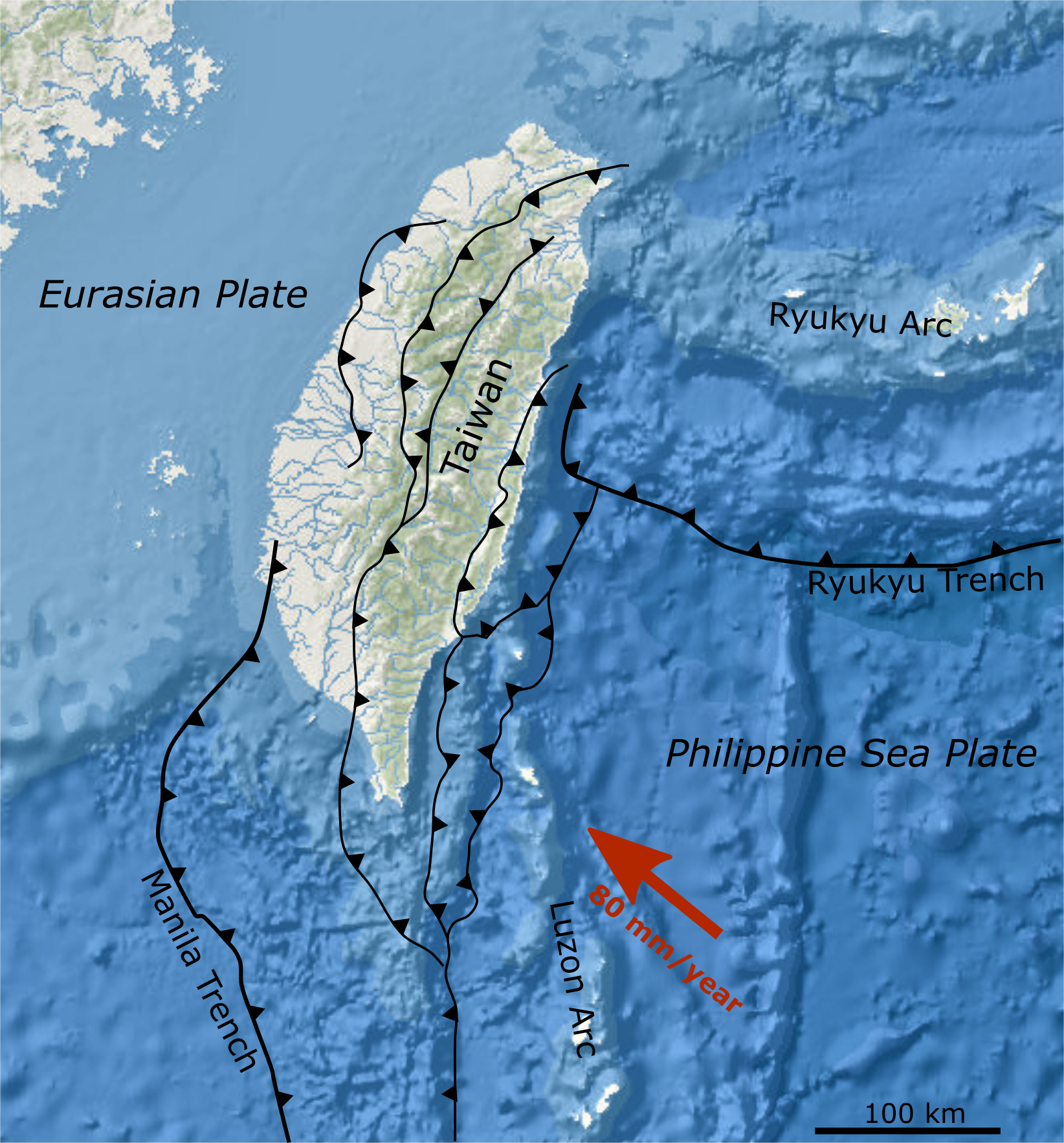
The 2006 Hengchun earthquakes occurred on December 26 at 20:26 and 20:34 China Standard Time, local time off the southwest coast of Taiwan in the Luzon Strait, which connects the South China Sea with the Philippine Sea. The International Seismological Centre measured the shocks at 7.0 and 6.9 on the moment magnitude scale. The earthquakes not only caused casualties and building damage, but several submarine communications cables were cut, disrupting telecommunication services in various parts of Asia. Tectonic setting Taiwan lies in a zone of complex interaction between the Philippine Sea plate (PSP) and the Eurasian plate (EP). To the north, the PSP is subduction, subducting beneath the EP along the line of the Ryukyu Trench, forming the Ryukyu arc, Ryukyu Volcanic Arc. To the south, in contrast, the EP is subducting beneath the PSP along the line of the Manila Trench, forming the Luzon Volcanic Arc. At its northern end the Luzon Arc is colliding with the continental margin of th ... [...More Info...] [...Related Items...] OR: [Wikipedia] [Google] [Baidu] |
Peak Ground Acceleration
Peak ground acceleration (PGA) is equal to the maximum ground acceleration that occurred during earthquake shaking at a location. PGA is equal to the amplitude of the largest absolute acceleration recorded on an wikt:accelerogram, accelerogram at a site during a particular earthquake. Earthquake shaking generally occurs in all three directions. Therefore, PGA is often split into the horizontal and vertical components. Horizontal PGAs are generally larger than those in the vertical direction but this is not always true, especially close to large earthquakes. PGA is an important parameter (also known as an intensity measure) for earthquake engineering, The design basis earthquake ground motion (DBEGM) is often defined in terms of PGA. Unlike the Richter magnitude scale, Richter and Moment magnitude scale, moment magnitude scales, it is not a measure of the total seismic scales#Magnitude and intensity, energy (magnitude, or size) of an earthquake, but rather of how much the earth shake ... [...More Info...] [...Related Items...] OR: [Wikipedia] [Google] [Baidu] |
Focal Mechanism
The focal mechanism of an earthquake describes the Fault (geology)#Slip.2C heave.2C throw, deformation in the Hypocenter, source region that generates the seismic waves. In the case of a Fault (geology), fault-related event, it refers to the orientation of the fault plane that slipped, and the slip Euclidean vector, vector and is also known as a fault-plane solution. Focal mechanisms are derived from a solution of the moment tensor for the earthquake, which itself is estimated by an analysis of observed seismic waveforms. The focal mechanism can be derived from observing the pattern of "first motions", whether the first arriving P waves break up or down. This method was used before waveforms were recorded and analysed digitally, and this method is still used for earthquakes too small for easy moment tensor solution. Focal mechanisms are now mainly derived using semi-automatic analysis of the recorded waveforms. Moment tensor solutions The moment tensor solution is displayed gra ... [...More Info...] [...Related Items...] OR: [Wikipedia] [Google] [Baidu] |

