Yawal on:
[Wikipedia]
[Google]
[Amazon]
Yawal is a
 * Shree Jagatguru Ved Maharshi Vyas Muni Mandir. He wrote the

taluka
A tehsil (, also known as tahsil, taluk, or taluka () is a local unit of administrative division in India and Pakistan. It is a subdistrict of the area within a district including the designated populated place that serves as its administrative ...
, city and a municipal council
A municipal council is the legislative body of a municipality or local government area. Depending on the location and classification of the municipality it may be known as a city council, town council, town board, community council, borough cou ...
in Jalgaon
Jalgaon () is a city in the state of Maharashtra, India. The city is located in North Maharashtra in the subregion of Khandesh, and serves as the administrative headquarters of its namesake district, the Jalgaon district. In the subregion of ...
, Maharashtra
Maharashtra () is a state in the western peninsular region of India occupying a substantial portion of the Deccan Plateau. It is bordered by the Arabian Sea to the west, the Indian states of Karnataka and Goa to the south, Telangana to th ...
, India
India, officially the Republic of India, is a country in South Asia. It is the List of countries and dependencies by area, seventh-largest country by area; the List of countries by population (United Nations), most populous country since ...
.
Geography
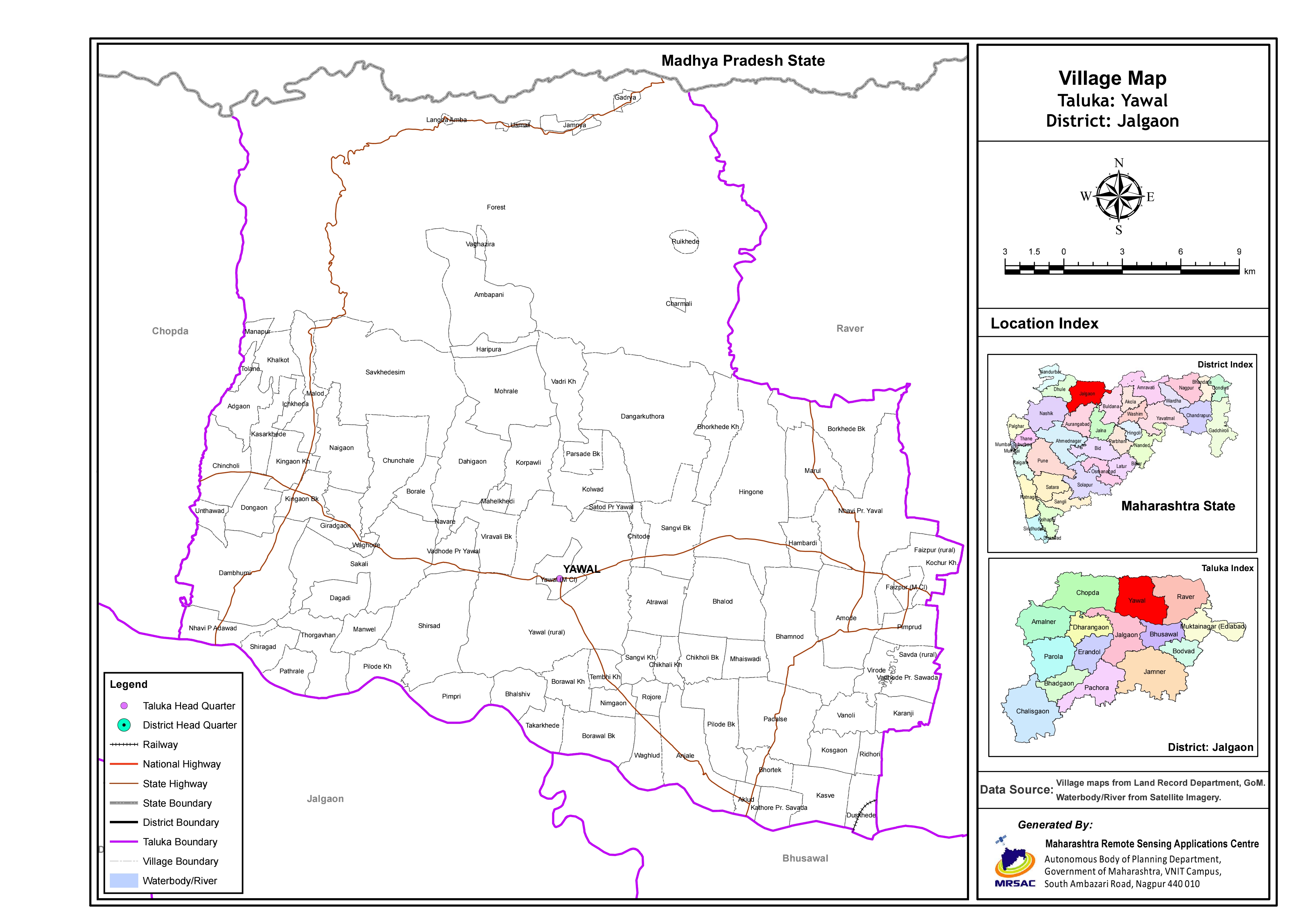
Yawal has 1 river with 2 tributaries, (Harita and Sarita a.k.a. Hadkai and Khadkai). In the stream of Suki River Suresh Chopane, Geologist from Chandrapur discovered Columnar Basalt in August 2021.This is a rare Geological formation. Yawal taluka consists of Atrawal,Kingaon
Kingaon is a village in Yawal taluka of Jalgaon district, Maharashtra, India. It is located between the foot hill of Satpura mountain and the bank of Tapti River. Kingaon is 25 km from the city of Jalgaon. Majority of the population consi ...
, Anjale, Amoda, Sakali, Faizpur, Sangavi Bk, Nhavi, Korpawali, Haripura
Haripura is a village located near Kadod town in the Surat district of Gujarat, India. It is around 13 kilometres north east of Bardoli. During the Indian independence movement, it was the venue of annual session of the Indian National Congr ...
, Viravali and many other villages.
Demographics
Yawal have a Hindu Population of 68.28%, followers of Islam is 26.19%, Buddhism Religion followers are 3.89 and other religion citizens are 1.64% as of May-2022Politics
Yawal is also a taluka city in the district of Jalgaon, Maharashtra. The Yawal city is divided into 19 wards for which elections are held every 5 years. The Yawal Municipal Council has a population of 36,706 of which 18,965 are males while 17,741 are females as per report released by Census India 2011. Yawal Municipal Council has total administration over 7,363 houses to which it supplies basic amenities like water and sewerage.Transport
Yawal is located on theBurhanpur
Burhanpur is a historical city in the Indian state of Madhya Pradesh. It is the administrative seat of Burhanpur District. It is situated on the north bank of the Tapti River and northeast of city of Mumbai , southwest of the state's capita ...
-Ankaleshwer MH SH 4. The nearest main railway station is Bhusawal which is just 18 km. The nearest airport to Yawal is Jalgaon Airport
Jalgaon Airport is a domestic airport serving the city of Jalgaon in Maharashtra, India. It is located in Kusumbe, off National Highway 753F (NH-753F), southeast of the city centre, and away from the Ajanta Caves, for which it is its closes ...
which is just 45 km away.
Temples
 * Shree Jagatguru Ved Maharshi Vyas Muni Mandir. He wrote the
 Mahabharata
The ''Mahābhārata'' ( ; , , ) is one of the two major Sanskrit Indian epic poetry, epics of ancient India revered as Smriti texts in Hinduism, the other being the ''Ramayana, Rāmāyaṇa''. It narrates the events and aftermath of the Kuru ...
.
* Tarkeshwar Mandir.
It has a fort said to have belonged to the Sansthanik Raje Nimbalkar. Gavali Wadaa has a 9–10 km long wall.
Yawal Taluka(Tehsil)
Yawal is a city withtehsil
A tehsil (, also known as tahsil, taluk, or taluka () is a local unit of administrative division in India and Pakistan. It is a subdistrict of the area within a Zila (country subdivision), district including the designated populated place that ser ...
headquarter in Jalgaon
Jalgaon () is a city in the state of Maharashtra, India. The city is located in North Maharashtra in the subregion of Khandesh, and serves as the administrative headquarters of its namesake district, the Jalgaon district. In the subregion of ...
district of Maharashtra
Maharashtra () is a state in the western peninsular region of India occupying a substantial portion of the Deccan Plateau. It is bordered by the Arabian Sea to the west, the Indian states of Karnataka and Goa to the south, Telangana to th ...
state in India
India, officially the Republic of India, is a country in South Asia. It is the List of countries and dependencies by area, seventh-largest country by area; the List of countries by population (United Nations), most populous country since ...
. In Yawal taluka there is 91 villages and 2 towns(Yawal & Faizpur).
According to Indian census of 2011, population of Yawal taluka was 2,72,242. In which, 23.3% people lives in Urban areas and 76.7% lives in the Rural areas.

See also
*Jalgaon
Jalgaon () is a city in the state of Maharashtra, India. The city is located in North Maharashtra in the subregion of Khandesh, and serves as the administrative headquarters of its namesake district, the Jalgaon district. In the subregion of ...
* Raver
* Yawal Fort
References
{{Jalgaon district topics Talukas in Maharashtra Cities and towns in Jalgaon district