Y Foel on:
[Wikipedia]
[Google]
[Amazon]
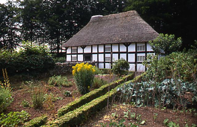
Banwy is a  Abernodwydd Farmhouse, a wooden-framed farmhouse built in 1678 from the Llangadfan was reassembled at the
community
A community is a social unit (a group of people) with a shared socially-significant characteristic, such as place, set of norms, culture, religion, values, customs, or identity. Communities may share a sense of place situated in a given g ...
in northwest Montgomeryshire
Montgomeryshire ( ) was Historic counties of Wales, one of the thirteen counties of Wales that existed from 1536 until their abolishment in 1974. It was named after its county town, Montgomery, Powys, Montgomery, which in turn was named after ...
, Powys
Powys ( , ) is a Principal areas of Wales, county and Preserved counties of Wales, preserved county in Wales. It borders Gwynedd, Denbighshire, and Wrexham County Borough, Wrexham to the north; the English Ceremonial counties of England, ceremo ...
, Wales
Wales ( ) is a Countries of the United Kingdom, country that is part of the United Kingdom. It is bordered by the Irish Sea to the north and west, England to the England–Wales border, east, the Bristol Channel to the south, and the Celtic ...
, named after the River Banwy
The River Banwy is a river about long in Powys, Wales. It is a tributary of the River Vyrnwy.
The Banwy rises in the hills near the pass which takes the A458 road between Mallwyd and Welshpool. The river is called Nant Cerrig-y-groes at its ...
and also called ''Banw'' in Welsh.
The community with the villages of Llangadfan
Llangadfan is a small village in Powys, Wales, based in the community of Banwy. The village lies on the A458 between Foel and Llanerfyl, from Llanwddyn. Dyfnant Forest is located nearby. The village is said to be known for its country dances.
...
and Foel, also called Garthbeibio. It is a sparsely populated area centred on the village of Llangadfan and extending west for some 10 km to the boundary with Gwynedd
Gwynedd () is a county in the north-west of Wales. It borders Anglesey across the Menai Strait to the north, Conwy, Denbighshire, and Powys to the east, Ceredigion over the Dyfi estuary to the south, and the Irish Sea to the west. The ci ...
. It is located along the upper River Banwy valley, on either side of the A458 road
The A458 is a route on the UK highway network that runs from Mallwyd, near Machynlleth, in Wales, merging with the A456 Hagley Road and the Quinton Expressway on the outskirts of Birmingham, in England. On the way it passes through Welshpool ...
between Llanfair Caereinion
Llanfair Caereinion () is a market town and community in Montgomeryshire, Powys, Wales upon the River Banwy (also known as the River Einion), around 8 miles west of Welshpool. In 2011 the ward had a population of 1,810; the town itself had a p ...
and Mallwyd
Mallwyd () is a small village at the most southern end of Gwynedd, Wales, in the Mawddwy community, in the valley of the River Dyfi. It lies on the A470 approximately halfway between Dolgellau and Machynlleth, and forms the junction of the A ...
.
The population according to the 2011 UK census
A census of the population of the United Kingdom is taken every ten years. The 2011 census was held in all countries of the UK on 27 March 2011. It was the first UK census which could be completed online via the Internet. The Office for National ...
was 605. In 2005, the population was 534.
 Abernodwydd Farmhouse, a wooden-framed farmhouse built in 1678 from the Llangadfan was reassembled at the
 St Fagans National Museum of History
St Fagans National Museum of History ( ; ), commonly referred to as St Fagans after the village where it is located, is an open-air museum in St Fagans, Cardiff, Wales, chronicling the historical lifestyle, culture, and architecture of the Wels ...
. Banwy was the site of Ffridd y Castell, or Ffriddycastell. The site is located southwest of Llangadfan.
References
External links
{{Powys Montgomeryshire Communities in Powys