World Port Index on:
[Wikipedia]
[Google]
[Amazon]
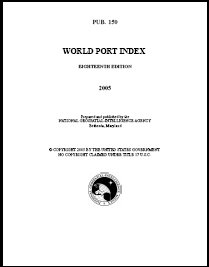
 The World Port Index (PUB 150) contains a tabular listing of thousands of ports throughout the world, describing their location, characteristics, known facilities, and available services. Of particular interest are the applicable volume of
Chapter 4: Nautical Publications
- from the online edition of
World Port Index at National Geospatial-Intelligence Agency
* https://web.archive.org/web/20070304011545/http://www.nga.mil/portal/site/maritime/?epi_menuItemID=f00695a20370bb625b2a7fbd3227a759&epi_menuID=35ad5b8aabcefa1a0fc133443927a759&epi_baseMenuID=e106a3b5e50edce1fec24fd73927a759 Navigation Hydrography Lists of ports Water transport-related lists
 The World Port Index (PUB 150) contains a tabular listing of thousands of ports throughout the world, describing their location, characteristics, known facilities, and available services. Of particular interest are the applicable volume of
 Sailing Directions
General information
Sailing Directions are volumes published by various National Hydrographic Offices or Coast Guard Agencies which provide essential information to support port entry and coastal navigation for all classes of ships at sea. Sail ...
and the number of the harbor chart. The table is arranged geographically, with an alphabetical index.
The selection of these places is based on criteria established by the National Geospatial-Intelligence Agency
The National Geospatial-Intelligence Agency (NGA) is a combat support agency within the United States Department of Defense whose primary mission is collecting, analyzing, and distributing geospatial intelligence (GEOINT) to support national se ...
. They are not random choices. The applicable chart
A chart (sometimes known as a graph) is a graphics, graphical representation for data visualization, in which "the data is represented by symbols, such as bars in a bar chart, lines in a line chart, or slices in a pie chart". A chart can repres ...
and Sailing Directions
General information
Sailing Directions are volumes published by various National Hydrographic Offices or Coast Guard Agencies which provide essential information to support port entry and coastal navigation for all classes of ships at sea. Sail ...
is given for each place listed.
In order to present such a large amount of diversified data in a single volume of convenient size, a simple code is used to indicate certain types of information. The code symbols are explained at the top of each page of text.
This book is corrected by the National Geospatial-Intelligence Agency
The National Geospatial-Intelligence Agency (NGA) is a combat support agency within the United States Department of Defense whose primary mission is collecting, analyzing, and distributing geospatial intelligence (GEOINT) to support national se ...
.
Data availability
In addition to the published text edition of the World Port Index, the National Geospatial-Intelligence Agency also makes the data available in tabular and spatial formats. This includesMicrosoft Access
Microsoft Access is a database management system (DBMS) from Microsoft that combines the relational database, relational Access Database Engine (ACE) with a graphical user interface and software-development tools. It is a member of the Microsof ...
database and Esri Shapefile
The shapefile format is a geospatial vector data format for geographic information system (GIS) software. It is developed and regulated by Esri as a mostly open specification for data interoperability among Esri and other GIS software product ...
formats. Archived publications are also available with past Access databases dating to 2000 and Shapefiles dating to 2010. The data is available from the National Geospatial-Intelligence Agency's World Port Index webpage.
Sources
The text of this article originated from the preface of the ''World Port Index'' and section 413 of TheAmerican Practical Navigator
''The American Practical Navigator'' (colloquially often referred to as ''Bowditch''), originally written by Nathaniel Bowditch, is an encyclopedia of navigation. It serves as a valuable handbook on oceanography and meteorology, and contains use ...
. These documents are produced by the government of the United States of America
The United States of America (USA), also known as the United States (U.S.) or America, is a country primarily located in North America. It is a federal republic of 50 states and a federal capital district, Washington, D.C. The 48 contiguo ...
and in the public domain.
See also
*American Practical Navigator
''The American Practical Navigator'' (colloquially often referred to as ''Bowditch''), originally written by Nathaniel Bowditch, is an encyclopedia of navigation. It serves as a valuable handbook on oceanography and meteorology, and contains use ...
*Coast Pilots
''United States Coast Pilot'' is a ten-volume American navigation publication distributed yearly by the Office of Coast Survey, a part of the National Oceanic and Atmospheric Administration's National Ocean Service. The purpose of the publication ...
* Distances Between Ports
* List of Lights
*Local Notice to Mariners
Local may refer to:
Geography and transportation
* Local (train), a train serving local traffic demand
* Local, Missouri, a community in the United States
Arts, entertainment, and media
* ''Local'' (comics), a limited series comic book by Bria ...
* Notice to Mariners
*Sailing Directions
General information
Sailing Directions are volumes published by various National Hydrographic Offices or Coast Guard Agencies which provide essential information to support port entry and coastal navigation for all classes of ships at sea. Sail ...
References
{{ReflistExternal links
Chapter 4: Nautical Publications
- from the online edition of
Nathaniel Bowditch
Nathaniel Bowditch (March 26, 1773 – March 16, 1838) was an early American mathematician remembered for his work on ocean navigation. He is often credited as the founder of modern maritime navigation; his book '' The New American Practical Navi ...
's ''American Practical Navigator''
World Port Index at National Geospatial-Intelligence Agency
* https://web.archive.org/web/20070304011545/http://www.nga.mil/portal/site/maritime/?epi_menuItemID=f00695a20370bb625b2a7fbd3227a759&epi_menuID=35ad5b8aabcefa1a0fc133443927a759&epi_baseMenuID=e106a3b5e50edce1fec24fd73927a759 Navigation Hydrography Lists of ports Water transport-related lists