Vallard Atlas on:
[Wikipedia]
[Google]
[Amazon]
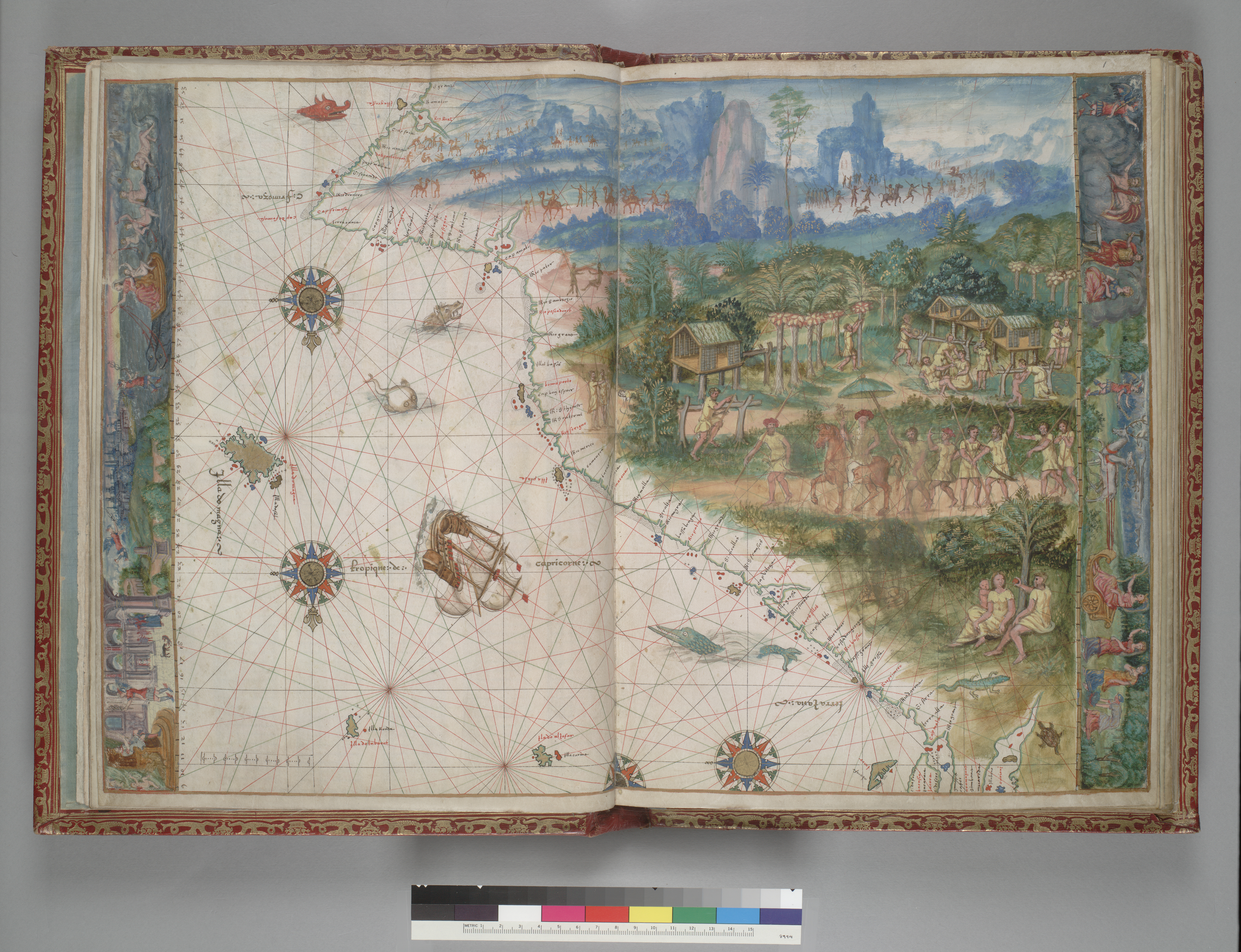
 The Vallard Atlas is a world
Image published by El Mundo newspaper on 15 October 2015
atlases 1547 books French travel books
 The Vallard Atlas is a world
 atlas
An atlas is a collection of maps; it is typically a bundle of world map, maps of Earth or of a continent or region of Earth. Advances in astronomy have also resulted in atlases of the celestial sphere or of other planets.
Atlases have traditio ...
, one of the Dieppe school of maps, produced in 1547. It is believed to have been owned by , its authorship being unknown.
History
It is considered one of the most notable 16th-century atlases of the Dieppe school of Cartography. It is believed that Nicholas Vallard was the first owner and this is why the publication bears his name The atlas is held at theHuntington Library
The Huntington Library, Art Museum and Botanical Gardens, known as The Huntington, is a collections-based educational and research institution established by Henry E. Huntington and Arabella Huntington in San Marino, California, United State ...
based in San Marino
San Marino, officially the Republic of San Marino, is a landlocked country in Southern Europe, completely surrounded by Italy. Located on the northeastern slopes of the Apennine Mountains, it is the larger of two European microstates, microsta ...
, California, USA.
Description
The atlas consists of 68 pages, and contains 15nautical charts
A nautical chart or hydrographic chart is a graphic representation of a sea region or water body and adjacent coasts or banks. Depending on the scale of the chart, it may show depths of water (bathymetry) and heights of land (topography), na ...
with rich illustrations as well as a calendar and some in-depth maritime information.
The atlas contains numerous illuminations that show the New World
The term "New World" is used to describe the majority of lands of Earth's Western Hemisphere, particularly the Americas, and sometimes Oceania."America." ''The Oxford Companion to the English Language'' (). McArthur, Tom, ed., 1992. New York: ...
’s inhabitants, and this is why it is considered a valuable testimony of discovery. The original publication is bound in crimson leather with golden decorations.
The maps depicted in the atlas are inverted compared to modern depictions, as the North Pole
The North Pole, also known as the Geographic North Pole or Terrestrial North Pole, is the point in the Northern Hemisphere where the Earth's rotation, Earth's axis of rotation meets its surface. It is called the True North Pole to distingu ...
is placed on the bottom side of the atlas while the South Pole
The South Pole, also known as the Geographic South Pole or Terrestrial South Pole, is the point in the Southern Hemisphere where the Earth's rotation, Earth's axis of rotation meets its surface. It is called the True South Pole to distinguish ...
is placed on the top.
There is some speculation that like some other works of the Dieppe school of maps, the atlas may show the Australian coastline with its depiction of a continent labelled Jave la Grande
La grande isle de Java ("the great island of Java") was, according to Marco Polo, the largest island in the world; his Java Minor was the actual island of Sumatra, which takes its name from the city of Samudera (now Lhokseumawe) situated on its n ...
, which would mean it was created before the documented discoveries of Willem Janszoon
Willem Janszoon (; ) was a Dutch navigator and colonial governor. He served in the Dutch East Indies in the periods 1603–1611 and 1612–1616, including as governor of Fort Henricus on the island of Solor. During his voyage of 1605–1606 ...
or James Cook
Captain (Royal Navy), Captain James Cook (7 November 1728 – 14 February 1779) was a British Royal Navy officer, explorer, and cartographer famous for his three voyages of exploration to the Pacific and Southern Oceans, conducted between 176 ...
. However, most historians do not accept this theory, and the interpretation of this feature of the Vallard and other Dieppe maps is highly contentious.Robert J. King, "Regio Patalis: Australia on the map in 1531?", ''The Portolan'', Issue 82, Winter 2011, pp. 8–17.
References
{{reflistExternal links
Image published by El Mundo newspaper on 15 October 2015
atlases 1547 books French travel books