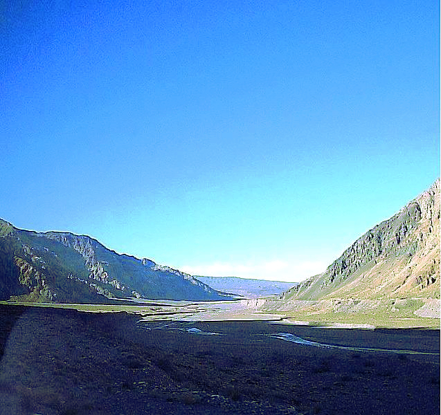
Uspallata Pass on:
[Wikipedia]
[Google]
[Amazon]
 The Uspallata Pass, Bermejo Pass or Cumbre Pass, is an
Andean
The Andes ( ), Andes Mountains or Andean Mountain Range (; ) are the longest continental mountain range in the world, forming a continuous highland along the western edge of South America. The range is long and wide (widest between 18°S ...
pass which provides a route between the wine-growing region around the Argentine
Argentines, Argentinians or Argentineans are people from Argentina. This connection may be residential, legal, historical, or cultural. For most Argentines, several (or all) of these connections exist and are collectively the source of their ...
city of Mendoza, the Chile
Chile, officially the Republic of Chile, is a country in western South America. It is the southernmost country in the world and the closest to Antarctica, stretching along a narrow strip of land between the Andes, Andes Mountains and the Paci ...
an city Los Andes and Santiago
Santiago (, ; ), also known as Santiago de Chile (), is the capital and largest city of Chile and one of the largest cities in the Americas. It is located in the country's central valley and is the center of the Santiago Metropolitan Regi ...
, the Chile
Chile, officially the Republic of Chile, is a country in western South America. It is the southernmost country in the world and the closest to Antarctica, stretching along a narrow strip of land between the Andes, Andes Mountains and the Paci ...
an capital situated in the central Chilean valley.
Overview
The pass has been used since colonial times as the most direct link between thePacific
The Pacific Ocean is the largest and deepest of Earth's five oceanic divisions. It extends from the Arctic Ocean in the north to the Southern Ocean, or, depending on the definition, to Antarctica in the south, and is bounded by the cont ...
seaport of Valparaiso and the Atlantic
The Atlantic Ocean is the second largest of the world's five oceanic divisions, with an area of about . It covers approximately 17% of Earth's surface and about 24% of its water surface area. During the Age of Discovery, it was known for se ...
port of Buenos Aires
Buenos Aires, controlled by the government of the Autonomous City of Buenos Aires, is the Capital city, capital and largest city of Argentina. It is located on the southwest of the Río de la Plata. Buenos Aires is classified as an Alpha− glob ...
, avoiding the 11-day, journey by sea, via Cape Horn
Cape Horn (, ) is the southernmost headland of the Tierra del Fuego archipelago of southern Chile, and is located on the small Hornos Island. Although not the most southerly point of South America (which is Águila Islet), Cape Horn marks the nor ...
, between the two ports. In 1817 it was used by the Army of the Andes
The Army of the Andes () was a military force created by the United Provinces of South America, United Provinces of the Río de la Plata (Argentina) and assembled by General José de San Martín as part of his campaign to liberate Chile from the S ...
to cross the Andes, in the campaign to free Chile from the Spanish Empire
The Spanish Empire, sometimes referred to as the Hispanic Monarchy (political entity), Hispanic Monarchy or the Catholic Monarchy, was a colonial empire that existed between 1492 and 1976. In conjunction with the Portuguese Empire, it ushered ...
.
Reaching a maximum elevation of about , the pass runs between the peaks of the Aconcagua
Aconcagua () is a mountain in the Principal Cordillera of the Andes mountain range, in Mendoza Province, Argentina. It is the highest mountain in the Americas, the highest outside Asia, and the highest in both the Western Hemisphere and the ...
to the north and the Tupungato
Tupungato, one of the highest mountains in the Americas, is a massive Andes, Andean lava dome dating to Pleistocene times. It lies on the Argentina–Chile border, between the Chilean Metropolitan Region (near a major international highway about ...
to the south.
In the 1990s it was the most used pass in all of South America. A railroad tunnel built by the now defunct Transandine Railway (1910–1982) runs underneath. The Pan-American Highway
The Pan-American Highway is a vast network of roads that stretches about 30,000 kilometers (about 19,000 miles) from Prudhoe Bay, Alaska, in the northernmost part of North America to Ushuaia, Argentina, at the southern tip of South America. I ...
runs through the nearby Cristo Redentor Tunnel (in Spanish: ''Paso Internacional Cristo Redentor'') and a monument, Christ the Redeemer of the Andes
''Christ the Redeemer of the Andes'' () is a monument high in the Principal Cordillera of the Andes at 3,832 metres (12,572 ft) above mean sea level on Argentina–Chile border, the border between Argentina and Chile. It was unveiled on 13 ...
(''"Cristo Redentor de los Andes"'' in Spanish) is located at the pass.
See also
* Paso Internacional Los LibertadoresReferences
External links
Argentina–Chile border crossings Landforms of Mendoza Province Landforms of Valparaíso Region Mountain passes of the Andes Mountain passes of Argentina Mountain passes of Chile Principal Cordillera {{MendozaAR-geo-stub