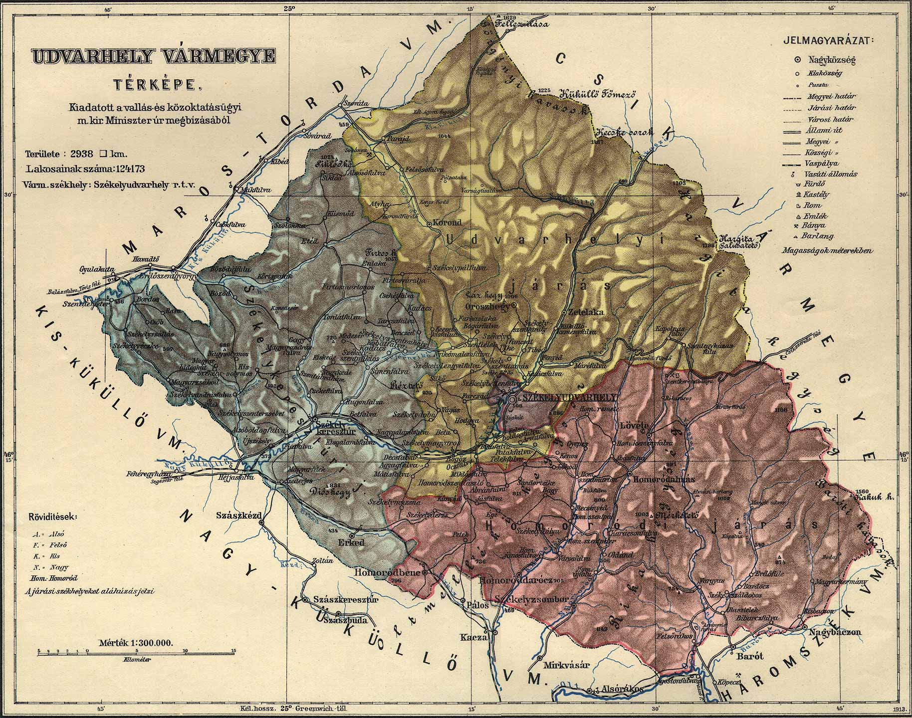
Udvarhely Ethnic Map on:
[Wikipedia]
[Google]
[Amazon]
Udvarhely () was an administrative county (

 In the early 20th century, the subdivisions of Udvarhely county were:
comitatus
Comitatus may refer to:
*Comitatus (warband), a Germanic warband who follow a leader
* ''Comitatus'', the office of a Roman or Frankish comes, translated as count.
* ''Comitatus'', translated as county, a territory such as governed by medieval cou ...
) of the Kingdom of Hungary
The Kingdom of Hungary was a monarchy in Central Europe that existed for nearly a millennium, from 1000 to 1946 and was a key part of the Habsburg monarchy from 1526-1918. The Principality of Hungary emerged as a Christian kingdom upon the Coro ...
. Its territory is now in central Romania
Romania is a country located at the crossroads of Central Europe, Central, Eastern Europe, Eastern and Southeast Europe. It borders Ukraine to the north and east, Hungary to the west, Serbia to the southwest, Bulgaria to the south, Moldova to ...
(eastern Transylvania
Transylvania ( or ; ; or ; Transylvanian Saxon dialect, Transylvanian Saxon: ''Siweberjen'') is a List of historical regions of Central Europe, historical and cultural region in Central Europe, encompassing central Romania. To the east and ...
). The capital of the county was ''Székelyudvarhely'' (now Odorheiu Secuiesc
Odorheiu Secuiesc (; , ; ) is the second largest municipality in Harghita County, Transylvania, Romania. In its short form, it is also known as ''Odorhei'' in Romanian and ''Udvarhely'' in Hungarian. The Hungarian name of the town "Udvarhely" mean ...
).
Geography
Udvarhely county shared borders with the counties ofMaros-Torda
Maros-Torda was an administrative county (comitatus) of the Kingdom of Hungary. Its territory is now in central Romania (eastern Transylvania) and has been administratively succeeded by county Mureș which consist of about half the territory of ...
, Csík, Háromszék, Nagy-Küküllő, and Kis-Küküllő. The county lay in the Carpathian Mountains
The Carpathian Mountains or Carpathians () are a range of mountains forming an arc across Central Europe and Southeast Europe. Roughly long, it is the third-longest European mountain range after the Ural Mountains, Urals at and the Scandinav ...
. Its area was 2,938 km2 around 1910.
History
Udvarhely county consisted of three formerseats
A seat is a place to sit. The term may encompass additional features, such as back, armrest, head restraint but may also refer to concentrations of power in a wider sense (i.e " seat (legal entity)"). See disambiguation.
Types of seat
The ...
of the Székelys
The Székelys (, Old Hungarian script, Székely runes: ), also referred to as Szeklers, are a Hungarians, Hungarian subgroup living mostly in the Székely Land in Romania. In addition to their native villages in Suceava County in Bukovina, a ...
: Udvarhelyszék
Udvarhelyszék (; formerly called ''Telegdiszék'') was one of the Székely seats in the historical Székely Land.
Situated on the western part of the Székely Land, it was the main seat (, , ''sedes capitalis'') for a significant period, being ...
, Bardóc and Keresztúr (the latter two as filial seats of the former). It was formed in 1876, when the administrative structure of Transylvania was changed. In 1920, by the Treaty of Trianon
The Treaty of Trianon (; ; ; ), often referred to in Hungary as the Peace Dictate of Trianon or Dictate of Trianon, was prepared at the Paris Peace Conference (1919–1920), Paris Peace Conference. It was signed on the one side by Hungary ...
, the county became part of Romania until 1940 when, by the Second Vienna Award
The Second Vienna Award was the second of two territorial disputes that were arbitrated by Nazi Germany and the Kingdom of Italy. On 30 August 1940, they assigned the territory of Northern Transylvania, including all of Maramureș and part of Cri ...
, much of its territory was reassigned to Hungary. After the end of World War II
World War II or the Second World War (1 September 1939 – 2 September 1945) was a World war, global conflict between two coalitions: the Allies of World War II, Allies and the Axis powers. World War II by country, Nearly all of the wo ...
it became again part of Romania. Most of its territory lies in the present-day Romanian county of Harghita
Harghita County (, and , ) is a county () in the center of Romania, in eastern Transylvania, with the county seat at Miercurea Ciuc.
Demographics 2002 census
In 2002, Harghita County had a population of 326,222 and a population density of ...
, with small parts in Mureș (a small part in the west) and Covasna (a small part in the south-east).
Demographics

Subdivisions
 In the early 20th century, the subdivisions of Udvarhely county were:
Notes
References
{{Authority control States and territories established in 1940 States and territories disestablished in 1920 States and territories disestablished in 1945 Counties of the Kingdom of Hungary in Transylvania