Stamford Road on:
[Wikipedia]
[Google]
[Amazon]
 Stamford Road ( Chinese: 史丹福路; ) is a one-way
Heritage Places of Singapore
', Singapore: Marshall Cavendish International (Asia) Private Limited, 2009, pages 85-87. Retrieved 3 April 2022.
 Stamford Road ( Chinese: 史丹福路; ) is a one-way
 road
A road is a thoroughfare used primarily for movement of traffic. Roads differ from streets, whose primary use is local access. They also differ from stroads, which combine the features of streets and roads. Most modern roads are paved.
Th ...
in Singapore
Singapore, officially the Republic of Singapore, is an island country and city-state in Southeast Asia. The country's territory comprises one main island, 63 satellite islands and islets, and one outlying islet. It is about one degree ...
within the planning areas of Downtown Core
The Downtown Core is the historical and downtown centre of the city-state of Singapore and the main commercial area in Singapore excluding reclaimed lands with two integrated resorts such as the Marina Bay Sands, one of the most expensive buil ...
and Museum
A museum is an institution dedicated to displaying or Preservation (library and archive), preserving culturally or scientifically significant objects. Many museums have exhibitions of these objects on public display, and some have private colle ...
. The road continues after the traffic light
Traffic lights, traffic signals, or stoplights – also known as robots in South Africa, Zambia, and Namibia – are signaling devices positioned at intersection (road), road intersections, pedestrian crossings, and other locations in order t ...
junction of Nicoll Highway
Nicoll Highway ( , , , ) is a major arterial road in Singapore which links the junctions of Guillemard Road, Sims Way and Mountbatten Road in Kallang to the junctions of Esplanade Drive, Raffles Avenue and Stamford Road in the city. En route, ...
, Esplanade Drive and Raffles Avenue towards Orchard Road
Orchard Road, often known colloquially as simply Orchard, is a major -long road in the Central Area, Singapore, Central Area of Singapore. A famous tourist attraction, it is an upscale shopping area, with numerous internationally renowned de ...
. It then ends at the junction of Fort Canning Road, Bencoolen Street and Orchard Road, which it continues to be Orchard Road. Stamford Road is home to several landmarks, including Swissôtel The Stamford and the National Museum of Singapore.
Etymology and history
Stamford Road was named after the modern founder of Singapore, Thomas Stamford Raffles. The road used to house the Saint Andrew's School from the late 19th century till 1941 when it moved to Woodsville Hill. The site was taken by theNational Library
A national library is a library established by a government as a country's preeminent repository of information. Unlike public library, public libraries, these rarely allow citizens to borrow books. Often, they include numerous rare, valuable, ...
in 1960 until it was demolished in 2005 to make way for the new Fort Canning Tunnel.
Landmarks
This is a list of landmarks, from east to west. * Civilian War Memorial * Saint Andrew's Cathedral * Raffles City and Swissôtel The Stamford *City Hall MRT station
City Hall MRT station is an underground Singapore Mass Rapid Transit (Singapore), Mass Rapid Transit (MRT) interchange station on the North South MRT line, North–South line (NSL) and East West MRT line, East–West line (EWL). Situated in t ...
* SMRT Headquarters Building
* Capitol Building
* CHIJMES
* Stamford House
* Stamford Court
* Singapore Management University
* National Museum of Singapore
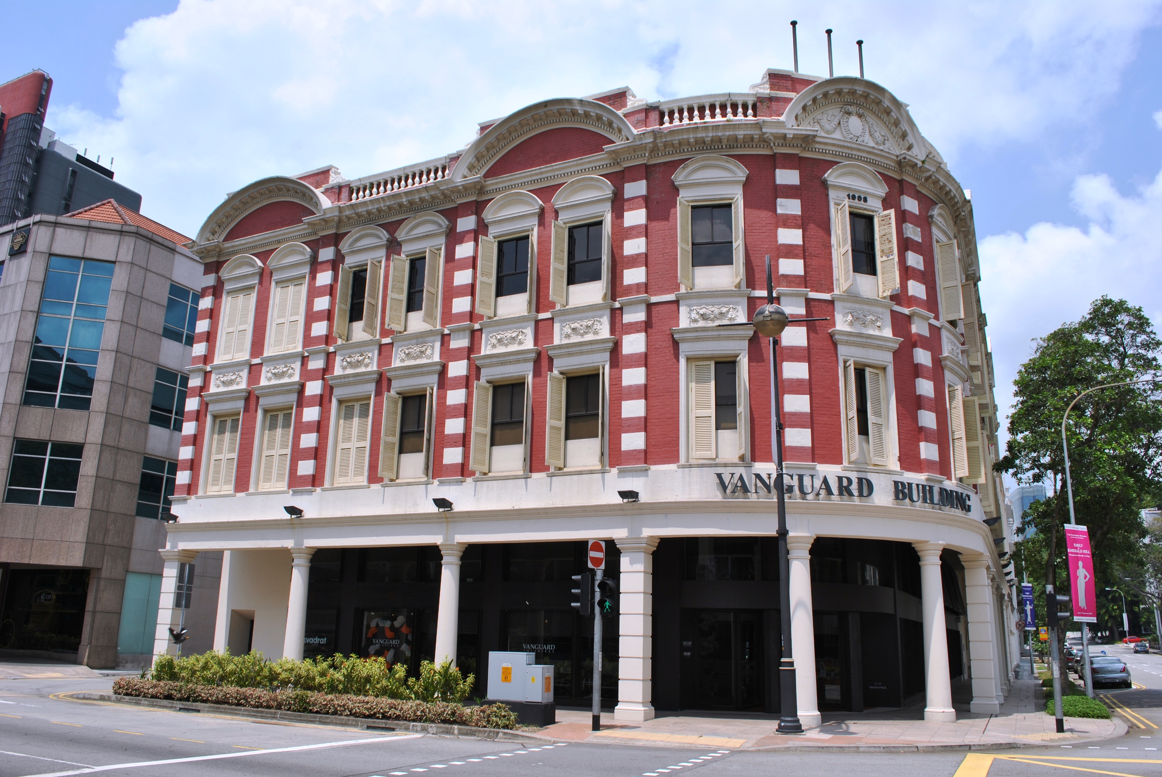
* Vanguard Building (formerly known as the MPH Building) - located at corner of Stamford Road and Armenian Street - former site of Methodist Publishing Press and MPH Bookstore"MPH Building" (entry) in: Wan Meng Hao and Jacqueline Lau, Heritage Places of Singapore
', Singapore: Marshall Cavendish International (Asia) Private Limited, 2009, pages 85-87. Retrieved 3 April 2022.
References
*Victor R Savage, Brenda S A Yeoh (2004), ''Toponymics - A Study of Singapore Street Names'', Eastern University Press, {{coord, 1, 17, 39, N, 103, 51, 04, E, region:SG_type:landmark_source:kolossus-ruwiki, display=title Roads in Singapore Downtown Core (Singapore) Museum Planning Area