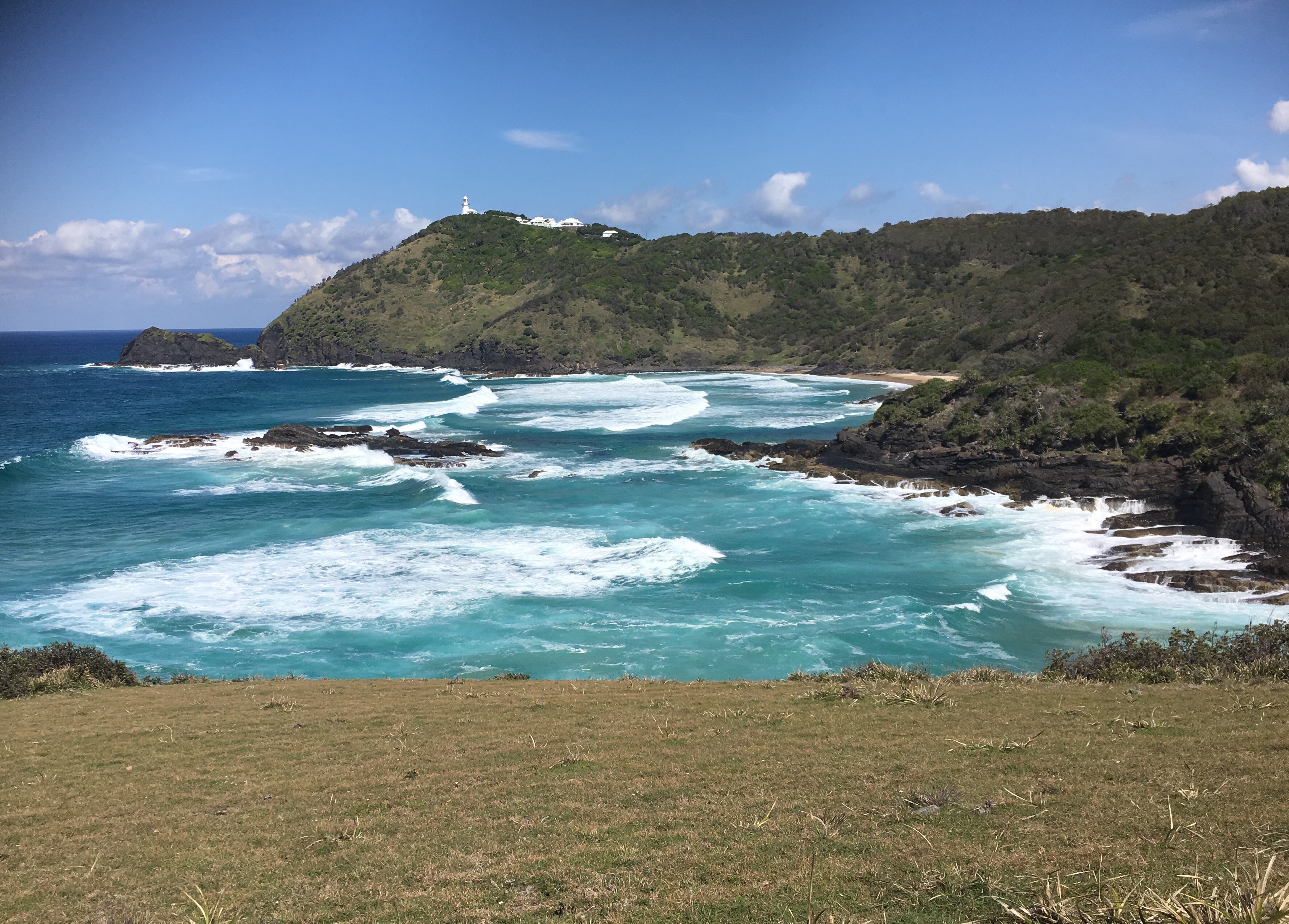
Smoky Cape on:
[Wikipedia]
[Google]
[Amazon]
Smoky Cape is a

Smoky Cape Lighthouse page
at the NSW National Parks and Wildlife Service * For photos of the area see th
South West Rocks Photo Gallery
{{1stVoyageCookAus Headlands of New South Wales Mid North Coast Kempsey Shire
headland
A headland, also known as a head, is a coastal landform, a point of land usually high and often with a sheer drop, that extends into a body of water. It is a type of promontory. A headland of considerable size often is called a cape.Whittow, Jo ...
in Australia
Australia, officially the Commonwealth of Australia, is a country comprising mainland Australia, the mainland of the Australia (continent), Australian continent, the island of Tasmania and list of islands of Australia, numerous smaller isl ...
on the New South Wales
New South Wales (commonly abbreviated as NSW) is a States and territories of Australia, state on the Eastern states of Australia, east coast of :Australia. It borders Queensland to the north, Victoria (state), Victoria to the south, and South ...
Mid-North Coast. It lies just east of the town of South West Rocks
South West Rocks is a town located on the Mid North Coast of New South Wales, Australia, near the mouth of the Macleay River. It is approximately from Kempsey. Jerseyville is located nearby.
The population of South West Rocks is 5,443 peopl ...
, and within the Hat Head National Park
Hat Head is a national park on the Mid North Coast of New South Wales, Australia, north-east of Sydney. It lies within the Hastings-Macleay Important Bird Area. Within the park is the eponymous village of Hat Head, with about 320 inhabitants.
...
.
Cape
The cape was named ''Smoky Cape'' byCaptain Cook
Captain James Cook (7 November 1728 – 14 February 1779) was a British Royal Navy officer, explorer, and cartographer famous for his three voyages of exploration to the Pacific and Southern Oceans, conducted between 1768 and 1779. He complet ...
when he passed it on 13 May 1770, writing of "a point or headland, on which were fires that caused a great quantity of smook, which occasioned my giving it the name of Smooky Cape". ''Smook'' was his usual spelling of ''smoke;'' the spelling for the cape now follows the modern spelling. The hills there were an important meeting place for aboriginal people from various surrounding areas; it's possible Cook saw fires from such a gathering.
A lighthouse was proposed for the cape in 1886 and completed in 1891. Known as the Smoky Cape Lighthouse, it was built from concrete and local granite aggregate in an octagonal shape at the highest point on the cape.

Fish Rock
Fish Rock is a small, bare rock that juts out of the sea just south-east of the cape. It's a notedscuba diving
Scuba diving is a Diving mode, mode of underwater diving whereby divers use Scuba set, breathing equipment that is completely independent of a surface breathing gas supply, and therefore has a limited but variable endurance. The word ''scub ...
location and home to various fish species. A 120-metre cave runs right under the rock, and there are various gutters nearby where grey nurse shark
The sand tiger shark (''Carcharias taurus''), grey/gray nurse shark (in Australia), spotted ragged-tooth shark (in South Africa), or blue-nurse sand tiger, is a species of shark that inhabits subtropical and temperate waters worldwide. It inhabit ...
s live. The area is one of about a dozen in New South Wales recognised as critical for the shark, so fishing in the vicinity is restricted.
Green Island
Green Island is a small island close to the coast just north of the cape. It has also been categorised as a critical habitat area for the grey nurse shark.References
External links
Smoky Cape Lighthouse page
at the NSW National Parks and Wildlife Service * For photos of the area see th
South West Rocks Photo Gallery
{{1stVoyageCookAus Headlands of New South Wales Mid North Coast Kempsey Shire