Smirnenski Point on:
[Wikipedia]
[Google]
[Amazon]

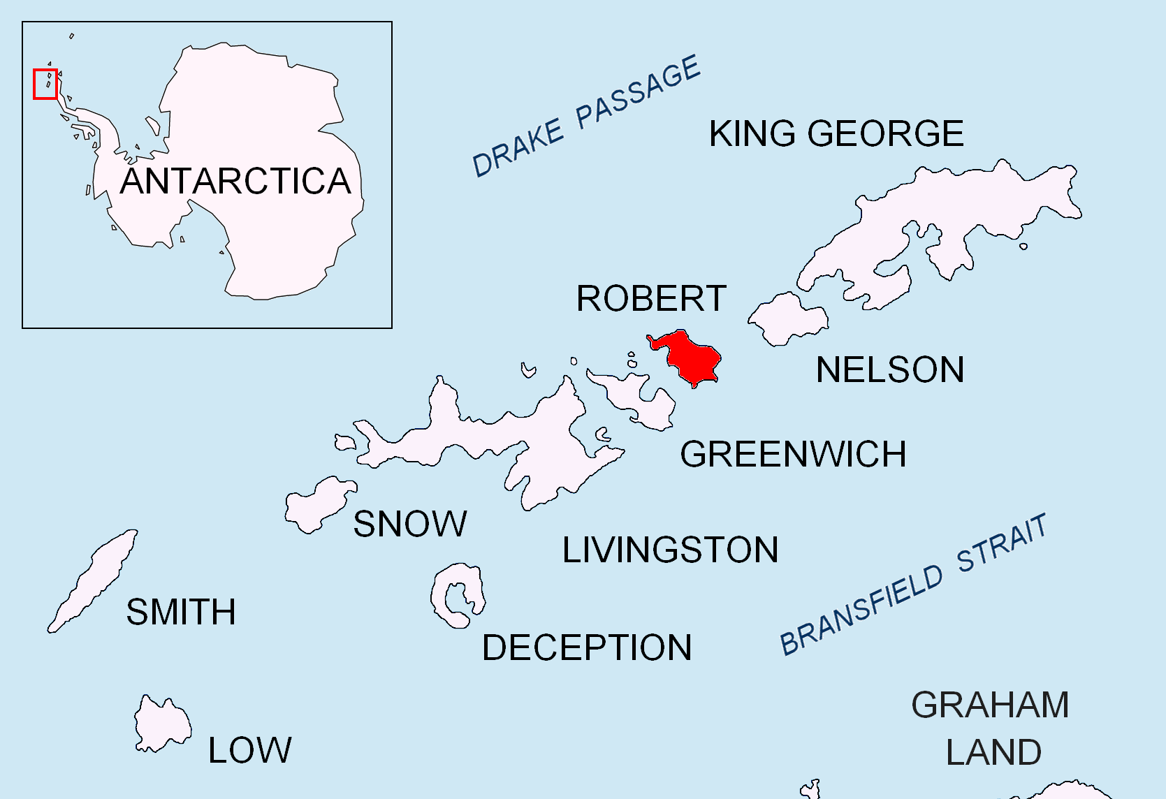
 Smirnenski Point (, ‘Nos Smirnenski’ \'nos 'smir-nen-ski\) is a narrow, ice-free point on the east coast of
Antarctica: Livingston Island and Greenwich, Robert, Snow and Smith Islands.
Scale 1:120000 topographic map. Troyan: Manfred Wörner Foundation, 2009.
Smirnenski Point.
Bulgarian Antarctic Gazetteer.
basic data
in English)
Smirnenski Point.
Copernix satellite image Headlands of Robert Island Bulgaria and the Antarctic {{RobertIsland-geo-stub

 Smirnenski Point (, ‘Nos Smirnenski’ \'nos 'smir-nen-ski\) is a narrow, ice-free point on the east coast of
 Robert Island
Robert Island or Mitchells Island or Polotsk Island or Roberts Island is an island
An island or isle is a piece of land, distinct from a continent, completely surrounded by water. There are continental islands, which were formed by being ...
projecting 1.1 km into Nelson Strait in the South Shetland Islands
The South Shetland Islands are a group of List of Antarctic and subantarctic islands, Antarctic islands located in the Drake Passage with a total area of . They lie about north of the Antarctic Peninsula, and between southwest of the n ...
, Antarctica
Antarctica () is Earth's southernmost and least-populated continent. Situated almost entirely south of the Antarctic Circle and surrounded by the Southern Ocean (also known as the Antarctic Ocean), it contains the geographic South Pole. ...
, and forming the northwest side of the entrance to Garnya Cove.
It is situated 1.2 km northwest of Perelik Point, 4.4 km north-northwest of Batuliya Point
Batuliya Point (, ‘Nos Batuliya’ \'nos ba-'tu-li-ya\) is an ice-free tipped point forming the east extremity of Robert Island and the south side of the entrance to Tsepina Cove in the South Shetland Islands, Antarctica.
The point, projecting ...
, 1.42 km east of Treklyano Island
Treklyano Island (, ) is an island off the northeast coast of Robert Island, South Shetland Islands Extending , with a low rocky formation projecting northeastwards, the island emerged as a distinct geographical entity following the retreat of ...
, 4.7 km east of Ugarchin Point and 8.11 km southeast of Newell Point. Bulgarian early mapping in 2009.
The feature is named after the Bulgaria
Bulgaria, officially the Republic of Bulgaria, is a country in Southeast Europe. It is situated on the eastern portion of the Balkans directly south of the Danube river and west of the Black Sea. Bulgaria is bordered by Greece and Turkey t ...
n poet Hristo Smirnenski (1898–1923).
Maps
* L.L. IvanovAntarctica: Livingston Island and Greenwich, Robert, Snow and Smith Islands.
Scale 1:120000 topographic map. Troyan: Manfred Wörner Foundation, 2009.
References
Smirnenski Point.
SCAR
A scar (or scar tissue) is an area of fibrosis, fibrous tissue that replaces normal skin after an injury. Scars result from the biological process of wound repair in the skin, as well as in other Organ (anatomy), organs, and biological tissue, t ...
Composite Gazetteer of Antarctica
The Composite Gazetteer of Antarctica (CGA) of the Scientific Committee on Antarctic Research (SCAR) is the authoritative international gazetteer containing all Antarctic toponyms published in national gazetteers, plus basic information about th ...
.
Bulgarian Antarctic Gazetteer.
Antarctic Place-names Commission
The Antarctic Place-names Commission was established by the Bulgarian Antarctic Institute in 1994, and since 2001 has been a body affiliated with the Ministry of Foreign Affairs (Bulgaria), Ministry of Foreign Affairs of Bulgaria.
The Commis ...
. (details in Bulgarianbasic data
in English)
External links
Smirnenski Point.
Copernix satellite image Headlands of Robert Island Bulgaria and the Antarctic {{RobertIsland-geo-stub