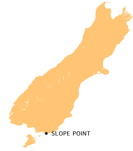
Slope Point on:
[Wikipedia]
[Google]
[Amazon]
 Slope Point is the southernmost point of the
 Slope Point is the southernmost point of the
 South Island
The South Island, also officially named , is the larger of the two major islands of New Zealand in surface area, the other being the smaller but more populous North Island. It is bordered to the north by Cook Strait, to the west by the Tasma ...
of New Zealand
New Zealand ( mi, Aotearoa ) is an island country in the southwestern Pacific Ocean. It consists of two main landmasses—the North Island () and the South Island ()—and over 700 List of islands of New Zealand, smaller islands. It is the ...
.
Slope Point lies just south of the small settlements of Waikawa and Haldane, near the southwestern edge of the Catlins
The Catlins (sometimes referred to as The Catlins Coast) comprises an area in the southeastern corner of the South Island of New Zealand. The area lies between Balclutha and Invercargill, straddling the boundary between the Otago and Southl ...
and Toetoes Bay and 71 km (40 mi) east of Invercargill.
The land around Slope Point is used for sheep farming with no houses anywhere nearby. Eroded
Erosion is the action of surface processes (such as water flow or wind) that removes soil, rock, or dissolved material from one location on the Earth's crust, and then transports it to another location where it is deposited. Erosion is distin ...
cliffs drop down to the sea below. An AA signpost there shows the distance to the Equator
The equator is a circle of latitude, about in circumference, that divides Earth into the Northern and Southern hemispheres. It is an imaginary line located at 0 degrees latitude, halfway between the North and South poles. The term can al ...
and the South Pole
The South Pole, also known as the Geographic South Pole, Terrestrial South Pole or 90th Parallel South, is one of the two points where Earth's axis of rotation intersects its surface. It is the southernmost point on Earth and lies antipod ...
, and a small solar-powered lighthouse stands on farmland.
There is no road to Slope Point; it can be reached by a 20-minute walk following dilapidated yellow markers. Its latitude, longitude is approximately 46.67 S, 169.00 E. There is no public access during the lambing season (September – November).
See also
{{commons category * Jacquemart Island Headlands of Southland, New Zealand The Catlins Foveaux Strait Southland District