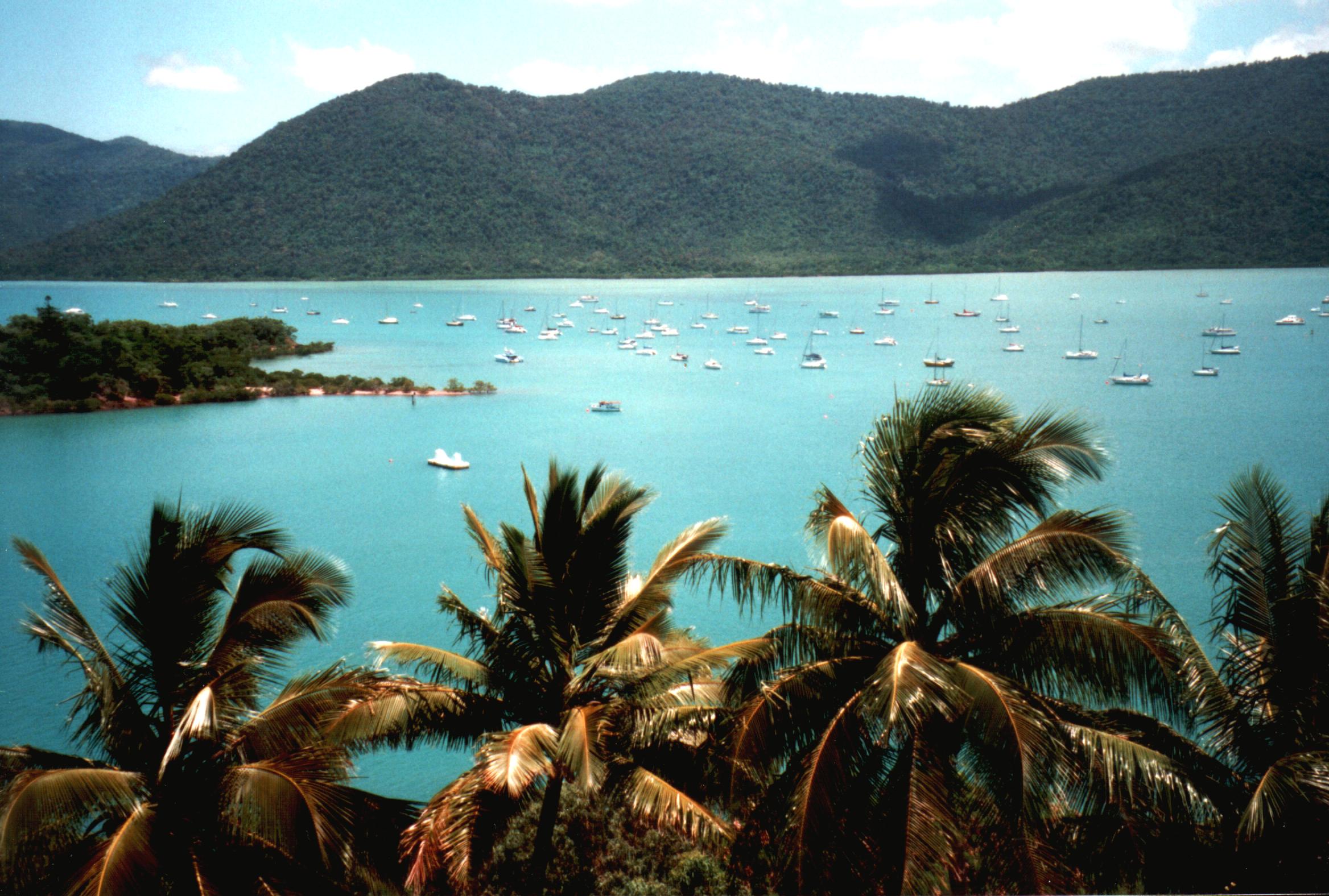
Shute Harbour on:
[Wikipedia]
[Google]
[Amazon]
Shute Harbour is a coastal
 The harbour is busy with many small boats. Commercial operators provide a range of services including bareboats and charter yachts, day tours, scheduled ferries, and water taxi and seaplane services.
A public boat ramp is available on Shute Harbour Road for launching private boats (). It is managed by the Whitsunday Regional Council.
There is also a public fishing jetty.
There are regular bus services available to and from the port which take the winding road through
Shute HarbourConway National Park
{{Whitsunday Region Whitsunday Region Central Queensland Ports and harbours of Queensland Localities in Queensland
locality
Locality may refer to:
* Locality, a historical named location or place in Canada
* Locality (association), an association of community regeneration organizations in England
* Locality (linguistics)
* Locality (settlement)
* Suburbs and localitie ...
and harbour in the Whitsunday Region
The Whitsunday Region is a Local government areas of Queensland, local government area located in North Queensland, North Queensland, Australia. Established in 2008, it was preceded by two previous local government areas with a history extending ...
of Queensland
Queensland ( , commonly abbreviated as Qld) is a States and territories of Australia, state in northeastern Australia, and is the second-largest and third-most populous state in Australia. It is bordered by the Northern Territory, South Austr ...
, Australia. It has port facilities and transport options for people seeking to access the Whitsunday Islands
The Whitsunday Islands are 74 continental islands of various sizes off the central coast of Queensland, Australia, north of Brisbane. The northernmost of the islands are off the coast by the town of Bowen, while the southernmost islands ar ...
and holiday destinations.
In the , Shute Harbour had a population of 113 people.
Geography
The Proserpine–Shute Harbour Road (State Route 59) enters the locality from the north-west ( Mount Rooper), and terminates at the harbour carpark. Shute Harbour has the following coastal features (from west to east): * Shute Bay () * Rooper Inlet, a bay () * Shute Harbour () * Coral Point () Apart from the harbour services, the only other land use is a small residential area on the Coral Point peninsula.History
Shute Harbour takes its name from Shute Island which is about south-east of the headland of Shute Harbour. The island was named by in May 1881 by Captain John Fiot Lee Pearse Maclear of HMS Alert, possibly after a crew-member of that ship. When the Proserpine Shire Council decided to construct tourist facilities in the area in October 1960, they created a town called Shutehaven. On 31 January 1987, the town of Shutehaven was amalgamated into the larger town ofWhitsunday
Whitsun (also Whitsunday or Whit Sunday) is the name used in Britain, and other countries among Anglicans and Methodists, for the Christian holy day of Pentecost. It falls on the seventh Sunday after Easter and commemorates the descent of the Ho ...
.
Whitsunday Regional Council
The Whitsunday Region is a local government area located in North Queensland, Australia. Established in 2008, it was preceded by two previous local government areas with a history extending back to the establishment of regional local government ...
opened the renovated Shute Harbour Marine Terminal in mid December 2021. However, there were criticisms about the safety of the public boat ramp facilities, particularly that the jetty did not float but became submerged at high tide, forcing boat users to wade through water that might contain crocodiles
Crocodiles (family Crocodylidae) or true crocodiles are large, semiaquatic reptiles that live throughout the tropics in Africa, Asia, the Americas and Australia. The term "crocodile" is sometimes used more loosely to include all extant member ...
or the dangerous Irukandji jellyfish
The Irukandji jellyfish ( ) are any of several similar, extremely venomous species of rare box jellyfish. With a very small adult size of about a cubic centimetre (1 cm3 or 0.061 in3), they are both one of the smallest and one of the ...
. In August 2023, it was announced that a review of the boat ramp would be undertaken.
Demographics
In the , Shute Harbour had a population of 122 people. In the , Shute Harbour had a population of 113 people.Education
There are no schools in Shute Harbour. The nearest government primary school is Cannonvale State School in Cannonvale to the west. The nearest government secondary school isProserpine State High School
Proserpine State High School (established in 1963) is a public high school in the town of Proserpine in Queensland, Australia.
History Campus
The school was established in 1963. Since then, several buildings have been refurbished and a num ...
in Proserpine to the south-west.
Harbour facilities
Conway National Park
Conway is a national park in Queensland, Australia, 911 km northwest of Brisbane. The park's main feature is the Conway Peninsula which is covered by the largest area of lowland tropical rainforest in Queensland outside Tropical North Quee ...
towards the harbour from Proserpine, Cannonvale and Airlie Beach
Airlie Beach is a coastal locality and resort town in the Whitsunday Region of Queensland, Australia. In the , Airlie Beach had a population of 1,312 people.
Geography
Airlie Beach is one of many departure points for the Great Barrier Reef. ...
.
See also
* List of ports in QueenslandReferences
External links
Shute Harbour
{{Whitsunday Region Whitsunday Region Central Queensland Ports and harbours of Queensland Localities in Queensland