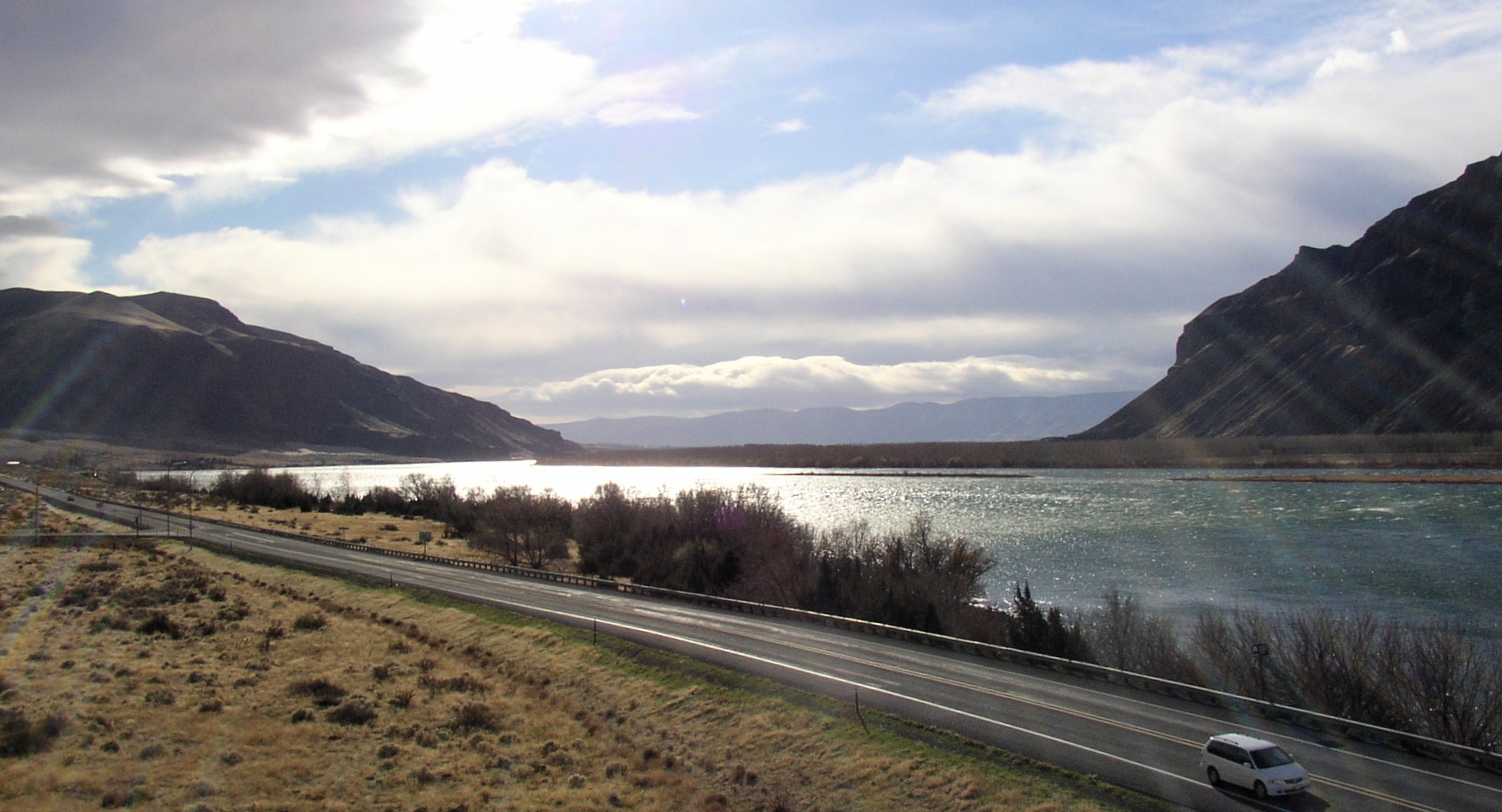
Sentinel Gap on:
[Wikipedia]
[Google]
[Amazon]
 Sentinel Gap is a
water gap
A water gap is a gap that flowing water has carved through a mountain range or mountain ridge and that still carries water today. Such gaps that no longer carry water currents are called wind gaps. Water gaps and wind gaps often offer a pract ...
formed by the Columbia River
The Columbia River (Upper Chinook language, Upper Chinook: ' or '; Sahaptin language, Sahaptin: ''Nch’i-Wàna'' or ''Nchi wana''; Sinixt dialect'' '') is the largest river in the Pacific Northwest region of North America. The river headwater ...
in the Saddle Mountains
The Saddle Mountains consists of an upfolded anticline ridge of basalt in Grant County of central Washington state. The ridge, reaching to 2,700 feet, terminates in the east south of Othello, Washington near the foot of the Drumheller Channel ...
, near Mattawa in Washington
Washington most commonly refers to:
* George Washington (1732–1799), the first president of the United States
* Washington (state), a state in the Pacific Northwest of the United States
* Washington, D.C., the capital of the United States
** A ...
state. The gap is "a water gap where erosion by the Columbia River was able to keep pace with folding, faulting and uplifting across the Saddle Mountain anticline". During Ice Age floods in which waters from the Channeled Scablands
The Channeled Scablands are a relatively barren and soil-free region of interconnected relict and dry flood channels, coulees and cataracts eroded into Palouse loess and the typically flat-lying basalt flows that remain after cataclysmic floods ...
found passage to the Pacific Ocean here and at Wallula Gap
Wallula Gap () is a large water gap of the Columbia River in the Northwestern United States, in Southeastern Washington. It cuts through the Horse Heaven Hills basalt anticlines in the Columbia River Basin, just south of the confluence of t ...
, this opening was "repeatedly reamed out, which probably widened and steepened the walls of the gap". Strandlines from the floods can be seen on the basalt walls of the gap.
SR 243 runs along the east side of the river through the gap, and the river is spanned by the Beverly Railroad Bridge
The Beverly Railroad Bridge is a historic railroad bridge that now carries hikers, bicyclists, and pedestrians over the Columbia River near Beverly, Washington, United States. It was constructed by the Chicago, Milwaukee, St. Paul and Pacific Ra ...
. The gap is located between the Wanapum
The Wanapum (also Wanapam) tribe of Native Americans in the United States, Native Americans formerly lived along the Columbia River from above Priest Rapids down to the mouth of the Snake River in what is now the US state of Washington (state), Was ...
and Priest Rapids
Priest Rapids was a narrow, fast-flowing stretch of the Columbia River, located in the central region of the U.S. state of Washington. It was flooded by the construction of the Priest Rapids Dam in the 1950s.
Before the dam's construction, the ...
dams. Priest Rapids
Priest Rapids was a narrow, fast-flowing stretch of the Columbia River, located in the central region of the U.S. state of Washington. It was flooded by the construction of the Priest Rapids Dam in the 1950s.
Before the dam's construction, the ...
, for which the dam was named, are now submerged beneath the dam's reservoir about downstream from Sentinel Gap.
References
Sources
* *External links
* Columbia River Landforms of Kittitas County, Washington Water gaps of Washington (state) {{KittitasCountyWA-geo-stub