Rustad Knoll on:
[Wikipedia]
[Google]
[Amazon]
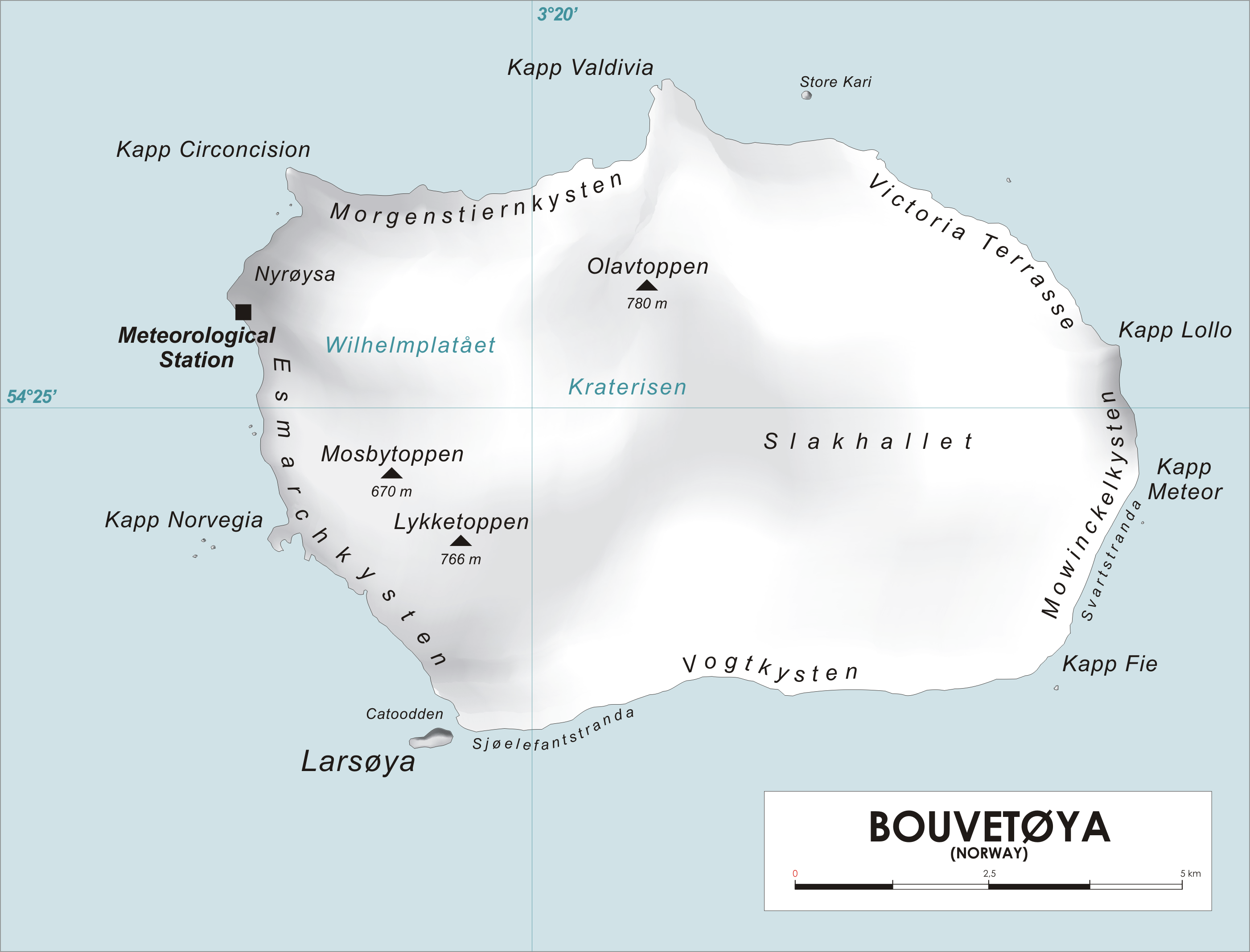
 Rustad Knoll () is a rounded, snow-topped elevation (365 m) which surmounts the south shore of the island of
 Rustad Knoll () is a rounded, snow-topped elevation (365 m) which surmounts the south shore of the island of
 Bouvetøya
Bouvet Island ( ; ) is an uninhabited subantarctic volcanic island and dependency of Norway. It is a protected nature reserve, and situated in the South Atlantic Ocean at the southern end of the Mid-Atlantic Ridge, it is the world's most remo ...
immediately east of Cato Point
Cato Point ()is a headland forming the southwest extremity of Bouvet Island. It was first charted in 1898 by a German expedition under Carl Chun. The Norwegian expedition under Captain Harald Horntvedt
Harald or Haraldr is the Old Norse form of t ...
. First charted in 1898 by a German expedition under Carl Chun
Carl Chun or Karl Friedrich Gustav Chun (1 October 1852 – 11 April 1914) was a German marine biologist who worked as a professor at the Universities of Königsberg (1883), Breslau (1891) and Leipzig (1898). He was a pioneer of German oceanogr ...
. The knoll was recharted in December 1927 by the Norvegia expedition under Captain Harald Horntvedt
Harald or Haraldr is the Old Norse form of the given name Harold. It may refer to:
Medieval Kings of Denmark
* Harald Bluetooth (935–985/986)
Kings of Norway
* Harald Fairhair (c. 850–c. 933)
* Harald Greycloak (died 970)
* Harald Hardrad ...
. They named it for Ditlef Rustad who was in charge of the biological research of the expedition.
References
Hills of Antarctica Landforms of Bouvet Island {{BouvetIsland-geo-stub