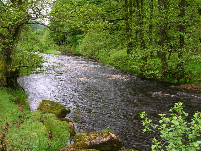
River Dunsop on:
[Wikipedia]
[Google]
[Amazon]
 The River Dunsop is a river in the
 The River Dunsop is a river in the
 Forest of Bowland
The Forest of Bowland, also known as the Bowland Fells and formerly the Chase of Bowland, is an area of gritstone fells, deep valleys and peat moorland, mostly in north-east Lancashire, England, with a small part in North Yorkshire (however ro ...
in Northern England
Northern England, or the North of England, refers to the northern part of England and mainly corresponds to the Historic counties of England, historic counties of Cheshire, Cumberland, County Durham, Durham, Lancashire, Northumberland, Westmo ...
. It flows into the River Hodder
The River Hodder is in Lancashire, England. It is a County Biological Heritage Site.
It rises on White Hill and flows for approximately 23 miles to the River Ribble, of which it is the largest tributary.
The Hodder drains much of the Fore ...
at Dunsop Bridge.
It begins at the confluence of the Brennand River and Whitendale River, both of which rise high up in the surrounding moorland
Moorland or moor is a type of Habitat (ecology), habitat found in upland (geology), upland areas in temperate grasslands, savannas, and shrublands and the biomes of montane grasslands and shrublands, characterised by low-growing vegetation on So ...
. It then flows through the steep-sided Dunsop Valley before meeting the Hodder. An aqueduct carrying water to Blackburn
Blackburn () is an industrial town and the administrative centre of the Blackburn with Darwen borough in Lancashire, England. The town is north of the West Pennine Moors on the southern edge of the River Ribble, Ribble Valley, east of Preston ...
runs alongside.
The Dunsop drains a catchment approximately 9 km by 5 km, which comprises the sub-catchment areas of the Brennand and Whitendale, and is classed as a fifth order catchment. The catchment is primarily Millstone Grit
Millstone Grit is any of a number of coarse-grained sandstones of Carboniferous age which occur in the British Isles. The name derives from its use in earlier times as a source of millstones for use principally in watermills. Geologists refer to ...
, but the tributaries run through older shale
Shale is a fine-grained, clastic sedimentary rock formed from mud that is a mix of flakes of Clay mineral, clay minerals (hydrous aluminium phyllosilicates, e.g., Kaolinite, kaolin, aluminium, Al2Silicon, Si2Oxygen, O5(hydroxide, OH)4) and tiny f ...
and limestone
Limestone is a type of carbonate rock, carbonate sedimentary rock which is the main source of the material Lime (material), lime. It is composed mostly of the minerals calcite and aragonite, which are different Polymorphism (materials science) ...
strata
On 8 August 1967 Dunsop Valley entered the UK Weather Records
The United Kingdom weather records show the most extreme weather ever recorded in the United Kingdom, such as temperature, wind speed, and rainfall records. Reliable temperature records for the whole of the United Kingdom go back to about 1880.
...
with the ''Highest 90-min total'' rainfall
Rain is a form of precipitation where water droplets that have condensed from atmospheric water vapor fall under gravity. Rain is a major component of the water cycle and is responsible for depositing most of the fresh water on the Earth. ...
at 117 mm. The peak flow of the flood was deduced primarily from wrack mark evidence and roughness coefficients. As of July 2006 this record remains.
See also
* Dunsop Bridge (structure)References
External links
Rivers of Lancashire Rivers of Ribble Valley Forest of Bowland 1Dunsop {{England-river-stub