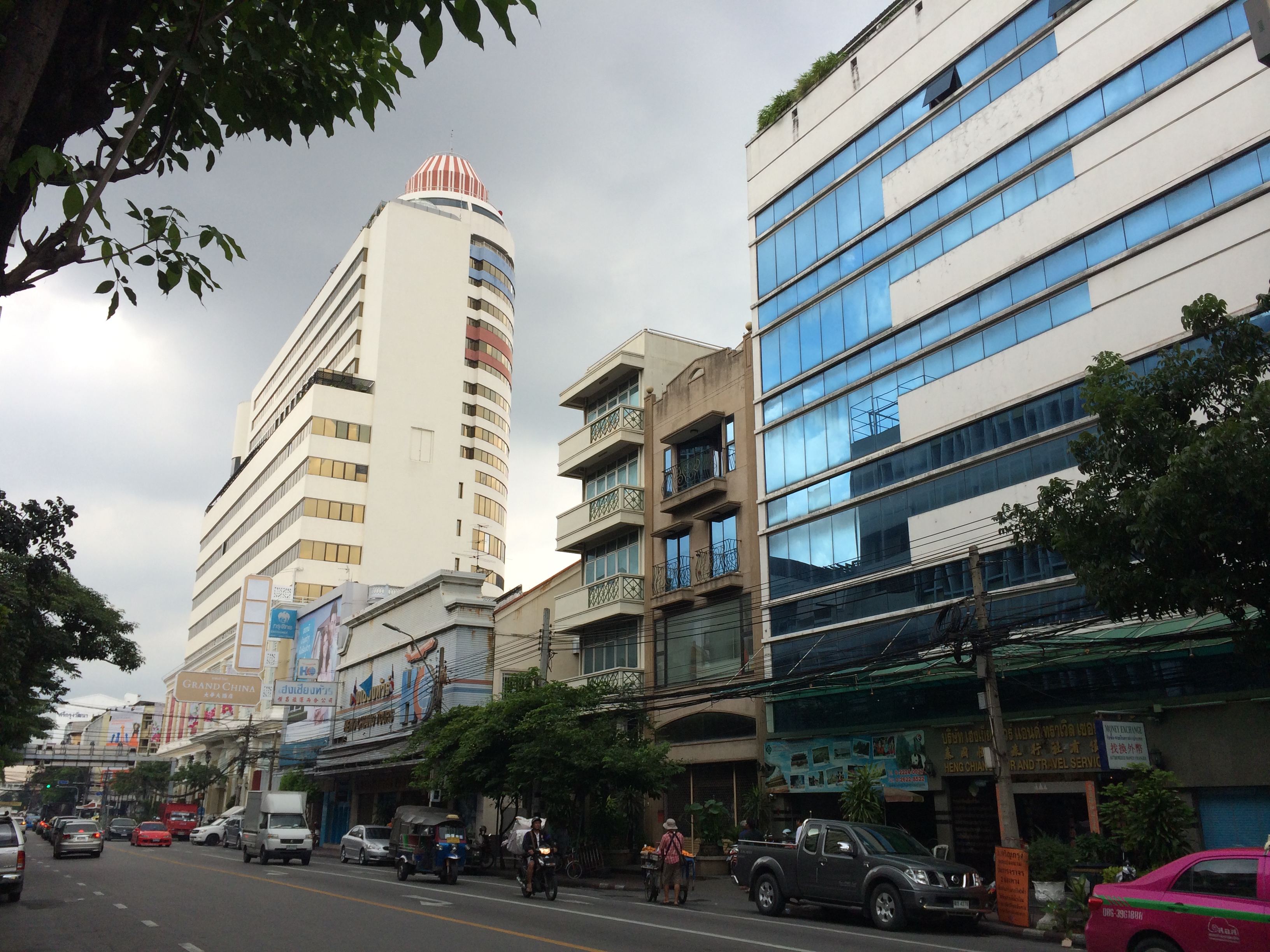
Ratchawong Road on:
[Wikipedia]
[Google]
[Amazon]
 Ratchawong Road (, , ; lit: ''dynasty road'') is a road in
Bangkok
Bangkok, officially known in Thai language, Thai as Krung Thep Maha Nakhon and colloquially as Krung Thep, is the capital and most populous city of Thailand. The city occupies in the Chao Phraya River delta in central Thailand and has an estim ...
, Thailand. It is located in the area of Bangkok's Chinatown
Bangkok's Chinatown is one of the largest Chinatowns in the world. It was founded in 1782 when the city was established as the capital of the Rattanakosin Kingdom, and served as the home of the mainly Teochew immigrant Chinese population, wh ...
, or popularly known in Thai as Yaowarat.
History
The road was constructed by KingChulalongkorn
Chulalongkorn (20 September 1853 – 23 October 1910), posthumously honoured as King Chulalongkorn the Great, was the fifth king of Siam from the Chakri dynasty, titled Rama V. Chulalongkorn's reign from 1868 until his death in 1910 was cha ...
(Rama V). It links Charoen Krung Road (New Road) at the connecting with Suea Pa Road runs passing Yaowarat Road
Yaowarat Road (, , ; ) in Samphanthawong District is the main artery of Bangkok's Chinatown. Modern Chinatown now covers a large area around Yaowarat and Charoen Krung Road. It has been the main centre for trading by the Chinese community si ...
at the point which officially known as Ratchawong Intersection. Then aims to Ratchawong Pier on the bank of Chao Phraya River
The Chao Phraya River is the major river in Thailand, with its low alluvial plain forming the centre of the country. It flows through Bangkok and then into the Gulf of Thailand.
Etymology
Written evidence of the river being referred to by the ...
, total length is about 700 m (229 ft). The pier was a main port for passengers and cargo ships sailing between Bangkok and other provinces. The building along the road were owned by foreign companies (Chinese, Indian, and European) who were running wholesale businesses. The area near Yaowarat Road were once situated shopping centres and restaurants with popular menu of boil rice, ice cream, people of nobel family loved to come for dinner. One of these restaurants was used as a planning facility for a group of naval officers involved in the 1932 revolution.
Presently, the old shops of the glorious days can still be seen at the beginning phase of the road while the ending phase near the pier owned by companies and commercial banks. In 1944, the time before World War II
World War II or the Second World War (1 September 1939 – 2 September 1945) was a World war, global conflict between two coalitions: the Allies of World War II, Allies and the Axis powers. World War II by country, Nearly all of the wo ...
would soon come to an end, this point used to be the first location of Bangkok Bank
Bangkok Bank Public Company Limited (, Royal Thai General System of Transcription, RTGS: Thanakhan Krung Thep) is one of the largest commercial banks in Thailand. Its branch network includes over 800 branches as of May 2024, within Thailand, wit ...
, founded and operated by Chin Sophonpanich. It has become Bangkok Bank, Ratchawong Branch today. At that time, Ratchawong Road could be considered as the real commercial district
Commercial area, commercial district or commercial zone in a city is an area, district, or neighborhoods primarily composed of commercial buildings, such as a strip mall, office parks, downtown, central business district, financial district, " ...
of Bangkok. It was the location where many commercial banks were stood, and had expanded to the neighbouring such as Suea Pa, Suan Mali, or even distant places like Si Lom
Si Lom Road (also written as Silom, , ) is a major street in Bangkok, Thailand. The road is best known for its commerecial neighbourhood, which, along with the nearby and roughly parallel Sathon Road, forms one of the city's main business distr ...
or Sathon since both Si Lom and Sathon were not as prosperous districts as in the present.
In addition, the end of the road is also the terminal of BMA's bus line 204 (2-52) (Mo Chit 2-Ratchawong Pier).
In early 2016, Ratchawong Road ranked as the best pedestrian street
Pedestrian zones (also known as auto-free zones and car-free zones, as pedestrian precincts in British English, and as pedestrian malls in the United States and Australia) are areas of a city or town restricted to use by people on foot or ...
of Bangkok from Urban Design and Development Center (UddC) due to the two sides surrounded by shaded trees, full of lively stalls and active shophouses.
References
category:Streets in Bangkok {{coord, 13, 44, 32.49, N, 100, 30, 25.13, E, type:adm3rd_region:TH-10, display=title Samphanthawong district category:Road junctions in Bangkok category:Neighbourhoods of Bangkok