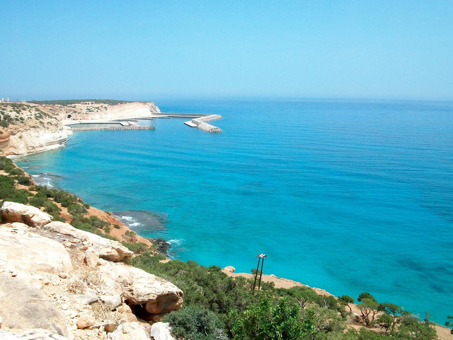
Ras Al-Helal on:
[Wikipedia]
[Google]
[Amazon]
Ras al-Helal (, ''Raʾs al-Helal'', "Crescent Cape") is a village on the southern shore of the


 The Ras al-Helal waterfalls are located up in the Jebel Akhdar, some from the coastal road. They are considered one of the most beautiful natural places in the country and attract many Libyan visitors and vacationers. The access road to the waterfalls, constructed during the Italian occupation, is old, narrow, and in poor condition. Some viewing locations for the waterfalls are along dangerous cliffs, so visiting alone is not safe.
Mediterranean Sea
The Mediterranean Sea ( ) is a sea connected to the Atlantic Ocean, surrounded by the Mediterranean basin and almost completely enclosed by land: on the east by the Levant in West Asia, on the north by Anatolia in West Asia and Southern Eur ...
in Derna District
Derna ( ''Darnah'') is one of the districts of Libya. It is in the northeast of the country, in the historical region of Cyrenaica. Its capital is Derna. In 2007 the district was enlarged to include what had been the Al Qubah District. In the ...
, Cyrenaica
Cyrenaica ( ) or Kyrenaika (, , after the city of Cyrene), is the eastern region of Libya. Cyrenaica includes all of the eastern part of Libya between the 16th and 25th meridians east, including the Kufra District. The coastal region, als ...
, Libya
Libya, officially the State of Libya, is a country in the Maghreb region of North Africa. It borders the Mediterranean Sea to the north, Egypt to Egypt–Libya border, the east, Sudan to Libya–Sudan border, the southeast, Chad to Chad–L ...
. It takes its name from its cape
A cape is a clothing accessory or a sleeveless outer garment of any length that hangs loosely and connects either at the neck or shoulders. They usually cover the back, shoulders, and arms. They come in a variety of styles and have been used th ...
, which appears to have a crescent
A crescent shape (, ) is a symbol or emblem used to represent the lunar phase (as it appears in the northern hemisphere) in the first quarter (the "sickle moon"), or by extension a symbol representing the Moon itself.
In Hindu iconography, Hind ...
shape when viewed from the surrounding Jebel Akhdar (English: The Green Mountain) mountainous plateau's foothills. It had a population totaling 2,235 in 2006.Amraja M. el Khajkhaj, "Noumou al Mudon as Sagheera fi Libia", Dar as Saqia, Benghazi-2008, p.123. Ras al-Helal is known for its green, forested beach and its nearby waterfalls.
Geography
Ras al-Helal is the southwest endpoint of theLevantine Sea
The Levantine Sea () is the easternmost part of the Mediterranean Sea.
Geography
The Levantine Sea is bordered by Turkey in the north and north-east corner, Syria, Lebanon, Israel, and Palestine in the east, Egypt in the south, and the Aegean ...
in the eastern Mediterranean
The Eastern Mediterranean is a loosely delimited region comprising the easternmost portion of the Mediterranean Sea, and well as the adjoining land—often defined as the countries around the Levantine Sea. It includes the southern half of Turkey ...
. It is located in Cyrenaica
Cyrenaica ( ) or Kyrenaika (, , after the city of Cyrene), is the eastern region of Libya. Cyrenaica includes all of the eastern part of Libya between the 16th and 25th meridians east, including the Kufra District. The coastal region, als ...
to the north-east of Bayda.
Beach
The Mediterranean coast of Libya is almost long, and nearly all its beaches are far from forests or significant vegetation. Being one of the few exceptions, Ras al-Helal attracts many vacationers. The area is isolated because of the lack of a direct coastal road connecting the nearby western town ofSusa
Susa ( ) was an ancient city in the lower Zagros Mountains about east of the Tigris, between the Karkheh River, Karkheh and Dez River, Dez Rivers in Iran. One of the most important cities of the Ancient Near East, Susa served as the capital o ...
with Benghazi
Benghazi () () is the List of cities in Libya, second-most-populous city in Libya as well as the largest city in Cyrenaica, with an estimated population of 859,000 in 2023. Located on the Gulf of Sidra in the Mediterranean Sea, Mediterranean, Ben ...
, the country's second largest city and the largest on the Cyrenaica coast.
Waterfalls

 The Ras al-Helal waterfalls are located up in the Jebel Akhdar, some from the coastal road. They are considered one of the most beautiful natural places in the country and attract many Libyan visitors and vacationers. The access road to the waterfalls, constructed during the Italian occupation, is old, narrow, and in poor condition. Some viewing locations for the waterfalls are along dangerous cliffs, so visiting alone is not safe.
See also
* Geography of the Levantine SeaReferences
{{coord, 32.883047, 22.180281, display=title Populated places in Derna District Jebel Akhdar (Libya) Cyrenaica Villages in Libya