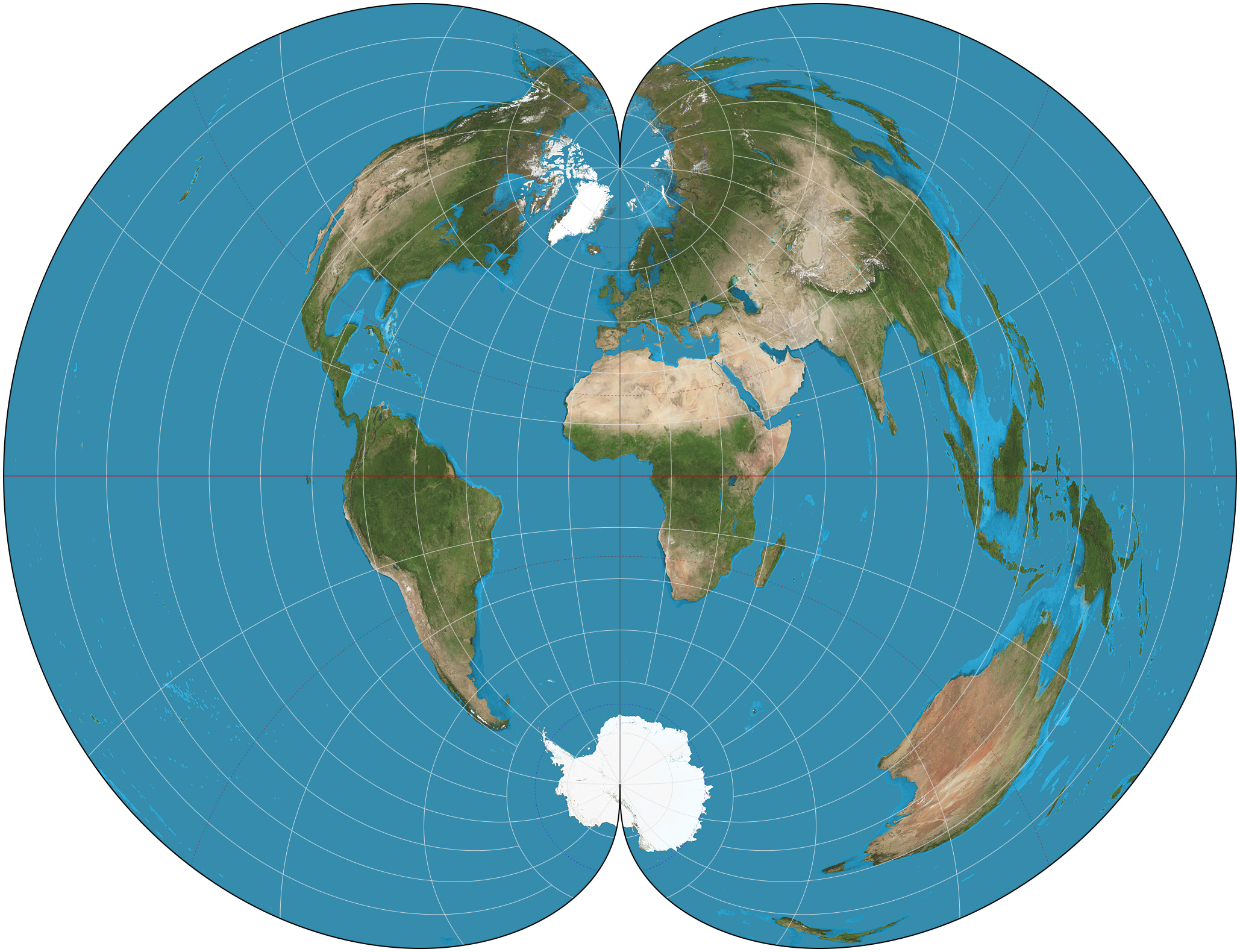
Polyconic Projection on:
[Wikipedia]
[Google]
[Amazon]
 In the
Table of examples and properties of all common projections
from radicalcartography.net
Map projections {{cartography-stub
 In the
 cartography of the United States
The cartography of the United States is the history of surveying and creation of maps of the United States. Maps of the New World had been produced since the 16th century. The history of cartography of the United States began in the 18th cent ...
, the American polyconic projection is a map projection
In cartography, a map projection is any of a broad set of Transformation (function) , transformations employed to represent the curved two-dimensional Surface (mathematics), surface of a globe on a Plane (mathematics), plane. In a map projection, ...
used for maps of the United States
The United States of America (USA), also known as the United States (U.S.) or America, is a country primarily located in North America. It is a federal republic of 50 U.S. state, states and a federal capital district, Washington, D.C. The 48 ...
and its regions beginning early in the 19th century. It belongs to the polyconic projection class
Polyconic can refer either to a class of map projections or to a specific projection known less ambiguously as the American polyconic projection. Polyconic as a class refers to those projections whose parallels are all non-concentric circular ar ...
, which consists of map projections whose parallels are non-concentric
In geometry, two or more objects are said to be ''concentric'' when they share the same center. Any pair of (possibly unalike) objects with well-defined centers can be concentric, including circles, spheres, regular polygons, regular polyh ...
circular arcs except for the equator
The equator is the circle of latitude that divides Earth into the Northern Hemisphere, Northern and Southern Hemisphere, Southern Hemispheres of Earth, hemispheres. It is an imaginary line located at 0 degrees latitude, about in circumferen ...
, which is straight. Often the American polyconic is simply called the polyconic projection.
The American polyconic projection was probably invented by Swiss-American cartographer Ferdinand Rudolph Hassler
Ferdinand Rudolph Hassler (October 6, 1770 – November 20, 1843) was a Swiss-American surveyor who is considered the forefather of both the National Oceanic and Atmospheric Administration (NOAA) and the National Institute of Standards and Techno ...
around 1825. It was commonly used by many map-making agencies of the United States from the time of its proposal until the middle of the 20th century.''Flattening the Earth: Two Thousand Years of Map Projections'', John P. Snyder, 1993, pp. 117-122, . It is not used much these days, having been replaced by conformal projections
Conformal may refer to:
* Conformal (software), in ASIC Software
* Conformal coating in electronics
* Conformal cooling channel, in injection or blow moulding
* Conformal field theory in physics, such as:
** Boundary conformal field theory
** C ...
in the State Plane Coordinate System
The State Plane Coordinate System (SPCS) is a set of 125 geographic zones or coordinate systems designed for specific regions of the United States. Each U.S. state contains one or more state plane zones, the boundaries of which usually follow co ...
.
Description
The American polyconic projection can be thought of as "rolling" a conetangent
In geometry, the tangent line (or simply tangent) to a plane curve at a given point is, intuitively, the straight line that "just touches" the curve at that point. Leibniz defined it as the line through a pair of infinitely close points o ...
to the Earth at all parallels of latitude. This generalizes the concept of a conic projection
In cartography, a map projection is any of a broad set of Transformation (function) , transformations employed to represent the curved two-dimensional Surface (mathematics), surface of a globe on a Plane (mathematics), plane. In a map projection, ...
, which uses a single cone to project the globe onto. By using this continuously varying cone, each parallel becomes a circular arc
A circular arc is the arc of a circle between a pair of distinct points. If the two points are not directly opposite each other, one of these arcs, the minor arc, subtends an angle at the center of the circle that is less than radians (180 ...
having true scale, contrasting with a conic projection, which can only have one or two parallels at true scale. The scale is also true on the central meridian of the projection.
The projection is defined by:
where:
* is the longitude
Longitude (, ) is a geographic coordinate that specifies the east- west position of a point on the surface of the Earth, or another celestial body. It is an angular measurement, usually expressed in degrees and denoted by the Greek lett ...
of the point to be projected;
* is the latitude
In geography, latitude is a geographic coordinate system, geographic coordinate that specifies the north-south position of a point on the surface of the Earth or another celestial body. Latitude is given as an angle that ranges from −90° at t ...
of the point to be projected;
* is the longitude of the central meridian;
* is the latitude chosen to be the origin at .
To avoid division by zero
In mathematics, division by zero, division (mathematics), division where the divisor (denominator) is 0, zero, is a unique and problematic special case. Using fraction notation, the general example can be written as \tfrac a0, where a is the di ...
, the formulas above are extended so that if , then and .
See also
*List of map projections
This is a summary of map projections that have articles of their own on Wikipedia or that are otherwise WP:NOTABLE, notable. Because there is no limit to the number of possible map projections,
there can be no comprehensive list.
Table of proj ...
References
External links
*Table of examples and properties of all common projections
from radicalcartography.net
Map projections {{cartography-stub