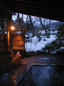
Naruko Onsen on:
[Wikipedia]
[Google]
[Amazon]
 was a
was a
 was a
was a town
A town is a type of a human settlement, generally larger than a village but smaller than a city.
The criteria for distinguishing a town vary globally, often depending on factors such as population size, economic character, administrative stat ...
located in Tamatsukuri District, Miyagi Prefecture
is a Prefectures of Japan, prefecture of Japan located in the Tōhoku region of Honshu. Miyagi Prefecture has a population of 2,265,724 (1 August 2023) and has a geographic area of . Miyagi Prefecture borders Iwate Prefecture to the north, Akit ...
, Japan
Japan is an island country in East Asia. Located in the Pacific Ocean off the northeast coast of the Asia, Asian mainland, it is bordered on the west by the Sea of Japan and extends from the Sea of Okhotsk in the north to the East China Sea ...
.
On February 30, 2006, Naruko, along with the city of Furukawa, the town of Iwadeyama (also from Tamatsukuri District), the towns of Kashimadai, Matsuyama
270px, Matsuyama City Hall
270px, Ehime Prefectural Capital Building
is the capital city of Ehime Prefecture, on the island of Shikoku, in Japan and is also Shikoku's largest city. , the city had an estimated population of 505,948 in 243,541 h ...
and Sanbongi (all from Shida District), and the town of Tajiri (from Tōda District), to create the new city of Ōsaki. Tamatsukuri District and Shida District were dissolved as a result of this merger.
Geography
Nestled in the mountainous backbone ofTōhoku region
The , Northeast region, , or consists of the northeastern portion of Honshu, the largest island of Japan. This traditional region consists of six prefectures (): Akita, Aomori, Fukushima, Iwate, Miyagi, and Yamagata.
Tōhoku retains ...
, Naruko is located entirely within the Kurikoma Quasi-National Park. Haiku poet Matsuo Bashō passed through the area on the trip that became his masterwork '' Oku no Hosomichi''.
Tourism and Sightseeing
The volcanically active area is famous for the Naruko Hot Spring Villages (鳴子温泉郷), a cluster of five villages—Naruko, East Naruko, Nakayamadaira, Kawatabi and Onikōbe—with abundanthot springs
A hot spring, hydrothermal spring, or geothermal spring is a Spring (hydrology), spring produced by the emergence of Geothermal activity, geothermally heated groundwater onto the surface of the Earth. The groundwater is heated either by shallow ...
. The reputed curative properties of the springs make them especially popular with people in ill health. Several ski resorts also operate nearby in the winter.
Naruko is one among many places to claim to have originated the '' kokeshi'', a cylindrical wooden doll emblematic of Tōhoku. The Japan Kokeshi Museum is located in Naruko, and some 80 craftsmen work full-time at the art today.
Transport
Naruko is accessible by train on theJR East
The is a major passenger railway company in Japan and the largest of the seven Japan Railways Group companies. The company name is officially abbreviated as JR-EAST or JR East in English, and as in Japanese. The company's headquarters are in ...
Rikuu East Line, some 40 minutes from Furukawa Station, where connections to Tokyo can be made via the Tōhoku Shinkansen. National Highways 47 and 108 also pass through the area.
Demographics
In 2003, the town had an estimatedpopulation
Population is a set of humans or other organisms in a given region or area. Governments conduct a census to quantify the resident population size within a given jurisdiction. The term is also applied to non-human animals, microorganisms, and pl ...
of 8,764 and a population density
Population density (in agriculture: Standing stock (disambiguation), standing stock or plant density) is a measurement of population per unit land area. It is mostly applied to humans, but sometimes to other living organisms too. It is a key geog ...
of 26.76 persons per km2. The total area was 327.55 km2.
References
External links
{{Authority control Dissolved municipalities of Miyagi Prefecture Ōsaki, Miyagi