Mulholland Highway on:
[Wikipedia]
[Google]
[Amazon]
 Mulholland Highway is a scenic
 In the early 1970s, five thousand local activists successfully prevented the cement paving of most of the Mulholland Drive stretch. This section, known as "Dirt Mulholland," is only open to cyclists and pedestrians. From Mulholland Bridge east, a cemented Mulholland Drive winds through the affluent Hollywood Hills to Mulholland Drive's easternmost terminus at Cahuenga Boulevard, near
 Mulholland Highway is a scenic
 road
A road is a thoroughfare used primarily for movement of traffic. Roads differ from streets, whose primary use is local access. They also differ from stroads, which combine the features of streets and roads. Most modern roads are paved.
Th ...
in Los Angeles County
Los Angeles County, officially the County of Los Angeles and sometimes abbreviated as LA County, is the most populous county in the United States, with 9,663,345 residents estimated in 2023. Its population is greater than that of 40 individua ...
, California
California () is a U.S. state, state in the Western United States that lies on the West Coast of the United States, Pacific Coast. It borders Oregon to the north, Nevada and Arizona to the east, and shares Mexico–United States border, an ...
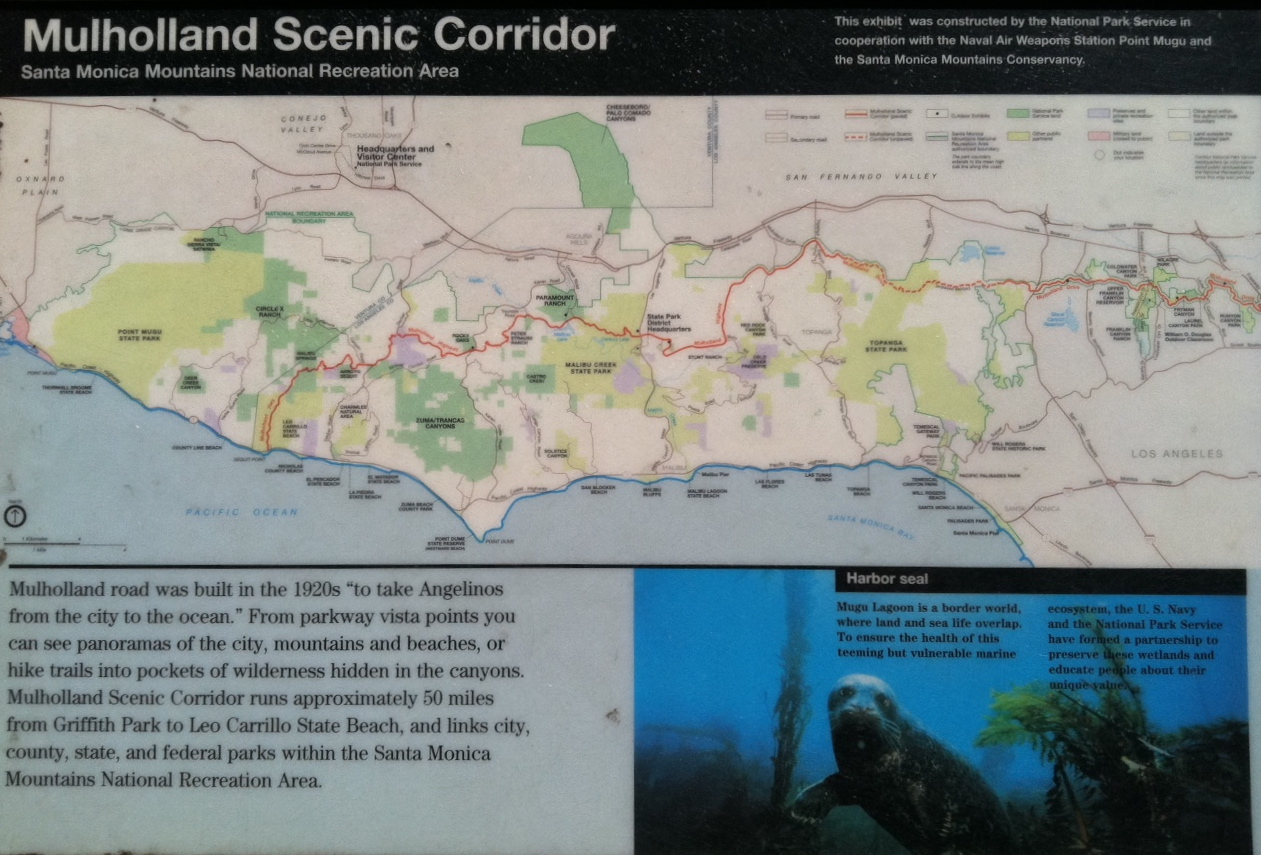
, that runs approximately through the western Santa Monica Mountains
The Santa Monica Mountains are a coastal mountain range in Southern California, next to the Pacific Ocean. It is part of the Transverse Ranges. The Santa Monica Mountains National Recreation Area encompasses this mountain range. Because of its p ...
from near US Route 101 (Ventura Freeway) in Calabasas
Calabasas may refer to:
* Calabasas, Arizona, former populated place in what is now Rio Rico, Arizona
* Calabasas, California, city in Los Angeles County, California
See also
* Calabaza
Calabaza is the generic name in the Spanish langua ...
to Highway 1 (Pacific Coast Highway) near Malibu at Leo Carrillo State Park
Leo Carrillo State Park is a state park in Los Angeles County, California, United States. Situated along the Malibu coast, the park is a component of Santa Monica Mountains National Recreation Area. With of beach, the parkland stretches into t ...
and the Pacific Ocean
The Pacific Ocean is the largest and deepest of Earth's five Borders of the oceans, oceanic divisions. It extends from the Arctic Ocean in the north to the Southern Ocean, or, depending on the definition, to Antarctica in the south, and is ...
coast – at the border of Los Angeles and Ventura Counties.
Mulholland Highway is the western rural portion and, with the eastern Mulholland Drive
Mulholland Drive is a street and road in the eastern Santa Monica Mountains of Southern California. It is named after pioneering Los Angeles civil engineer William Mulholland. The western rural portion in Los Angeles and Ventura counties is n ...
portion, is a scenic route named after Los Angeles civil engineer William Mulholland
William Mulholland (September 11, 1855 – July 22, 1935) was an Irish American self-taught civil engineer who was responsible for building the infrastructure to provide a water supply that allowed Los Angeles to grow into the largest city in Cal ...
and built throughout the 1920s "to take Angelenos from the city to the ocean".
Only the segment of Mulholland Highway between Pacific Coast Highway and Kanan Road/Kanan Dume Road
Kanan Road / Kanan Dume Road is a major mostly north–south road that runs for , connecting the Conejo Valley and U.S. Route 101 with California State Route 1 and Malibu in Ventura and Los Angeles counties. It is used by 40,000 commuters per ...
, and through Malibu Creek State Park
Malibu Creek State Park is a state park of California, United States, preserving the Malibu Creek canyon in the Santa Monica Mountains. The park was established in 1974. Opened to the public in 1976, the park is also a component of Santa Mo ...
between Cornell Road and Las Virgenes Road, is officially recognized by the California Department of Transportation
The California Department of Transportation (Caltrans) is an Executive (government), executive department of the U.S. state of California. The department is part of the Government of California#State agencies, cabinet-level California State Tran ...
as under the California Scenic Highway System, meaning that it is a substantial section of highway passing through a "memorable landscape" with no "visual intrusions", where the potential designation has gained popular favor with the community.
Geography
The name Mulholland Highway applies to a stretch that starts nearLouisville High School (California)
Louisville High School is a private, Catholic, college-preparatory school for girls in grades 9 through 12, located in Woodland Hills, CA at the western end of the San Fernando Valley. Louisville High School is a National Blue Ribbon School of Ex ...
in Woodland Hills and extends to its westernmost terminus at Leo Carrillo State Park
Leo Carrillo State Park is a state park in Los Angeles County, California, United States. Situated along the Malibu coast, the park is a component of Santa Monica Mountains National Recreation Area. With of beach, the parkland stretches into t ...
on the Pacific Coast Highway Pacific Coast Highway may refer to:
Roads
* Pacific Coast Highway or PCH, segments of California State Route 1
* Pacific Coast Highway, parts of New Zealand State Highway 2 and all of New Zealand State Highway 25 and New Zealand State Highway 35.
...
. Wholly contained within Los Angeles County, the scenic byway was formally opened in 1928. Mulholland zigzags through the Santa Monica Mountains
The Santa Monica Mountains are a coastal mountain range in Southern California, next to the Pacific Ocean. It is part of the Transverse Ranges. The Santa Monica Mountains National Recreation Area encompasses this mountain range. Because of its p ...
– one of the Southern California Transverse Ranges
The Transverse Ranges are a group of mountain ranges of Southern California, in the Pacific Coast Ranges physiographic region in North America. The Transverse Ranges begin at the southern end of the California Coast Ranges and lie within Santa Ba ...
– from Oxnard all the way to Hollywood. Original major intersections included Topanga Canyon Boulevard
State Route 27, commonly known by its street name Topanga Canyon Boulevard (), is a state highway in the U.S. state of California that runs from the Pacific Coast Highway (California State Route 1) at Topanga State Beach near Pacific Palisade ...
, Cornell Road, Latigo Canyon Road, Kanan Road/Kanan Dume Road
Kanan Road / Kanan Dume Road is a major mostly north–south road that runs for , connecting the Conejo Valley and U.S. Route 101 with California State Route 1 and Malibu in Ventura and Los Angeles counties. It is used by 40,000 commuters per ...
, and Decker Canyon Road.
The route provides access, directly or ''en route'', to many of the regional park
A regional park is an area of land preserved on account of its natural beauty, historic interest, recreational use or other reason, and under the administration of a form of local government.
Definition
A regional park can be a special park distr ...
s in the Santa Monica Mountains National Recreation Area
The Santa Monica Mountains National Recreation Area (SMMNRA) is a national recreation area containing many individual parks and open space preserves, located primarily in Southern California's Santa Monica Mountains. Located in greater Los Ange ...
.
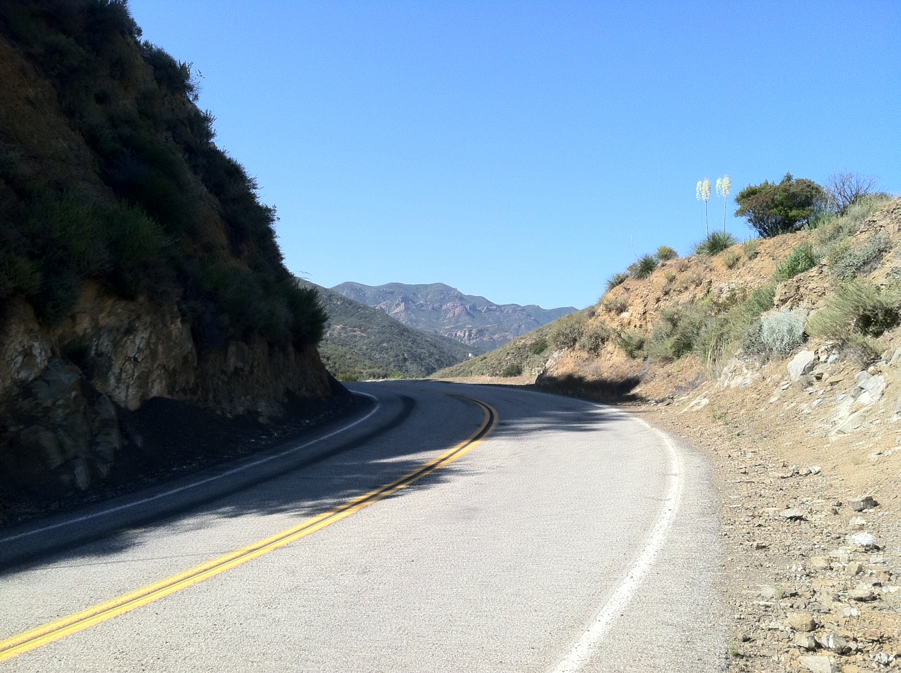
Running east–west along the spine of the Santa Monicas, Mulholland Highway makes its way through the mountains without benefit of tunnels. There are several automobile wrecks and fire-burnt structures that litter the bottoms of the canyons through which Mulholland Highway passes . The native flora of the Santa Monica Mountains
The Santa Monica Mountains, one of the Transverse Ranges located in Southern California, are in the California chaparral and woodlands ecoregion of the California Floristic Province. This ecoregion has two predominant ecosystems, with three primar ...
are seen throughout the scenic route.
Mulholland Drive
 In the early 1970s, five thousand local activists successfully prevented the cement paving of most of the Mulholland Drive stretch. This section, known as "Dirt Mulholland," is only open to cyclists and pedestrians. From Mulholland Bridge east, a cemented Mulholland Drive winds through the affluent Hollywood Hills to Mulholland Drive's easternmost terminus at Cahuenga Boulevard, near
 Universal Studios Universal Studios may refer to:
* Universal Studios, Inc., an American media and entertainment conglomerate
** Universal Pictures, an American film studio
** Universal Studios Lot, a film and television studio complex
* Various theme parks operat ...
. It then becomes Mulholland Highway again as an unpaved footpath to Griffith Park
Griffith Park is a large municipal park at the eastern end of the Santa Monica Mountains, in the Los Feliz neighborhood of Los Angeles, California. The park includes popular attractions such as the Los Angeles Zoo, the Autry Museum of the Amer ...
.
See also
*Malibu Creek State Park
Malibu Creek State Park is a state park of California, United States, preserving the Malibu Creek canyon in the Santa Monica Mountains. The park was established in 1974. Opened to the public in 1976, the park is also a component of Santa Mo ...
*The Rock Store
The Rock Store is a restaurant in Cornell, on Mulholland Highway in the Santa Monica Mountains, Los Angeles, California. It is popular with motorcyclists and celebrities.
History
It is a, "humble but infamous hangout is like a church for wayward ...
References
External links
{{SMMNRA Roads in Los Angeles County, California Roads in Ventura County, California Santa Monica Mountains State Scenic Highway System (California) Landmarks in Los Angeles Named highways in California