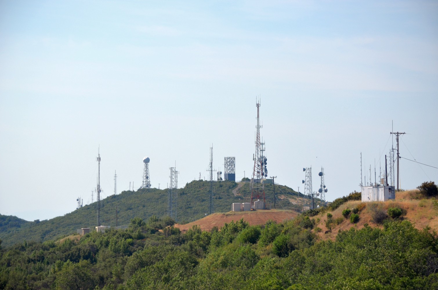
Mount Vaca on:
[Wikipedia]
[Google]
[Amazon]
Mount Vaca is a mountain in Napa and Solano counties of

Northern California
Northern California (commonly shortened to NorCal) is a geocultural region that comprises the northern portion of the U.S. state of California, spanning the northernmost 48 of the state's List of counties in California, 58 counties. Northern Ca ...
. It is both the highest point in the Vaca Mountains
The Vaca Mountains are a mountain range in Napa County, California, Napa and Solano County, California, Solano Counties, California that is one of the California Coast Ranges. They represent the easternmost of the Inner Coast Ranges in north−ce ...
and in Solano County. It is also one of several peaks in the San Francisco Bay Area
The San Francisco Bay Area, commonly known as the Bay Area, is a List of regions of California, region of California surrounding and including San Francisco Bay, and anchored by the cities of Oakland, San Francisco, and San Jose, California, S ...
that receive winter snow.
Origin of name
''Vaca'' is theSpanish
Spanish might refer to:
* Items from or related to Spain:
**Spaniards are a nation and ethnic group indigenous to Spain
**Spanish language, spoken in Spain and many countries in the Americas
**Spanish cuisine
**Spanish history
**Spanish culture
...
word for cow. Although cattle ranching historically played an important role in the area, Mount Vaca and the nearby city of Vacaville
Vacaville is a city located in Solano County, California, United States. It is located from Sacramento, California, Sacramento and from San Francisco, it is on the edge of the Sacramento Valley in Northern California. The city was founded in ...
are actually named for Juan Manuel Cabeza Vaca (1782–1856), who with Juan Felipe Pena received in 1843 the Rancho Los Putos Mexican land grant
In Alta California (now known as California) and Baja California, ranchos were concessions and land grants made by the Spanish and Mexican governments from 1775 to 1846. The Spanish concessions of land were made to retired soldiers as an indu ...
, which included the peak that now bears Vaca's name.
Public access
The summit of Mount Vaca is reached via either Mix Canyon Road or Gates Canyon Road, both of which originate in Vacaville California. These roads intersect Blue Ridge Road, which follows the ridge top to the summit.
High-definition Doppler weather radar
TheSan Francisco Bay Area
The San Francisco Bay Area, commonly known as the Bay Area, is a List of regions of California, region of California surrounding and including San Francisco Bay, and anchored by the cities of Oakland, San Francisco, and San Jose, California, S ...
is surrounded by mountain ranges that obstruct weather radar, even government broadcasts, thereby leaving blind spots in the weather prediction system. As a consequence, television station KPIX-TV
KPIX-TV (channel 5), branded on-air as CBS Bay Area, is a television station licensed to San Francisco, California, United States, serving as the CBS network outlet for the San Francisco Bay Area. It is owned and operated by the network's CBS ...
, a San Francisco CBS
CBS Broadcasting Inc., commonly shortened to CBS (an abbreviation of its original name, Columbia Broadcasting System), is an American commercial broadcast television and radio network serving as the flagship property of the CBS Entertainme ...
affiliate, partnered with the National Oceanic and Atmospheric Administration
The National Oceanic and Atmospheric Administration (NOAA ) is an American scientific and regulatory agency charged with Weather forecasting, forecasting weather, monitoring oceanic and atmospheric conditions, Hydrography, charting the seas, ...
(NOAA) to build a Doppler weather radar
A weather radar, also called weather surveillance radar (WSR) and Doppler weather radar, is a type of radar used to locate precipitation, calculate its motion, and estimate its type (rain, snow, hail etc.). Modern weather radars are mostly pu ...
on top of Mt. Vaca. Before this, the mountain blocked radar information about storms coming in from the Northwest, which compromised weather prediction and allowed for flooding, heavy rains, and high winds without prior warnings. This new radar system gives meteorologists a more complete view of precipitation
In meteorology, precipitation is any product of the condensation of atmospheric water vapor that falls from clouds due to gravitational pull. The main forms of precipitation include drizzle, rain, rain and snow mixed ("sleet" in Commonwe ...
and temperature patterns in the Bay Area, and allows for more accurate weather predictions.
See also
*List of highest points in California by county
This is a list of 58 counties of the U.S. State of California by their points of highest elevation. 6 of the 50 highest county high points in the United States are in California. Mount Whitney, located in Inyo and Tulare counties, is th ...
* List of summits of the San Francisco Bay Area
This is a list of named summits in the nine-county San Francisco Bay Area that are more than above sea level. Note that there are no natural features above in the city of San Francisco.
Unless otherwise referenced, all data are from the Geogra ...
References
{{DEFAULTSORT:Vaca, Mount Vaca Mountains Mountains of Napa County, California Mountains of Solano County, California Mountains of the San Francisco Bay Area Mountains of Northern California