Mount Dover on:
[Wikipedia]
[Google]
[Amazon]
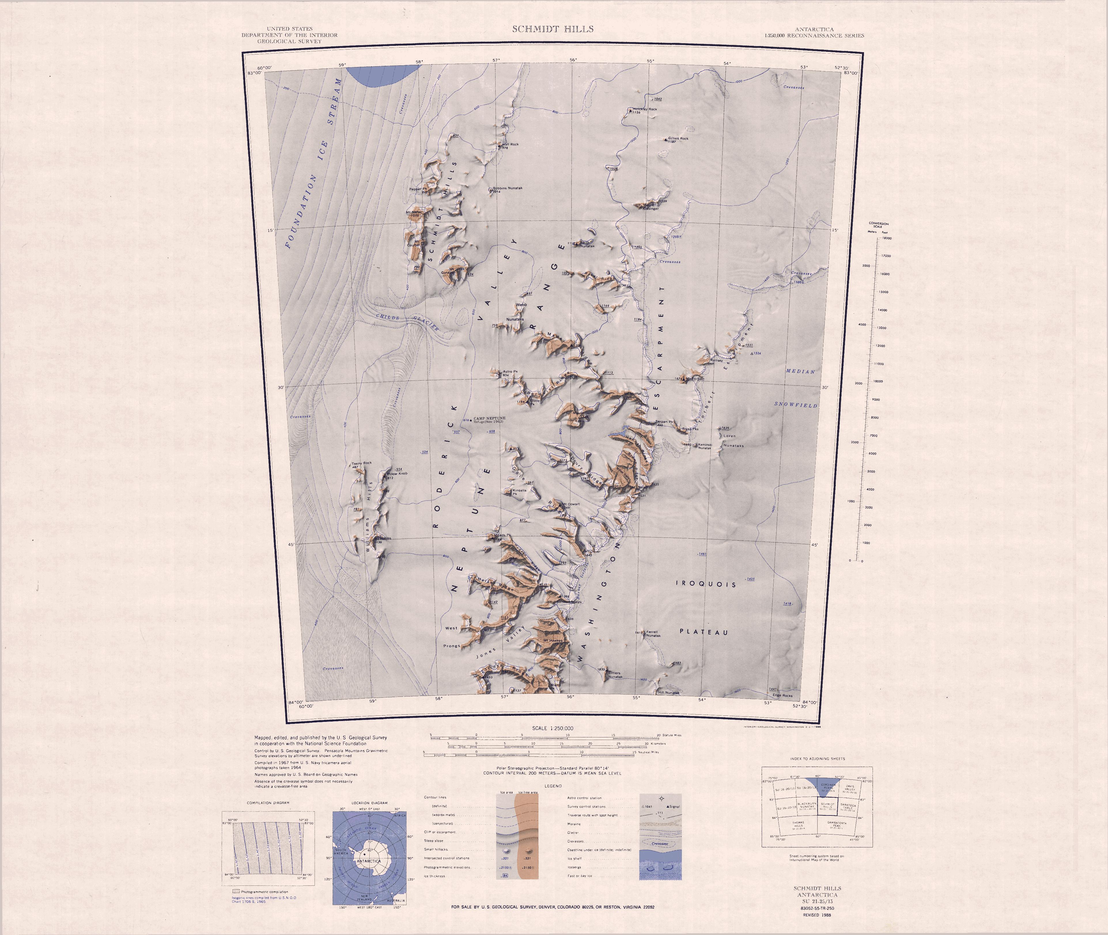
Mount Dover () is a mountain in Antarctica, high, surmounting the southeast end of Gale Ridge where the ridge abuts the
 Mount Dover is towards the south of the Washington Escarpment, west of the Iroquois Plateau and east of the Roderick Valley. It is north of Mount Hawkes, Bennett Spires and the Barnes Icefalls, and south of the
Washington Escarpment
The Neptune Range () is a mountain range, long, lying west-southwest of Forrestal Range in the central part of the Pensacola Mountains, Antarctica.
The range comprises Washington Escarpment with its associated ridges, valleys and peaks, the Ir ...
, in the Neptune Range, Pensacola Mountains
The Pensacola Mountains () are a large group of mountain ranges and peaks that extend in a northeast–southwest direction in the Transantarctic Mountains System, Queen Elizabeth Land region of Antarctica.
They comprise the Argentina Range, Forre ...
.
Exploration and name
Mount Dover was mapped by theUnited States Geological Survey
The United States Geological Survey (USGS), founded as the Geological Survey, is an agency of the U.S. Department of the Interior whose work spans the disciplines of biology, geography, geology, and hydrology. The agency was founded on Mar ...
(USGS) from surveys and United States Navy
The United States Navy (USN) is the naval warfare, maritime military branch, service branch of the United States Department of Defense. It is the world's most powerful navy with the largest Displacement (ship), displacement, at 4.5 millio ...
air photographs in 1956–66-
It was named by the United States Advisory Committee on Antarctic Names
The Advisory Committee on Antarctic Names (ACAN or US-ACAN) is an advisory committee of the United States Board on Geographic Names responsible for recommending commemorative names for features in Antarctica.
History
The committee was established ...
for James H. Dover, a geologist with the Patuxent Range field party in 1962–63.
Location
 Mount Dover is towards the south of the Washington Escarpment, west of the Iroquois Plateau and east of the Roderick Valley. It is north of Mount Hawkes, Bennett Spires and the Barnes Icefalls, and south of the
 Nelson Peak
Nelson Peak () is a peak in Antarctica, standing at the eastern end of Drury Ridge and Brown Ridge where the two ridges abut Washington Escarpment, in the Neptune Range, Pensacola Mountains.
Exploration and name
Nelson Peak was mapped by the ...
.
The Gale Ridge extends northwest from Mount Dover, and includes Mount Cowart and Kinsella Peak.
Nearby features
Barnes Icefalls
. The icefalls along Washington Escarpment between Mount Dover and Bennett Spires. Mapped by USGS from surveys and United States Navy air photos, 1956-66. Named by US-ACAN for James C. Barnes, meteorologist and station scientific leader at Ellsworth Station, winter 1962.Gale Ridge
. A ridge, long, extending northwestward from Mount Dover. Mapped by USGS from surveys and United States Navy air photos, 1956-66. Named by US-ACAN for Phillip L. Gale, meteorologist at Ellsworth Station, winter 1962.Mount Cowart
. A peak, high, midway along Gale Ridge. Mapped by USGS from surveys and air photos, 1956-66. Named by US-ACAN for M. Sergeant Ray J. Cowart, United States Air Force, flight engineer and member of the Electronic Test Unit in the Pensacola Mountains, summer 1957-58.Kinsella Peak
. A peak along the south side of Gale Ridge, west of Mount Cowart. Mapped by USGS from surveys and United States Navy air photos, 1956-66. Named by US-ACAN for William R. Kinsella, electronics technician at Ellsworth Station, winter 1958.References
Sources
* * * {{DEFAULTSORT:Dover, Mount Mountains of Queen Elizabeth Land Pensacola Mountains