Manor Hills on:
[Wikipedia]
[Google]
[Amazon]
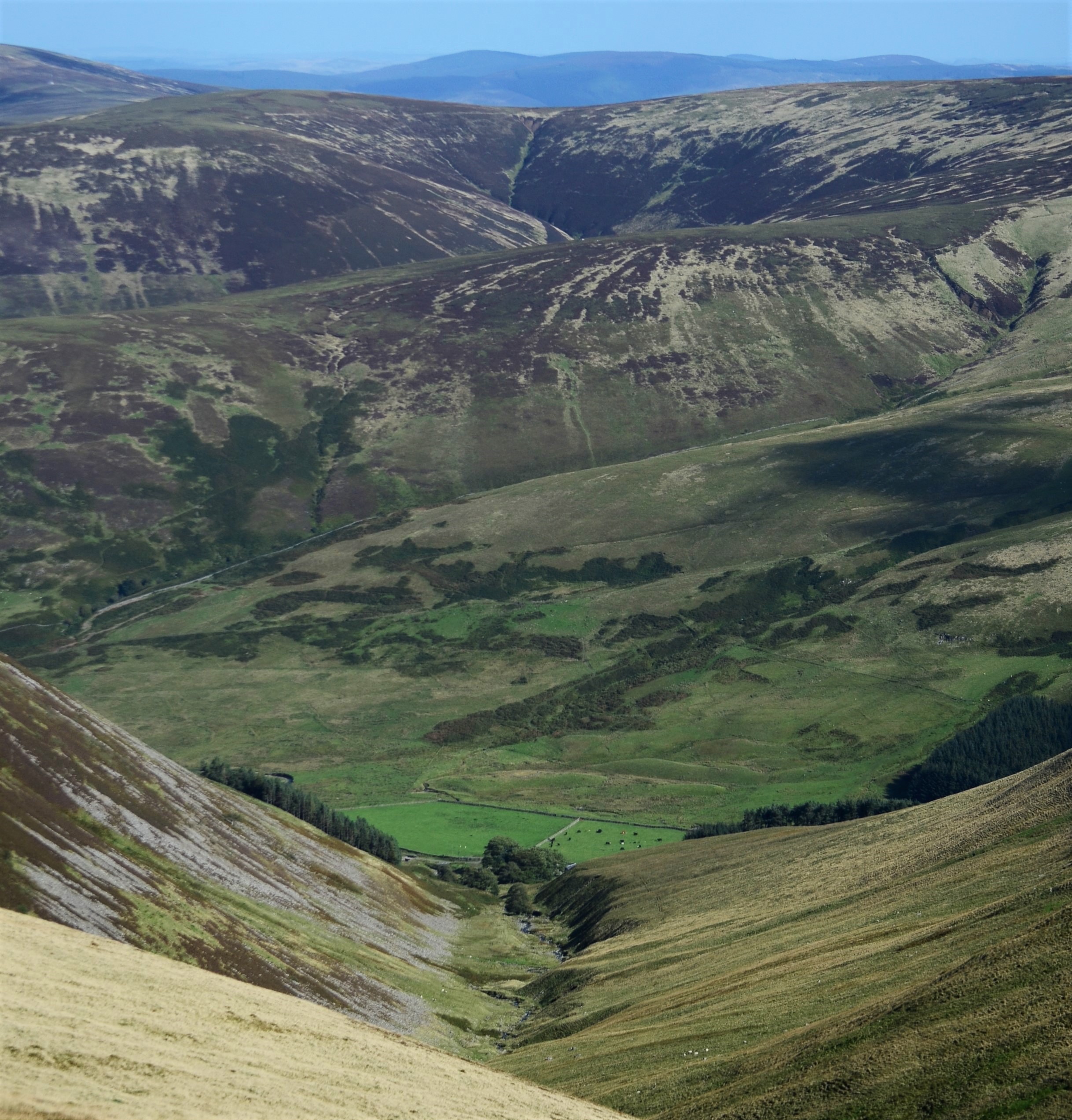
 The Manor Hills, also known as the Tweedsmuir Hills, are a range of hills south of
 A broad area, the higher hills could be said to generally split into three sections: those directly south of Peebles, those north of the Megget Reservoir and those southeast of Drumelzier. There is, however, a section of lower hills east of the B709 road as well as some isolated hills throughout. The highest point of the range is
 The Manor Hills, also known as the Tweedsmuir Hills, are a range of hills south of
 Peebles
Peebles () is a town in the Scottish Borders, Scotland. It was historically a royal burgh and the county town of Peeblesshire. According to the United Kingdom census, 2011, 2011 census, the population was 8,376 and the estimated population in ...
in the Scottish Borders
The Scottish Borders is one of 32 council areas of Scotland. It is bordered by West Lothian, Edinburgh, Midlothian, and East Lothian to the north, the North Sea to the east, Dumfries and Galloway to the south-west, South Lanarkshire to the we ...
, one of the ranges which collectively form the Southern Uplands
The Southern Uplands () are the southernmost and least populous of mainland Scotland's three major geographic areas (the others being the Central Lowlands and the Highlands). The term is used both to describe the geographical region and to col ...
. They are separated from the Moffat Hills
The Moffat Hills are a range of hills in the Southern Uplands of Scotland. They form a roughly triangular shape with a west facing side, a north facing side, and a south-east facing side. It is 17 kilometres from east to west across this triangl ...
by the Talla Reservoir, Megget Reservoir and St. Mary's Loch, the Moorfoot Hills by the A72 and the Culter Hills in South Lanarkshire
South Lanarkshire (; ) is one of 32 unitary authorities of Scotland. It borders the south-east of the Glasgow City council area and contains some of Greater Glasgow's suburban towns, as well as many rural towns and villages. It also shares bor ...
by the A701. The western portion of the hills are designated as the 'Tweedsmuir Hills' Site of Special Scientific Interest
A Site of Special Scientific Interest (SSSI) in Great Britain, or an Area of Special Scientific Interest (ASSI) in the Isle of Man and Northern Ireland, is a conservation designation denoting a protected area in the United Kingdom and Isle ...
and the ' Upper Tweeddale' National Scenic Area, with the major tributary rivers designated as Special Areas of Conservation
A special area of conservation (SAC) is defined in the European Union's Habitats Directive (92/43/EEC), also known as the ''Directive on the Conservation of Natural Habitats and of Wild Fauna and Flora''. They are to protect the 220 habitats and ap ...
.
The Hills
 A broad area, the higher hills could be said to generally split into three sections: those directly south of Peebles, those north of the Megget Reservoir and those southeast of Drumelzier. There is, however, a section of lower hills east of the B709 road as well as some isolated hills throughout. The highest point of the range is
 Broad Law
Broad Law is a hill in the Manor Hills range, part of the Southern Uplands of Scotland. The second-highest point in the Southern Uplands and the highest point in the Scottish Borders, it has an elevation of 840 metres, a prominence of 653 me ...
, which is also the highest point in the historic county of Peeblesshire
Peeblesshire (), the County of Peebles or Tweeddale is a Counties of Scotland, historic county of Scotland. Its county town is Peebles, and it borders Midlothian to the north, Selkirkshire to the east, Dumfriesshire to the south, and Lanarkshire ...
. The hills contain five Marilyns and thirteen Donalds, of which there is one Graham and one Corbett.
In a roughly clockwise direction, the hills in the range over (excluding tops) are as follows:
Other Information
The Southern Upland Way passes through the eastern end of the range, coming close to the summit of Minch Moor; this is the second highest point of the route after theLowther Hills
The Lowther Hills, also sometimes known as the Lowthers, are an extensive area of hill country in the Southern Uplands of Scotland, though some sub-ranges of hills in this area also go under their own local names – see "Hillwalking" below. They ...
.
References
{{Coord, 55.5767, -3.1960, region:GB-SCT, format=dms, display=title Mountains and hills of the Southern Uplands Mountains and hills of the Scottish Borders