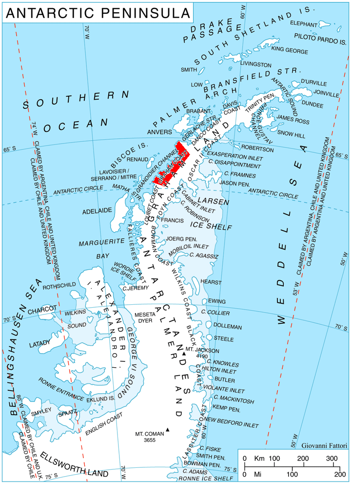
Leroux Bay on:
[Wikipedia]
[Google]
[Amazon]
 Leroux Bay () is a
Antarctic Digital Database (ADD).
Scale 1:250000
bay
A bay is a recessed, coastal body of water that directly connects to a larger main body of water, such as an ocean, a lake, or another bay. A large bay is usually called a ''gulf'', ''sea'', ''sound'', or ''bight''. A ''cove'' is a small, ci ...
long in a northwest–southeast direction and averaging wide, between Nunez Point and the narrow Magnier Peninsula
Magnier Peninsula is the mostly ice-covered peninsula projecting 18 km in northwest direction from Graham Coast in Graham Land, Antarctica. It is 17 km wide between Leroux Bay to the northeast and Bigo Bay to the southwest. Magnier Peaks rise ...
surmounted by the Magnier Peaks and Lisiya Ridge, along the west coast of Graham Land
Graham Land is the portion of the Antarctic Peninsula that lies north of a line joining Cape Jeremy and Cape Agassiz. This description of Graham Land is consistent with the 1964 agreement between the British Antarctic Place-names Committee ...
, Antarctica. The glaciers Chernomen, Luke
Luke may refer to:
People and fictional characters
* Luke (given name), including a list of people and fictional characters with the name
* Luke (surname), including a list of people with the name
* Luke the Evangelist, author of the Gospel of Luk ...
and Muldava feed the bay.
It was discovered by the French Antarctic Expedition, 1903–05
The French Antarctic Expedition is any of several French expeditions in Antarctica.
1837–1840
In 1837, during an 1837–1840 expedition across the deep southern hemisphere, Captain Jules Dumont d'Urville sailed his ship ''Astrolabe'' alo ...
, and named by Jean-Baptiste Charcot
Jean-Baptiste Étienne Auguste Charcot, better known in France as Commandant Charcot, (15 July 1867 in Neuilly-sur-Seine near Paris – 16 September 1936 at sea (30 miles north-west of Reykjavik, Iceland), was a French scientist, medical doctor ...
for Commander Leroux of the Argentine Navy
The Argentine Navy (ARA; ). This forms the basis for the navy's ship prefix "ARA". is the navy of Argentina. It is one of the three branches of the Armed Forces of the Argentine Republic, together with the Argentine Army, Army and the Argentine ...
. The bay was more accurately delineated by the British Graham Land Expedition in 1935.
Maps
Antarctic Digital Database (ADD).
Scale 1:250000
topographic map
In modern mapping, a topographic map or topographic sheet is a type of map characterized by large- scale detail and quantitative representation of relief features, usually using contour lines (connecting points of equal elevation), but histori ...
of Antarctica. Scientific Committee on Antarctic Research
The Scientific Committee on Antarctic Research (SCAR) is an interdisciplinary body of the International Science Council, International Science Council (ISC). SCAR coordinates international scientific research efforts in Antarctica, including th ...
(SCAR), 1993–2016.
References
Bays of Graham Land Graham Coast {{GrahamCoast-geo-stub