Lebanon Mountain Trail on:
[Wikipedia]
[Google]
[Amazon]
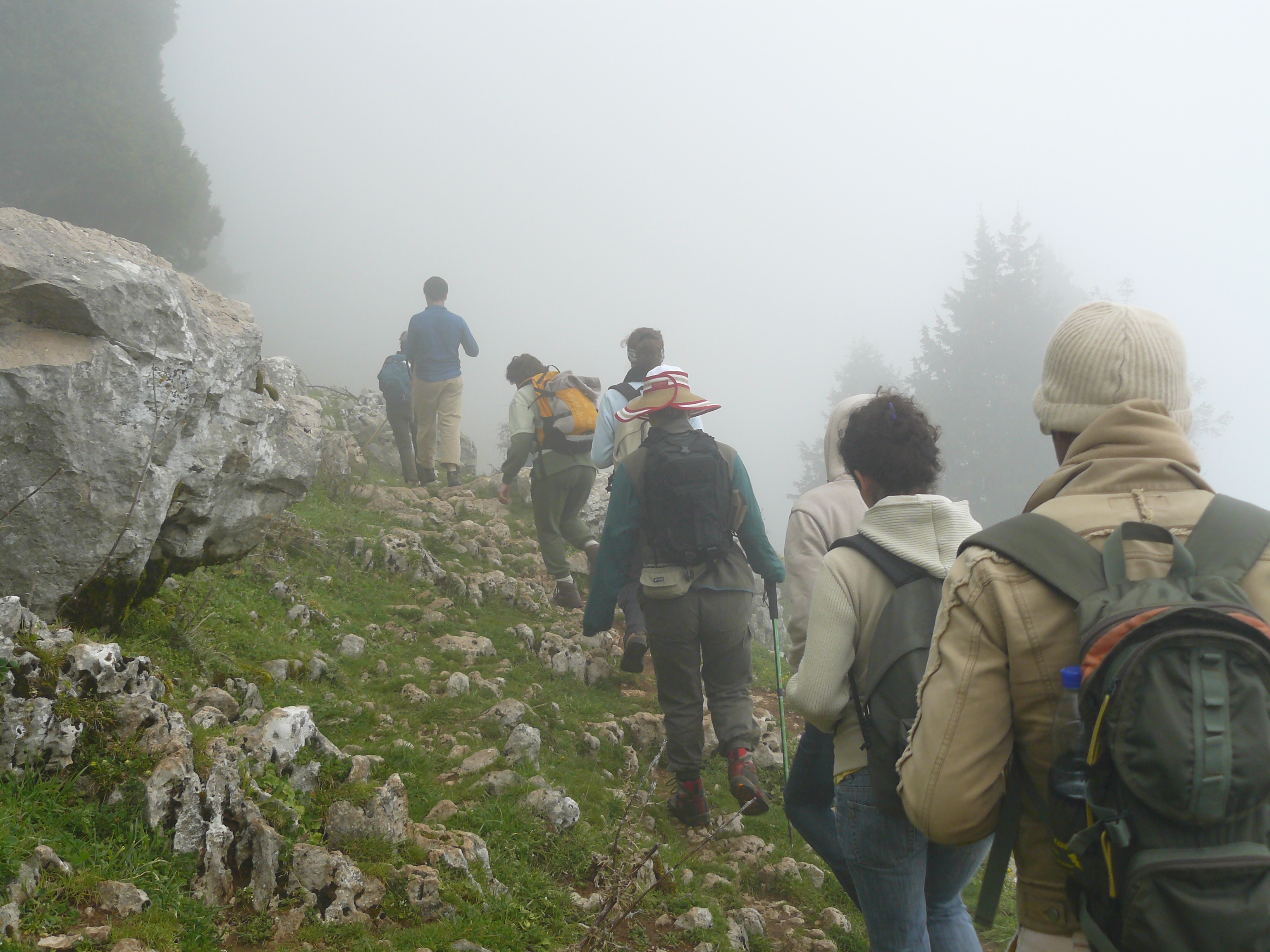


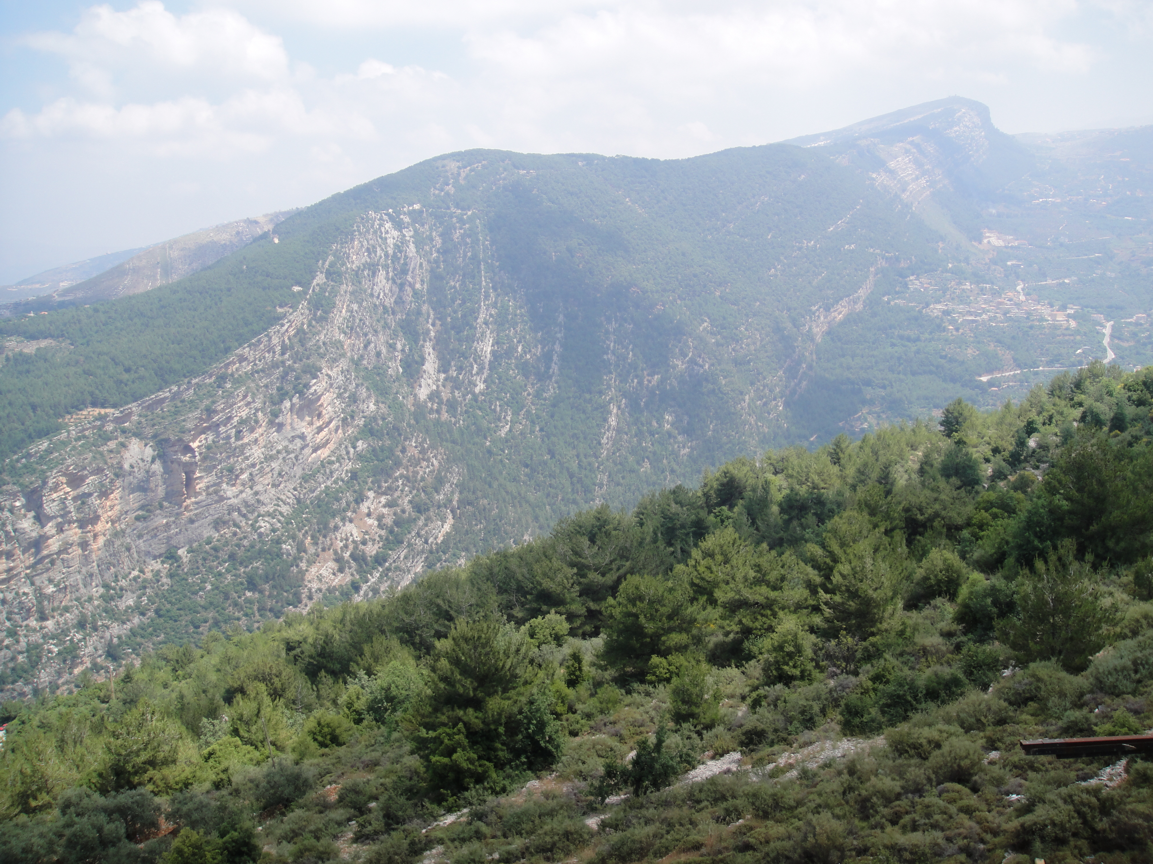
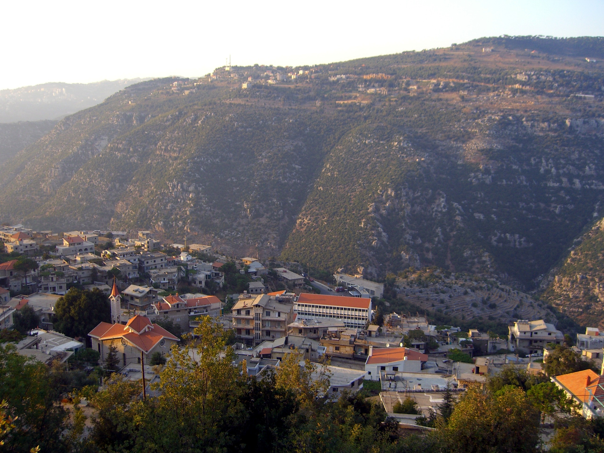
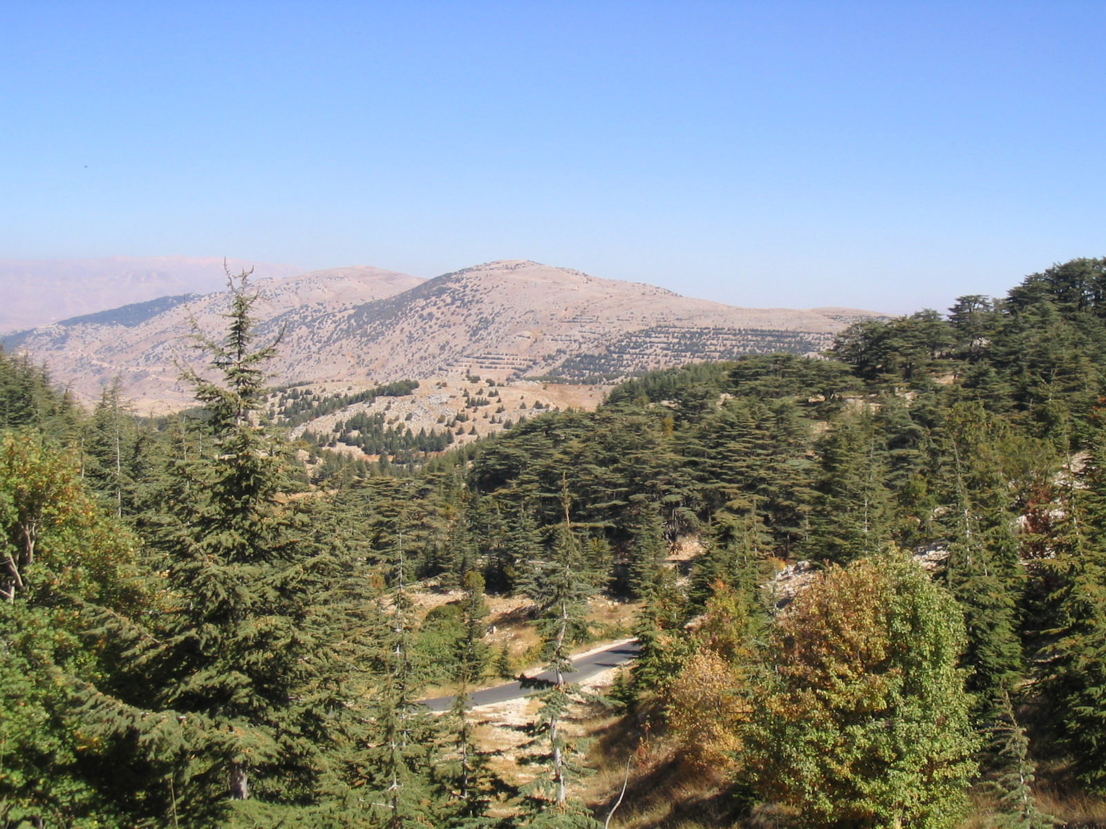
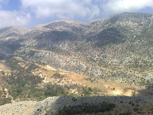
 The Lebanon Mountain Trail (LMT; ) is a long-distance hiking trail in
Lebanon Mountain Trail AssociationUSAID document
{{coord missing, Lebanon Sport in Lebanon Hiking trails in Lebanon


 The Lebanon Mountain Trail (LMT; ) is a long-distance hiking trail in
 Lebanon
Lebanon, officially the Republic of Lebanon, is a country in the Levant region of West Asia. Situated at the crossroads of the Mediterranean Basin and the Arabian Peninsula, it is bordered by Syria to the north and east, Israel to the south ...
. It extends from Andaket
Andaket, Aandqet, () is a Maronite Christianity in Lebanon, Maronite Christian village in Akkar Governorate, Lebanon. History
In 1838, Eli Smith noted Andakid'' as a Maronite village, located east of esh-Sheikh Muhammed.Robinson and Smith, 1841, ...
in north of Lebanon to Marjayoun
Marjayoun or Jdeidet Marjayoun (: Lebanese pronunciation ), also Marj 'Ayoun, Marjuyun or Marjeyoun (lit. "meadow of springs") which reflects the area's lush landscape and abundant water resources and Jdeideh / Jdeida / Jdeidet Marjeyoun, is a m ...
in the south along a path that transects more than 76 towns and villages at altitudes ranging from above sea level.
The LMT passes through UNESCO heritage sites
World Heritage Sites are landmarks and areas with legal protection under an international treaty administered by UNESCO for having cultural, historical, or scientific significance. The sites are judged to contain "cultural and natural heritage ...
, nature reserves, and protected areas, and consists of footpaths, dirt and paved roads, river crossings, and a wide range of terrain types. Though there are campgrounds along the trail, Lebanon does not have much of a camping culture.
Projects like the LMT are important for Lebanon during the country's financial and political turmoil. In 2019, hikers spent over $100,000 in villages along the trail, creating a major incentive for locals to preserve and protect their heritage.
History
The Lebanon Mountain Trail was proposed in 2002 by Joseph Karam, president of the US-based consulting company ECODIT, while thinking of ways to develop ecotourism products in Lebanon. Taking inspiration from theAppalachian Trail
The Appalachian Trail, also called the A.T., is a hiking trail in the Eastern United States, extending almost between Springer Mountain in Georgia and Mount Katahdin in Maine, and passing through 14 states.Gailey, Chris (2006)"Appalachian Tra ...
in the US, he conceptualized the idea with his colleague Karim El-Jisr, and in 2005 applied for grant funding from USAID
The United States Agency for International Development (USAID) is an agency of the United States government that has been responsible for administering civilian United States foreign aid, foreign aid and development assistance.
Established in 19 ...
Lebanon. ECODIT was awarded $3.3 million to implement the project between 2006 and 2008, and to establish the Lebanon Mountain Trail Association (LMTA) to "ensure the long-term sustainability of the trail".
In 2021, the German Government in partnership with the International Labour Organization
The International Labour Organization (ILO) is a United Nations agency whose mandate is to advance social and economic justice by setting international labour standards. Founded in October 1919 under the League of Nations, it is one of the firs ...
invested $1.1 million in the LMTA to fund maintenance of 590 kilometers of the main trail and side trails.
The LMT has been affected by Lebanon's economic crisis and the state of the country, including the Lebanese liquidity crisis
The Lebanese liquidity crisis is an ongoing financial crisis affecting Lebanon, that became fully apparent in August 2019, and was further exacerbated by the COVID-19 pandemic in Lebanon (which began in February 2020), the 2020 Beirut port ex ...
, the 2020 Beirut Explosion
On 4 August 2020, a major explosion occurred in Beirut, Lebanon, triggered by the ignition of 2,750 tonnes of ammonium nitrate. The chemical, confiscated in 2014 from the cargo ship and stored at the Port of Beirut without adequate safety me ...
, and the COVID-19 Pandemic
The COVID-19 pandemic (also known as the coronavirus pandemic and COVID pandemic), caused by severe acute respiratory syndrome coronavirus 2 (SARS-CoV-2), began with an disease outbreak, outbreak of COVID-19 in Wuhan, China, in December ...
, which caused a large decrease in tourism.
Thru-hiking
Every spring, the LMTA hosts a group thru-hike that covers the full trail in one month.Fastest known times
On May 1, 2021, Ali Kedami and Nayla Cortas completed the LMT together in 6 days 12 hours and 15 minutes. Nayla also became the first woman to run the LMT. The previous record of 6 days and 17 hours was set in June 2017 by Patrick Vaughan.Notable locations
*Kadisha Valley
Kadisha Valley (), also romanized as the Qadisha Valley and also known as the Kadisha Gorge or Wadi Kadisha (), is a gorge that lies within the Bsharri and Zgharta Districts of the North Governorate of Lebanon. The valley was carved by the Kad ...
* Cedars of God
The Cedars of God ( ''Arz ar-Rabb'' "Cedars of the Lord") is a forest located in the Kadisha Valley of Bsharre, Lebanon. It is one of the last vestiges of the extensive forests of the Lebanon cedar that thrived across Mount Lebanon in antiqui ...
* Mount Lebanon
Mount Lebanon (, ; , ; ) is a mountain range in Lebanon. It is about long and averages above in elevation, with its peak at . The range provides a typical alpine climate year-round.
Mount Lebanon is well-known for its snow-covered mountains, ...
Sections
The LMT is divided into 27 sections, each of which is 9–24 km long and can be hiked in one day: Section 0:Andaket
Andaket, Aandqet, () is a Maronite Christianity in Lebanon, Maronite Christian village in Akkar Governorate, Lebanon. History
In 1838, Eli Smith noted Andakid'' as a Maronite village, located east of esh-Sheikh Muhammed.Robinson and Smith, 1841, ...
–Qobaiyat
# Qobaiyat-Tachea
# Tachea–Qemmamine
# Qemmamine–Kfar Bnine
# Kfar Bnine–Sir Dinniyeh
# Sir Ed Dinnieh–Ehden
Ehden (, Syriac language, Syriac-Aramaic:ܐܗܕ ܢ) is a mountainous city in the heart of the northern mountains of Lebanon and on the southwestern slopes of Mount Makmal in the Mount Lebanon, Mount Lebanon Range. Its residents are the people of Z ...
# Ehden–Qannoubine
# Qannoubine–Bsharri
Bsharri ( ''Bšarrī''; also romanized ''Becharre'', ''Bcharre'', ''Bsharre'', ''Bcharre Al Arz'') is a Lebanese town located in the district of the same name, North Governorate, situated at altitudes between and . Bsharri is the location o ...
# Bsharri–Hasroun
Hasroun (also Hasrun or Hasroon, Arabic: حصرون ) is a village located in the Bsharri District in the North Governorate of Lebanon. It is situated in the Valley of Qadisha, overlooking the southern branch of this valley, the Qannoubine Valle ...
# Hasroun–Tannourine
Tannourine (, also Tannoureen, Tannorine) is a Lebanese town located in the Batroun District, part of the Governorate of North Lebanon, 80 km from the capital Beirut. Tannourine is formed by a cluster of mountain settlements located in the h ...
# Tannourine El Faouqa–Aaqoura
# Aaqoura–Afqa
Afqa (; also spelled ''Afka'') is a village and municipality located in the Byblos District of the Keserwan-Jbeil Governorate, northeast of Beirut in Lebanon. It has an average elevation of 1,200 meters above sea level and a total land area of ...
# Afqa–Hrajel
# Hrajel–Kfar Aaqab
# Kfar Aaqab–Baskinta
Baskinta () is a Lebanese village situated at an altitude ranging from 1250 metres above sea level and climbs up to approximately 1800 meters of height at Qanat Bakish, making it one of the highest villages of Lebanon. It is located 43 kilometers ...
# Baskinta–Mtain
# Mtain–Falougha
# Falougha–Aain Zhalta
# Aain Zhalta–Barouk
Barouk () is a village in the Chouf District of Mount Lebanon Governorate in Lebanon. Barouk is located 52 kilometers southeast of Beirut. Its average elevation is 1000 to 1200 meters above sea level and its total land area consists of 2,762 hecta ...
# Barouk–Maasser
# Maasser– Niha
# Niha–Jezzine
Jezzine ( ''Jizzīn'') is a municipality in Lebanon, located from Sidon and south of Beirut. It is the capital of Jezzine District. Surrounded by mountain peaks, pine forests (like the Bkassine Pine Forest), and at an average altitude of 95 ...
# Jezzine-Aaytanit
# Aaytanit-Kawkaba Bou Aarab
# Kawkaba Bou Aarab–Rashaya
Rashaya, Rachaya, Rashaiya, Rashayya or Rachaiya (), also known as Rashaya al-Wadi or Rachaya el-Wadi (and variations), is a town of the Rashaya District in the west of the Beqaa Government of Lebanon. It is situated at around above sea level ...
# Rachaya–Hasbaya
Hasbaya or Hasbeiya () is a municipality in Lebanon, situated at the foot of Mount Hermon, overlooking a deep amphitheatre from which a brook flows to the Hasbani River. In 1911, the population was about 5,000.
The town was a traditional seat of ...
# Hasbaya–Marjayoun
Marjayoun or Jdeidet Marjayoun (: Lebanese pronunciation ), also Marj 'Ayoun, Marjuyun or Marjeyoun (lit. "meadow of springs") which reflects the area's lush landscape and abundant water resources and Jdeideh / Jdeida / Jdeidet Marjeyoun, is a m ...
# Ain Ebel
Ain Ebel () is a municipality in the Nabatieh Governorate, about 90 kilometers (56 miles) south of Beirut. Its inhabitants are predominantly Christian.
Etymology
Historian Joseph Toufik Khoreich writes that the name means "Spring of the Mon ...
Side trails
* Douma side trail * Ehmej side trail * Baskinta side trail * Bkassine side trailReferences
External links
Lebanon Mountain Trail Association
{{coord missing, Lebanon Sport in Lebanon Hiking trails in Lebanon