Lachine Rapids on:
[Wikipedia]
[Google]
[Amazon]
The Lachine Rapids () are a series of
 The first European to see the rapids was
Habitat
/ref> The city maintains Des Rapids Park which doubles as bird sanctuary and a place for visitors to appreciate the rapids.
rapids
Rapids are sections of a river where the river bed has a relatively steep stream gradient, gradient, causing an increase in water velocity and turbulence. Flow, gradient, constriction, and obstacles are four factors that are needed for a rapid t ...
on the Saint Lawrence River, between the Island of Montreal and the South Shore. They are confusingly located near the borough of Lasalle and not Lachine.
The Lachine Rapids contain large standing waves because the water volume and current do not change with respect to the permanent features in the riverbed, namely its shelf-like drops. Seasonal variation in the water flow does not change the position of the waves, although it does change their size and shape. The rapids are about in length.
In the past these represented a considerable barrier to maritime traffic. Until the construction of the Lachine Canal through Montreal, the rapids had to be portaged. Even with the canal, the difficulty was such that it was usually more convenient to ship goods by rail to Montreal, where they could be loaded at the city's port. Montreal remains a major rail hub and one of Canada's largest ports for that reason.
The Lachine Rapids are now passed by the South Shore Canal (Saint-Lambert and Côte Sainte-Catherine locks) of the Saint Lawrence Seaway.
Wildlife
The rapids contain a number of islands used by migratory birds.History
 The first European to see the rapids was
 Jacques Cartier
Jacques Cartier (; 31 December 14911 September 1557) was a French maritime explorer from Brittany. Jacques Cartier was the first Europeans, European to describe and map the Gulf of Saint Lawrence and the shores of the Saint Lawrence River, wh ...
, who sailed up the St. Lawrence River in 1535, believing he had found the Northwest Passage. In 1611, Samuel de Champlain
Samuel de Champlain (; 13 August 1574#Fichier]For a detailed analysis of his baptismal record, see #Ritch, RitchThe baptism act does not contain information about the age of Samuel, neither his birth date nor his place of birth. – 25 December ...
named the rapids Sault Saint-Louis, after a teenaged crewman named Louis who drowned here; the name later extended to Lac Saint-Louis. This name remained in use until the mid-19th century, but later came to be replaced by the name of the adjacent town of Lachine. The name "Lachine" itself is derived from the French name for China - La Chine.
The first Europeans known to have traveled above these rapids were Champlain and Étienne Brûlé on 13 June 1611. Brûlé continued upriver to live among the Algonquin, while Champlain himself would not travel further up the Ottawa River
The Ottawa River (, ) is a river in the Canadian provinces of Ontario and Quebec. It is named after the Algonquin word "to trade", as it was the major trade route of Eastern Canada at the time. For most of its length, it defines the border betw ...
until May 1613. Louis Jolliet's July 1674 canoe accident in the rapids destroyed his official report on the existence of the Mississippi River
The Mississippi River is the main stem, primary river of the largest drainage basin in the United States. It is the second-longest river in the United States, behind only the Missouri River, Missouri. From its traditional source of Lake Ita ...
, and raised the standing of his fellow explorer Jacques Marquette
Jacques Marquette, Society of Jesus, S.J. (; June 1, 1637 – May 18, 1675), sometimes known as Père Marquette or James Marquette, was a French Society of Jesus, Jesuit missionary who founded Michigan's first European settlement, Sault Ste. M ...
.
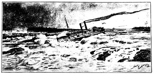
The first person to design a ship capable of shooting the Lachine Rapids was shipbuilder and carpenter John McQuaid, a native of County Armagh
County Armagh ( ) is one of the six counties of Northern Ireland and one of the traditional thirty-two counties of Ireland. It is located in the Provinces of Ireland, province of Ulster and adjoins the southern shore of Lough Neagh. It borders t ...
, Ireland who later settled in Kingston, Ontario
Kingston is a city in Ontario, Canada, on the northeastern end of Lake Ontario. It is at the beginning of the St. Lawrence River and at the mouth of the Cataraqui River, the south end of the Rideau Canal. Kingston is near the Thousand Islands, ...
with his family.
Recreation
Whitewater rafting and jet boat expeditions to the rapids are available in Montreal. Whitewater kayaking has become popular, along with river surfing, on a standing wave adjacent to the Habitat 67.()./ref> The city maintains Des Rapids Park which doubles as bird sanctuary and a place for visitors to appreciate the rapids.
References
{{Reflist Landforms of Montreal Portages in Canada Saint Lawrence River Landforms of Montérégie Tourist attractions in Montérégie Lachine, Quebec Bodies of water of Quebec Rapids of Canada