Kerridge on:
[Wikipedia]
[Google]
[Amazon]
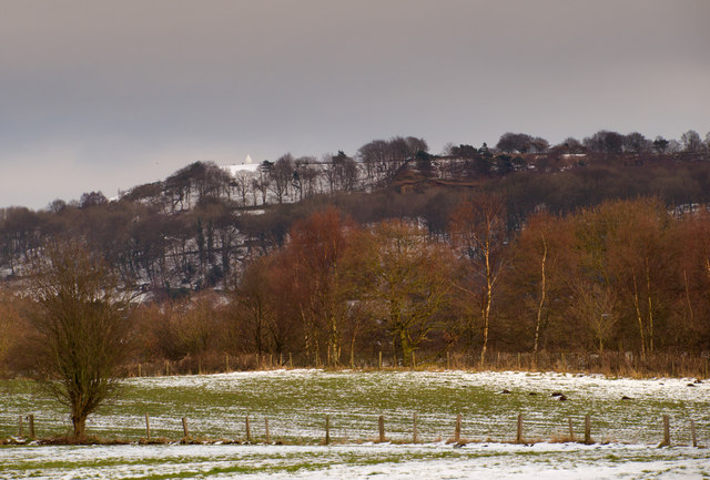
Kerridge is a village in the  It gives its name to Kerridge Ridge – one of the western foothills of the
Local webpage
Heritage project
Villages in Cheshire Towns and villages of the Peak District Former civil parishes in Cheshire Bollington {{Cheshire-geo-stub
civil parish
In England, a civil parish is a type of administrative parish used for local government. It is a territorial designation which is the lowest tier of local government. Civil parishes can trace their origin to the ancient system of parishes, w ...
of Bollington
Bollington is a town and civil parish in Cheshire, England, to the east of Prestbury. In the Middle Ages, it was part of the Earl of Chester's manor of Macclesfield and the ancient parish of Prestbury. At the 2021 census, the parish had a pop ...
, in the Cheshire East
Cheshire East is a unitary authority area with borough status in Cheshire, England. The local authority is Cheshire East Council, which is based in the town of Sandbach. Other towns within the area include Crewe, Macclesfield, Congleton, Wilms ...
district, in the ceremonial county of Cheshire
Cheshire ( ) is a Ceremonial counties of England, ceremonial county in North West England. It is bordered by Merseyside to the north-west, Greater Manchester to the north-east, Derbyshire to the east, Staffordshire to the south-east, and Shrop ...
, England. Kerridge borders the neighbouring parish of Rainow
Rainow is a village and Civil parish, civil parish in Cheshire, England, in the valley of the River Dean and next to the B roads in Zone 5 of the Great Britain numbering scheme, B5470 road between Macclesfield and Kettleshulme. It straddles the e ...
.
 It gives its name to Kerridge Ridge – one of the western foothills of the
 Pennines
The Pennines (), also known as the Pennine Chain or Pennine Hills, are a range of highland, uplands mainly located in Northern England. Commonly described as the "Vertebral column, backbone of England" because of its length and position, the ra ...
– by which it stands. It is overlooked by the local landmark of White Nancy
White Nancy is a structure at the top of Kerridge Hill, overlooking Bollington, Cheshire, England. Since 1966 it has been recorded in the National Heritage List for England (NHLE) as a designated Listed building#Grade II, Grade II Listed building ...
. The local industries were quarry
A quarry is a type of open-pit mining, open-pit mine in which dimension stone, rock (geology), rock, construction aggregate, riprap, sand, gravel, or slate is excavated from the ground. The operation of quarries is regulated in some juri ...
ing and cotton mill
A cotton mill is a building that houses spinning or weaving machinery for the production of yarn or cloth from cotton, an important product during the Industrial Revolution in the development of the factory system.
Although some were driven ...
s, of which remnants remain.
On 29 February 1912, the Macclesfield Canal
The Macclesfield Canal is a canal in east Cheshire, England. There were various proposals for a canal to connect the town of Macclesfield to the national network from 1765 onwards, but it was not until 1824 that a scheme came to fruition. There ...
at Kerridge burst its banks, flooding several nearby streets.
History
Kerridge itself comes from 'key ridge', and was known inOld English
Old English ( or , or ), or Anglo-Saxon, is the earliest recorded form of the English language, spoken in England and southern and eastern Scotland in the Early Middle Ages. It developed from the languages brought to Great Britain by Anglo-S ...
as 'Gaeg Hrycg'.
Kerridge became a civil parish in 1894, being formed from the rural
In general, a rural area or a countryside is a geographic area that is located outside towns and cities. Typical rural areas have a low population density and small settlements. Agricultural areas and areas with forestry are typically desc ...
part of Bollington, On 30 September 1900 the parish was abolished and merged with Bollington.
References
External links
Local webpage
Heritage project
Villages in Cheshire Towns and villages of the Peak District Former civil parishes in Cheshire Bollington {{Cheshire-geo-stub