Kara-Koshun on:
[Wikipedia]
[Google]
[Amazon]

 Karakoshun Lake () was an inland lake located in the
你不知道的罗布泊——罗布泊中遇见神秘圆形城池(越玩越野、2016年)
/ref>
塔里木河的变迁与罗布泊的演化 (Quarterly Sciences, 2009)
(in Chinese) {{coord missing, Xinjiang Lakes of Xinjiang Ruoqiang County Endorheic lakes of Asia

 Karakoshun Lake () was an inland lake located in the
 Bayingolin Mongol Autonomous Prefecture
Bayingolin Mongol Autonomous Prefecture is an autonomous prefecture in the southeastern Xinjiang, China. It borders Gansu to the east, Qinghai to the southeast and the Tibet Autonomous Region to the south. It is the largest prefecture-level div ...
, Xinjiang Uyghur Autonomous Region
Xinjiang,; , SASM/GNC: previously romanized as Sinkiang, officially the Xinjiang Uygur Autonomous Region (XUAR), is an autonomous region of the People's Republic of China (PRC), located in the northwest of the country at the crossroads ...
, China, which is now dry.
General
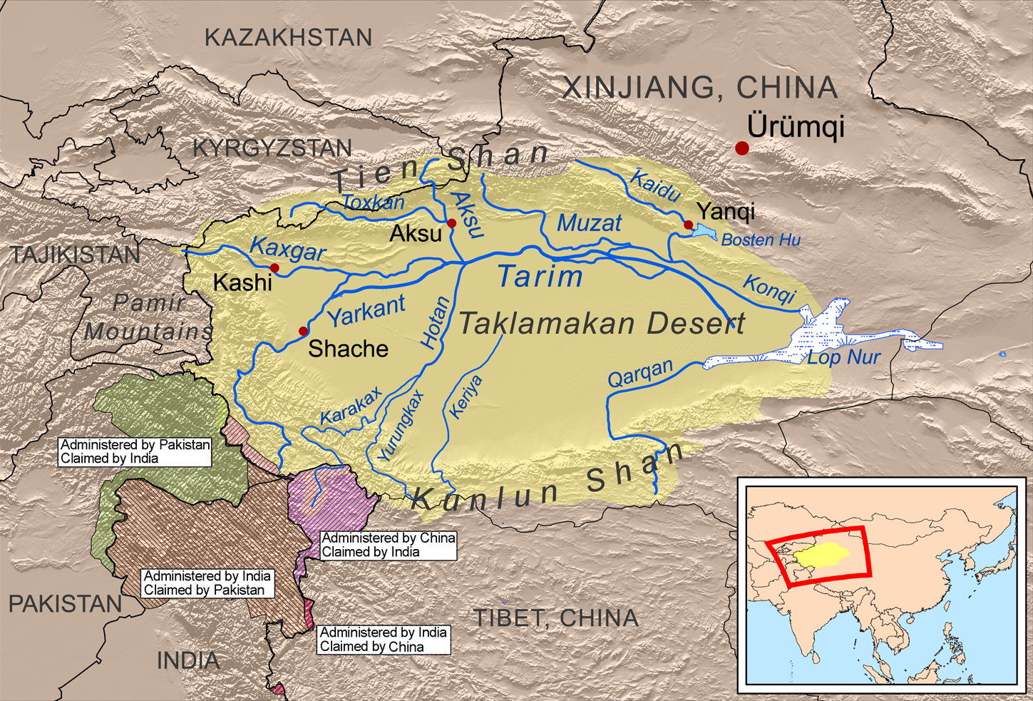
Karakoshun Lake is one of the major depressions in the southeastern part of theTarim Basin
The Tarim Basin is an endorheic basin in Xinjiang, Northwestern China occupying an area of about and one of the largest basins in Northwest China.Chen, Yaning, et al. "Regional climate change and its effects on river runoff in the Tarim Basin, Ch ...
, the others including Lop Nur
Lop Nur or Lop Nor (, , from an Oirat Mongolic name meaning "Lop Lake", where "Lop" is a toponym of unknown origin) is a now largely dried-up salt lake formerly located within the ''Lop Depression'' in the eastern fringe of the Tarim Basin in ...
and Taitema Lake. Until the first half of the 20th century, it was the terminal lake
A lake is often a naturally occurring, relatively large and fixed body of water on or near the Earth's surface. It is localized in a basin or interconnected basins surrounded by dry land. Lakes lie completely on land and are separate from ...
of the Tarim River, that emptied into Lop Nur, recorded by the explorers, Nikolay Przhevalsky
Nikolay Mikhaylovich Przhevalsky (or Prjevalsky;; , . – ) was a Russian geographer and a renowned explorer of Central and East Asia. Although he never reached his ultimate goal, the city of Lhasa in Tibet, he still travelled through regio ...
, Sven Hedin
Sven Anders Hedin, KNO1kl RVO,Wennerholm, Eric (1978) ''Sven Hedin – En biografi'', Bonniers, Stockholm (19 February 1865 – 26 November 1952) was a Swedish geographer, topographer, explorer, photographer, travel writer and illustrator ...
and Folke Bergman as the "Kara koshun" wetland. It also received water from Taitema Lake, which collected water from the Qiemo River.
By the end of the 20th century, Karakoshun Lake had completely dried up./ref>
Transport
*Xinjiang Region Highway S235 (China National Highway 315
Constructed in 1954, the Qinghai-Xinjiang Highway, also known as the China National Highway 315 (G315) runs west from Xining, Qinghai towards Kashgar, Xinjiang. It is in length. In 1994 the departments of communication and transportation in Qing ...
to Hami
Hami ( zh, c=哈密) or Kumul () is a prefecture-level city in eastern Xinjiang, China. It is well known for sweet Hami melons. In early 2016, the former Hami county-level city merged with Hami Prefecture to form the Hami prefecture-level city ...
)
See also
*Lop Nur
Lop Nur or Lop Nor (, , from an Oirat Mongolic name meaning "Lop Lake", where "Lop" is a toponym of unknown origin) is a now largely dried-up salt lake formerly located within the ''Lop Depression'' in the eastern fringe of the Tarim Basin in ...
References
External links
塔里木河的变迁与罗布泊的演化 (Quarterly Sciences, 2009)
(in Chinese) {{coord missing, Xinjiang Lakes of Xinjiang Ruoqiang County Endorheic lakes of Asia