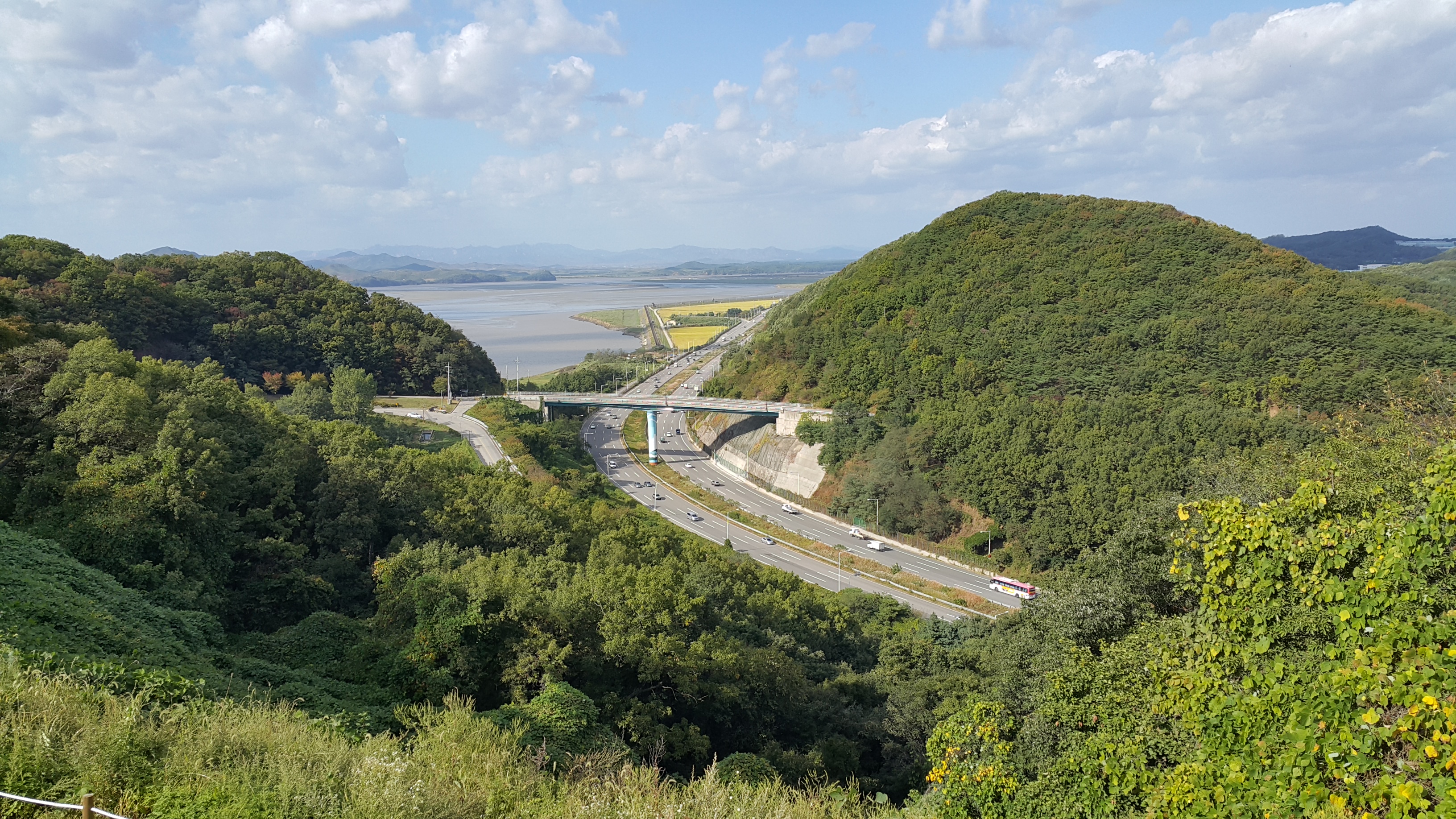
Jayu-ro on:
[Wikipedia]
[Google]
[Amazon]


 The Jayu Motorway (also called Jayu-ro, , lit. Freedom Road) is a major north–south arterial highway in


 The Jayu Motorway (also called Jayu-ro, , lit. Freedom Road) is a major north–south arterial highway in
 South Korea
South Korea, officially the Republic of Korea (ROK), is a country in East Asia. It constitutes the southern half of the Korea, Korean Peninsula and borders North Korea along the Korean Demilitarized Zone, with the Yellow Sea to the west and t ...
. Its southern terminus is in Seoul
Seoul, officially Seoul Special Metropolitan City, is the capital city, capital and largest city of South Korea. The broader Seoul Metropolitan Area, encompassing Seoul, Gyeonggi Province and Incheon, emerged as the world's List of cities b ...
, while its northern terminus is at National Route 1's Reunification Bridge leading into the DMZ. North Korea is visible from a section of the highway stretching from Seongdong-ri to Ogeum-ri. Its shape closely parallels the northern bank of the Han River and is heavily fortified with barbed wire and military observatories. It is part of National Route 77.
This route connects Seoul
Seoul, officially Seoul Special Metropolitan City, is the capital city, capital and largest city of South Korea. The broader Seoul Metropolitan Area, encompassing Seoul, Gyeonggi Province and Incheon, emerged as the world's List of cities b ...
( Gayang Bridge), Goyang
Goyang (; ) is a city in Gyeonggi Province in the north of South Korea. It is part of the Seoul Metropolitan Area, making Goyang one of Seoul's Satellite city, satellite cities. It is one of the largest cities in the Seoul Metropolitan Area, w ...
(Ilsan
Ilsan New Town () refers to a planned city occupying Ilsandong District and Ilsanseo District of Goyang.
Ilsan is located northwest of Seoul. Like other satellite cities in the Seoul National Capital Area such as Bundang, Ilsan was planned in o ...
) to Paju
Paju (; ) is a Administrative divisions of South Korea, city in Gyeonggi Province, South Korea. Paju was made a city in 1997; it had previously been a county (''gun'').
The city area of Paju is ,"Paju (Gyeonggi-do Province)." ''Naver Encyclopedi ...
(Munsan
Munsan is a town of Paju, Gyeonggi Province, South Korea. It lies on the south bank of the Imjin River, close to the edge of the Demilitarized Zone and near Panmunjom and the Joint Security Area.
History
Munsan has a heavy military presence becau ...
, Panmunjeom
Panmunjom (also spelled Panmunjeom) was a village just north of the ''de facto'' border between North Korea and South Korea, where the 1953 Korean Armistice Agreement that ended the Korean War was signed. It was located in what is now Paju, Gye ...
), with a total length of .
The highway is directly connected with the Gangbyeonbuk-ro
The Gangbyeon Expressway () is an eight-lane highway located in Seoul, South Korea. It is part of National Route 46 and National Route 77. This route connects Seoul to Namyangju, with a total length of . The highway is directly connected ...
at Gayang Bridge.
History
* May 19, 1990 - Construction Begin * August, 1992 -Haengju Bridge
The Haengju Bridge () crosses the Han River in South Korea and connects the city of Goyang and the Gangseo District, Seoul. The bridge was first completed in 1978, but the bridge was very narrow and could not handle the increased traffic as the ...
~Tongil observatory
Korean reunification is the hypothetical unification of North Korea and South Korea into a singular Korean sovereign state. The process towards reunification of the peninsula while still maintaining two opposing regimes was started by the Ju ...
section(29 km) opens to traffic.
* September, 1994 - Tongil observatory~Jayu Bridge(자유의다리) section(17.5 km) opens to traffic.
Compositions
Lanes
* Dangdong IC ~ Jayu IC: 4 * Nakha IC - Dangdong IC: 6 * Nakha IC - Isanpo JC: 8 * Gayang Bridge - Isanpo JC: 10Length
Speed limits
* 90 km/hList of facilities
* IC: Interchange, JC: Junction, SA: Service Area, TG:TollgateJayuro Ghost
The highway is also notable for its variant of thevanishing hitchhiker
The vanishing hitchhiker (or variations such as the ghostly hitchhiker, disappearing hitchhiker, phantom hitchhiker) is an urban legend in which people travelling by vehicle, meet with or are accompanied by a hitchhiker who subsequently vanishes ...
called the Jayuro Ghost. The area frequently experiences foggy weather and thus has a high rate of automobile collisions. According to the narrative, a woman can sometimes be seen along the side of the road wearing sunglasses. Upon closer inspection it is revealed that the so-called sunglasses are actually the woman's gouged-out eyes. Another version of the narrative has a driver picking up the ghost, only for the ghost to direct the driver to a cemetery or disappear when the driver reaches the destination. The Dark Side of Seoul Podcast released a video episode about this urban legend and other road-related Korean folklore.
See also
*List of streets in Seoul
A list is a set of discrete items of information collected and set forth in some format for utility, entertainment, or other purposes. A list may be memorialized in any number of ways, including existing only in the mind of the list-maker, but ...
*Olympicdaero
The Olympic-daero (also called Olympic Blvd ; ''Olrimpik Daero'') is 8-lane highway located in Seoul. South Korea.
This route connects Seoul to Gimpo, Hanam and Gimpo International Airport, with a total length of
This highway is a main r ...
*Gimpo Hangang Highway
The Gimpo Hangang Highway () is a 6-lanes highway in South Korea, connecting Gangseo District, Seoul to Gimpo, Gyeonggi Province.1992 establishments in South Korea
Roads in Seoul
Roads in Gyeonggi