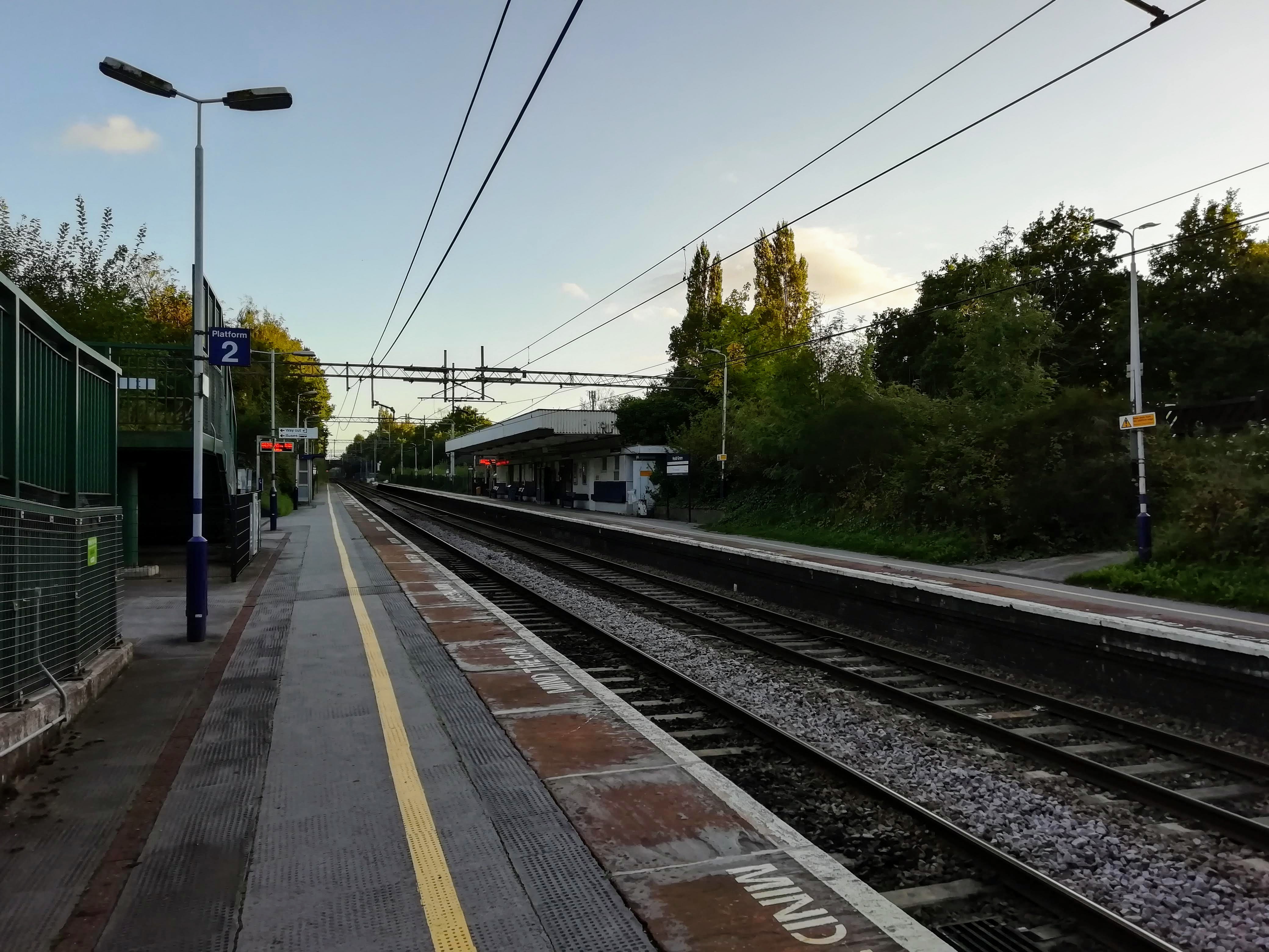
Heald Green on:
[Wikipedia]
[Google]
[Amazon]
Heald Green is a suburb in the
 Heald Green railway station is a stop on the Styal line, which provides regular trains to
Metropolitan Borough of Stockport
The Metropolitan Borough of Stockport is a metropolitan borough of Greater Manchester in England. It is south-east of central Manchester and south of Tameside. As well as the towns of Stockport, Bredbury and Marple, Greater Manchester, Marple, ...
, Greater Manchester
Greater Manchester is a ceremonial county in North West England. It borders Lancashire to the north, Derbyshire and West Yorkshire to the east, Cheshire to the south, and Merseyside to the west. Its largest settlement is the city of Manchester. ...
, England, south-west of Stockport
Stockport is a town in Greater Manchester, England, south-east of Manchester, south-west of Ashton-under-Lyne and north of Macclesfield. The River Goyt, Rivers Goyt and River Tame, Greater Manchester, Tame merge to create the River Mersey he ...
near Manchester Airport
Manchester Airport is an international airport in Ringway, Manchester, England, south-west of Manchester city centre. In 2024, it was the third busiest airport in the United Kingdom in terms of passengers (the busiest outside of London) ...
, bordered by Gatley
Gatley is a suburb in the Metropolitan Borough of Stockport, Greater Manchester, England, 3 miles north-east of Manchester Airport.
History Toponymy
Within the boundaries of the Historic counties of England, historic county of Cheshire, in 12 ...
and Cheadle to the north, Cheadle Hulme
Cheadle Hulme () is a suburb in the large village of Cheadle, Greater Manchester, Cheadle in the Metropolitan Borough of Stockport, Greater Manchester, England. It lies in the Historic counties of England, historic county of Cheshire, south-wes ...
to the east, Handforth and Styal
Styal (, like ''style'') is a village and civil parish in Cheshire, England; it is sited on the River Bollin. The village is located north-northwest of Wilmslow and southeast of Manchester Airport.
History
Styal village grew during the early ...
to the south, and Moss Nook and Peel Hall to the west.
Population
At the 2001 Census, Heald Green had a population of 12,640, of whom 6,520 (51.6%) were female and 6,120 (48.4%) male, 2,494 (19.7%) aged 16 and under and 2,409 (19.1%) aged 65 and over.Ethnicity
Ethnic white groups (British, Irish, other) account for 90.4% (11,440 people) of the population, with 9.6% (1200 people) being in ethnic groups other than white. Of the 9.6% (1200 people) in non-white ethnic groups: *144 (12%) belonged to mixed ethnic groups *881 (73.4%) were Asian or Asian British *47 (3.9%) were Black or Black British *128 (10.7%) were Chinese or other ethnic groupsReligion
*Christian – 77.1% (9,741 people) *Buddhist – 0.2% (23 people) *Hindu – 1% (126 people) *Jewish – 0.8% (106 people) *Muslim – 6.1% (770 people) *Sikh – 0.2% (20 people) *Other religions – 0.3% (43 people) *No religion – 8.3% (1,089 people) *Religion not stated – 5.7% (722 people)Transport
 Heald Green railway station is a stop on the Styal line, which provides regular trains to
 Manchester Piccadilly
Manchester Piccadilly is the main railway station of the city of Manchester, in the metropolitan county of Greater Manchester, England. Opened originally as Store Street in 1842, it was renamed Manchester London Road in 1847 and became Manchest ...
, Manchester Airport
Manchester Airport is an international airport in Ringway, Manchester, England, south-west of Manchester city centre. In 2024, it was the third busiest airport in the United Kingdom in terms of passengers (the busiest outside of London) ...
, Liverpool Lime Street
Liverpool Lime Street is a railway station complex located on Lime Street, Liverpool, Lime Street in Liverpool city centre. Although publicly a single, unified station, it is operationally divided into two official railway stations: Liv ...
, , and .
Bus services are operated by and D&G Bus. Key routes that serve Heald Green include:
* 42C between Manchester and Handforth Dean, via Didsbury
Didsbury is a suburb of Manchester, England, on the north bank of the River Mersey, south of Manchester city centre. The population at the United Kingdom Census 2011, 2011 census was 26,788.
Within the boundaries of the Historic counties of ...
and Cheadle
* 130 between Manchester Airport
Manchester Airport is an international airport in Ringway, Manchester, England, south-west of Manchester city centre. In 2024, it was the third busiest airport in the United Kingdom in terms of passengers (the busiest outside of London) ...
and Macclesfield
Macclesfield () is a market town and civil parish in the unitary authority of Cheshire East, Cheshire, England. It is sited on the River Bollin and the edge of the Cheshire Plain, with Macclesfield Forest to its east; the town lies south of Ma ...
, via Wythenshawe
Wythenshawe () is an area of Manchester, England. Historically part of Cheshire, in 1931 Wythenshawe was transferred to the City of Manchester, which had begun building a large housing estate there in the 1920s. With an area of approximately , ...
and Wilmslow
Wilmslow ( ) is a market town and civil parish in the borough of Cheshire East in Cheshire, England. It is south of Manchester. At the 2021 United Kingdom census, 2021 census the parish had a population of 26,213 and the built up area had a p ...
* 368 between Stockport and Manchester Airport, via Cheadle Hulme and Wythenshawe
* 378/9 between Stockport and Grove Lane, via Bramhall
See also
* Listed buildings in Cheadle and GatleyReferences
Areas of Stockport {{GreaterManchester-geo-stub