Headland on:
[Wikipedia]
[Google]
[Amazon]
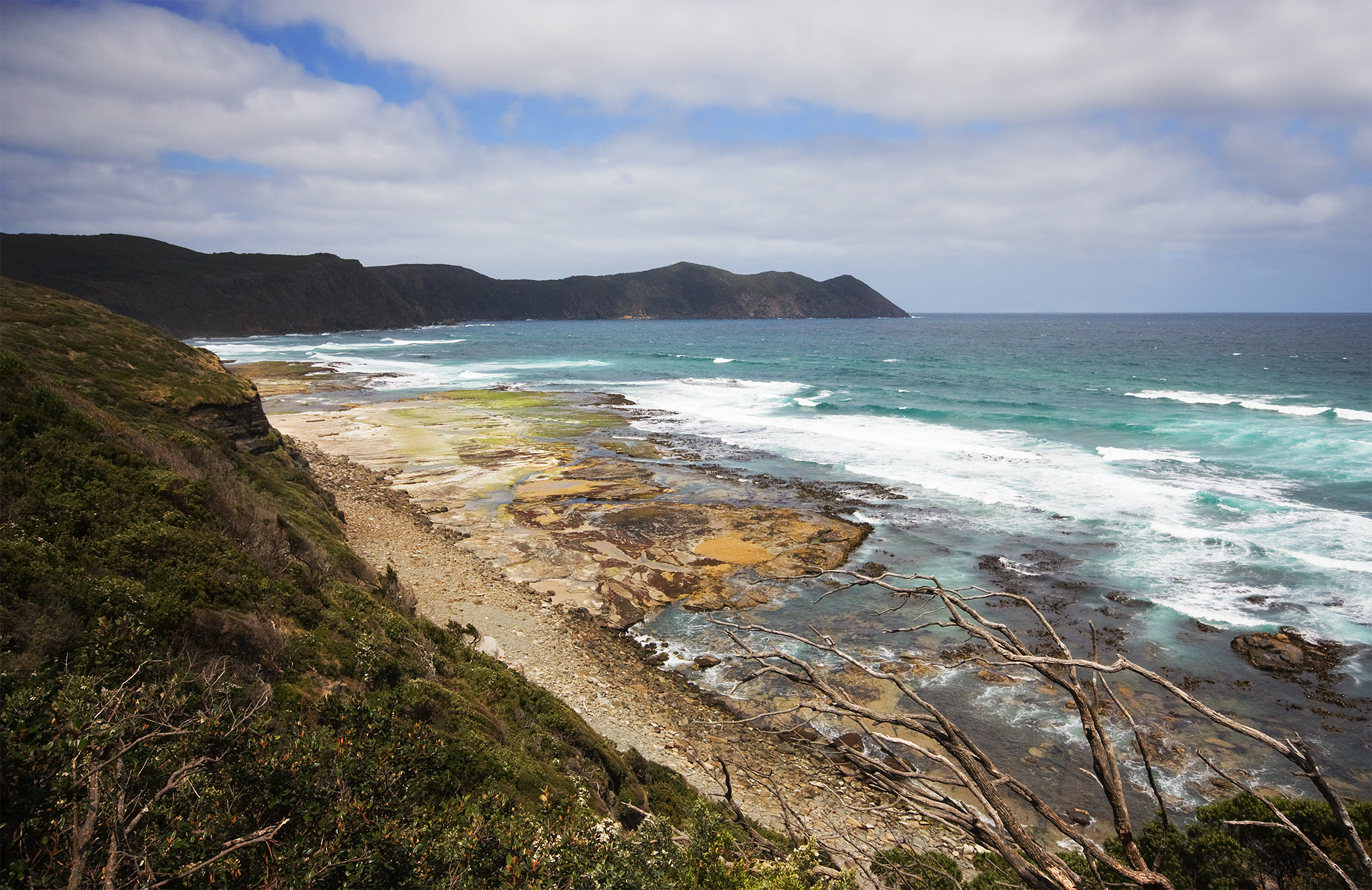
A headland, also known as a head, is a
 *, Mauritania
* Cap-Vert, Senegal
* Cape Agulhas, South Africa, Africa's southernmost point
*


 * Cape Froward, Chile
* Cape Horn, Chile, South America's southernmost point
* Cape Virgenes, Argentina
coast
A coast (coastline, shoreline, seashore) is the land next to the sea or the line that forms the boundary between the land and the ocean or a lake. Coasts are influenced by the topography of the surrounding landscape and by aquatic erosion, su ...
al landform
A landform is a land feature on the solid surface of the Earth or other planetary body. They may be natural or may be anthropogenic (caused or influenced by human activity). Landforms together make up a given terrain, and their arrangement ...
, a point of land usually high and often with a sheer drop, that extends into a body of water
A body of water or waterbody is any significant accumulation of water on the surface of Earth or another planet. The term most often refers to oceans, seas, and lakes, but it includes smaller pools of water such as ponds, wetlands, or more rare ...
. It is a type of promontory. A headland of considerable size often is called a cape.Whittow, John (1984). ''Dictionary of Physical Geography''. London: Penguin, 1984, pp. 80, 246. . Headlands are characterised by high, breaking waves, rocky shores, intense erosion
Erosion is the action of surface processes (such as Surface runoff, water flow or wind) that removes soil, Rock (geology), rock, or dissolved material from one location on the Earth's crust#Crust, Earth's crust and then sediment transport, tran ...
, and steep sea cliff.
Headlands and bays are often found on the same coastline. A bay is flanked by land on three sides, whereas a headland is flanked by water on three sides. Headlands and bays form on discordant coastlines, where bands of rock of alternating resistance run perpendicular to the coast. Bays form when weak (less resistant) rocks (such as sands and clays) are eroded, leaving bands of stronger (more resistant) rocks (such as chalk, limestone
Limestone is a type of carbonate rock, carbonate sedimentary rock which is the main source of the material Lime (material), lime. It is composed mostly of the minerals calcite and aragonite, which are different Polymorphism (materials science) ...
, and granite
Granite ( ) is a coarse-grained (phanerite, phaneritic) intrusive rock, intrusive igneous rock composed mostly of quartz, alkali feldspar, and plagioclase. It forms from magma with a high content of silica and alkali metal oxides that slowly coo ...
) forming a headland, or peninsula
A peninsula is a landform that extends from a mainland and is only connected to land on one side. Peninsulas exist on each continent. The largest peninsula in the world is the Arabian Peninsula.
Etymology
The word ''peninsula'' derives , . T ...
. Through the deposition of sediment
Sediment is a solid material that is transported to a new location where it is deposited. It occurs naturally and, through the processes of weathering and erosion, is broken down and subsequently sediment transport, transported by the action of ...
within the bay and the erosion of the headlands, coastlines eventually straighten out, then start the same process all over again.
List of notable headlands
Africa
 *, Mauritania
* Cap-Vert, Senegal
* Cape Agulhas, South Africa, Africa's southernmost point
*
*, Mauritania
* Cap-Vert, Senegal
* Cape Agulhas, South Africa, Africa's southernmost point
*Cape Bojador
Cape Bojador (, Arabic transliteration, trans. ''Rā's Būjādūr''; , ''Bujdur''; Spanish language, Spanish and ; ) is a headland on the west coast of Western Sahara, at 26° 07' 37"N, 14° 29' 57"W (various sources give various locations: this ...
, Morocco
*Cape Correntes
Cape Correntes (sometimes also called "Cape Corrientes" in English) ( Port.: "Cabo das Correntes") is a cape or headland in the Inhambane Province in Mozambique. It sits at the southern entry of the Mozambique Channel.•
Cape Correntes wa ...
, Mozambique
*Cape Delgado
Cape Delgado () is a coastal promontory south of Mozambique's border with Tanzania. It is the arc-shaped delta of the Rovuma River and was created from sediment deposited by the Rovuma as it empties into the Indian Ocean. It is sometimes identif ...
, Mozambique
*Cape Juby
Cape Juby (, trans. ''Raʾs Juby'', ) is a cape on the coast of southern Morocco, near the border with Western Sahara, directly east of the Canary Islands.
Its surrounding area, including the cities of Tarfaya and Tan-Tan, is called the C ...
, Morocco
*Cape Malabata
__NOTOC__
Cape Malabata (, ''Ras Malabata'', or ''Rās al-Manār'', "Lighthouse Cape"; ; ) is a cape located about east of central Tangier, Morocco, facing the Strait of Gibraltar. The cape features a lighthouse and a medieval-style castle th ...
, Morocco
*Cape Spartel
Cape Spartel (; ; ) is a promontory in Morocco about above sea level at the entrance to the Strait of Gibraltar, 12 km west of Tangier. It is the northwesternmost point of the African continent. Below the cape are the Caves of Hercules.
Des ...
, Morocco
*Cape of Good Hope
The Cape of Good Hope ( ) is a rocky headland on the Atlantic Ocean, Atlantic coast of the Cape Peninsula in South Africa.
A List of common misconceptions#Geography, common misconception is that the Cape of Good Hope is the southern tip of Afri ...
, South Africa
*, Tunisia, Africa's northernmost point
Asia
*Beirut
Beirut ( ; ) is the Capital city, capital and largest city of Lebanon. , Greater Beirut has a population of 2.5 million, just under half of Lebanon's population, which makes it the List of largest cities in the Levant region by populatio ...
, Lebanon
*Cabo de Rama
Praça do Cabo de Rama, also known as Cabo de Rama Fort, is a medieval hillfort located in Khola village, on the coast of Canacona, Goa in India.
History
In the 1760s, the Portuguese gained control of Cabo de Rama after the Raja of Soonda su ...
, Goa, India
* Cape Comorin or Kanyakumari, Tamil Nadu, India
* Cape Dezhnev, Russia
* Cape Engaño, Philippines
* Cape of Fire, Central Sulawesi, Indonesia
* Coconut Tree Hill, Mirissa, Sri Lanka
* Indira Point, Andaman and Nicobar Islands, India
Europe
* Beachy Head, England *, Portugal, the western tip of mainland Europe * Cap Gris-Nez, France * Cape Arkona, Germany * Cape Emine, Bulgaria * Cape Enniberg, Faroe Islands * Cape Finisterre, Galicia, Spain * San Vito lo Capo, Sicily,Italy * Cape Greco, Cyprus * Cape Kaliakra, Bulgaria * Cape St. Vincent/ Sagres Point, Portugal, the southwestern tip of mainland Europe * Cape Tainaron, Greece, the southernmost tip of mainland Europe * Cape Wrath, Scotland * Dungeness, England *Gibraltar
Gibraltar ( , ) is a British Overseas Territories, British Overseas Territory and British overseas cities, city located at the southern tip of the Iberian Peninsula, on the Bay of Gibraltar, near the exit of the Mediterranean Sea into the A ...
, British Overseas Territory
* Great Orme, Wales
Wales ( ) is a Countries of the United Kingdom, country that is part of the United Kingdom. It is bordered by the Irish Sea to the north and west, England to the England–Wales border, east, the Bristol Channel to the south, and the Celtic ...
* Hengistbury Head, England
* Land's End, Cornwall, England
* Mull of Kintyre, Scotland
* North Cape, Norway, the northern tip of mainland Europe
* Pointe du Raz, France
* St Bees Head, UK, the most westerly point of northern England
North America

Canada
* Cape Chidley, Newfoundland and Labrador/Nunavut * Cape Columbia, Nunavut, Canada's northernmost point * Cape Freels, Newfoundland and Labrador * Cape Norman, Newfoundland and Labrador * Cape Spear, Newfoundland and Labrador, Canada's easternmost point * Cape Tormentine, New Brunswick * Leslie Street Spit,Toronto
Toronto ( , locally pronounced or ) is the List of the largest municipalities in Canada by population, most populous city in Canada. It is the capital city of the Provinces and territories of Canada, Canadian province of Ontario. With a p ...
, Ontario
Ontario is the southernmost Provinces and territories of Canada, province of Canada. Located in Central Canada, Ontario is the Population of Canada by province and territory, country's most populous province. As of the 2021 Canadian census, it ...
- man made landform
Greenland
* Cape Farewell, Greenland's southernmost point * Cape Morris Jesup, Greenland's northernmost pointMexico
*, Baja California Sur, MexicoUnited States
* Cape Ann, Massachusetts * Cape Canaveral, Florida * Cape Charles, Virginia * Cape Cod, Massachusetts * Cape Disappointment, Washington * Cape Fear, North Carolina * Cape Flattery, Washington * Cape Hatteras, North Carolina * Cape Henlopen, Delaware * Cape Henry, Virginia * Cape May, New Jersey * Cape Mendocino, California * Cape Prince of Wales, Alaska * Cascade Head, Oregon * Heceta Head, Oregon * Hilton Head, South Carolina * Marin Headlands, California * Mount Mitchill, New Jersey * North Shore, Lake Superior, Minnesota * Point Reyes, California * West Quoddy Head, MaineOceania


Australia
* Cape Leeuwin, Western Australia * Cape York Peninsula, Queensland * South East Cape, Tasmania * South West Cape, Tasmania * Sydney Heads, New South Wales * Barrenjoey, New South WalesNew Zealand
* Cape Egmont * Cape Foulwind * Cape Reinga * East Cape * North Cape * Young Nick's HeadUnited States (Hawaii)
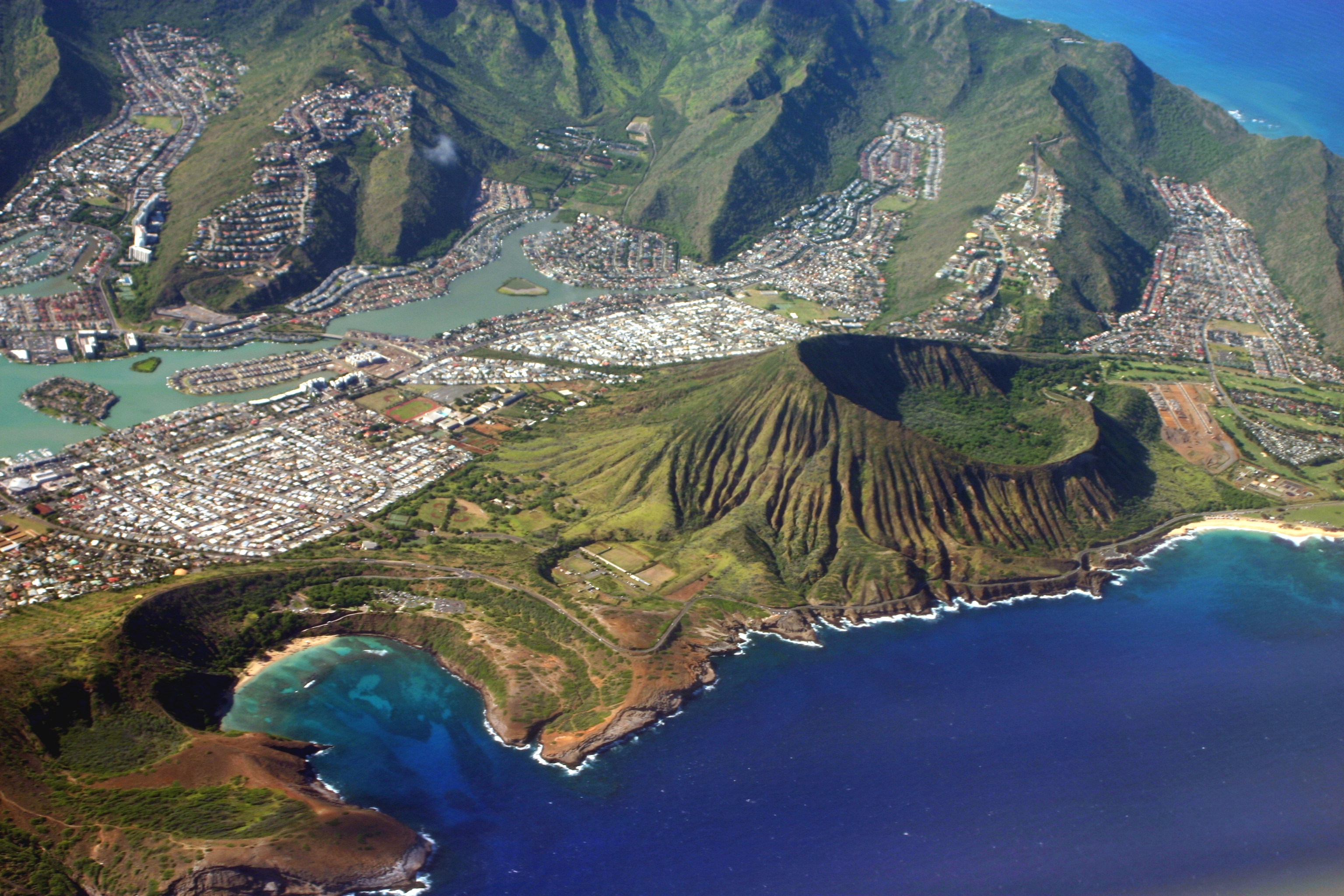
* Diamond Head, Hawaii * Koko Head, HawaiiSouth America
 * Cape Froward, Chile
* Cape Horn, Chile, South America's southernmost point
* Cape Virgenes, Argentina
See also
*Cape (geography)
In geography, a cape is a headland, peninsula or promontory extending into a body of water, usually a sea. A cape usually represents a marked change in trend of the Coast, coastline, often making them important landmarks in sea navigation. T ...
* Headland-bay beach
References
{{Authority control Coastal and oceanic landforms Coastal geography fr:Cap (géographie) hi:रास (भूमि प्रकार) tr:Burun (coğrafya)