Gaines Trace on:
[Wikipedia]
[Google]
[Amazon]


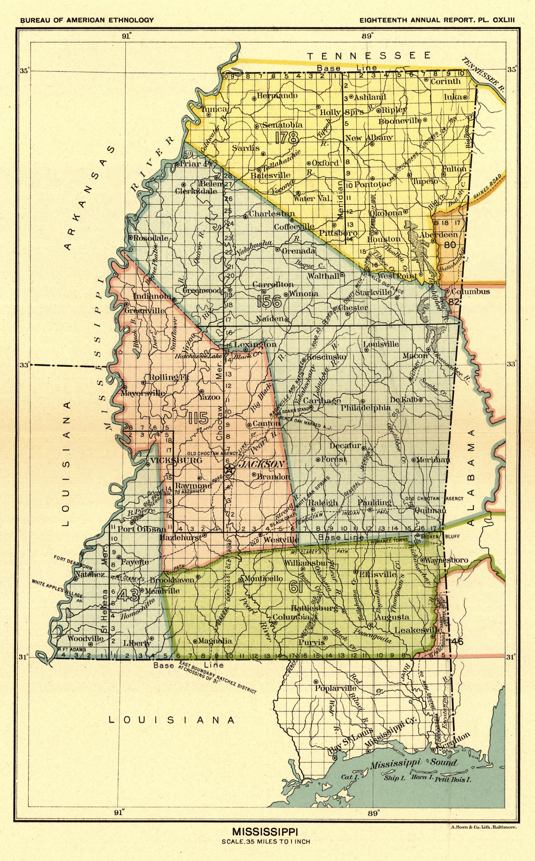
 The Gaines Trace was a road in the
"History of Russellville"
2004, RussellvilleGov.com, Archived page of March 22, 2004.


 The Gaines Trace was a road in the
 Mississippi Territory
The Territory of Mississippi was an organized incorporated territory of the United States that was created under an organic act passed by the United States Congress, Congress of the United States. It was approved and signed into law by Presiden ...
. It was constructed in 1811 and 1812 from the Tennessee River
The Tennessee River is a long river located in the Southern United States, southeastern United States in the Tennessee Valley. Flowing through the states of Tennessee, Alabama, Mississippi, and Kentucky, it begins at the confluence of Fren ...
(opposite the Elk River's mouth) to Cotton Gin Port on the upper Tombigbee River
The Tombigbee River is a tributary of the Mobile River, approximately 200 mi (325 km) long, in the U.S. states of Mississippi and Alabama. Together with the Alabama, it merges to form the short Mobile River before the latter empties i ...
and on to Fort Stoddert
Fort Stoddert, also known as Fort Stoddard, was a stockade fort in the U.S. Mississippi Territory, in what is today Alabama. It was located on a bluff of the Mobile River, near modern Mount Vernon, close to the confluence of the Tombigbee and ...
on the lower Tombigbee. The portion from the Tennessee River to Cotton Gin Port was surveyed in 1807 and 1808 by Edmund P. Gaines
Edmund Pendleton Gaines (March 20, 1777 – June 6, 1849) was an American Army officer who served for nearly fifty years, and attained the rank of major general by brevet. He was one of the Army's senior commanders during its formative years ...
, the road's namesake and a career United States Army officer.
In 1816, the Gaines Trace and the Tombigbee River
The Tombigbee River is a tributary of the Mobile River, approximately 200 mi (325 km) long, in the U.S. states of Mississippi and Alabama. Together with the Alabama, it merges to form the short Mobile River before the latter empties i ...
were the boundaries between United States and Chickasaw
The Chickasaw ( ) are an Indigenous people of the Southeastern Woodlands, United States. Their traditional territory was in northern Mississippi, northwestern and northern Alabama, western Tennessee and southwestern Kentucky. Their language is ...
territory in Mississippi.
A portion of the road appeared on an 1831 map of Mississippi that illustrated the "Gaines Road" extending from Russellville, Alabama
Russellville is a city in Franklin County in the U.S. state of Alabama. At the 2020 census, the population of the city was 10,855, up from 9,830 at the 2010 census. The city is the county seat of Franklin County.
History
After the War of 1812, ...
to Cotton Gin Port.
Jackson's Military Road
Jackson's Military Road was a 19th-century route connecting Nashville, Tennessee, with New Orleans, Louisiana. After the War of 1812, Congress appropriated funds in 1816 to build and improve this road. It was completed in 1820. The road was nam ...
, constructed from 1816 to 1820, intersected Gaines Trace in Russellville. Tennessee Street in Courtland, Alabama
Courtland is a town in Lawrence County, Alabama, United States, and is included in the Decatur Metropolitan Area, as well as the Huntsville-Decatur Combined Statistical Area. The population was 609 at the 2010 census, down from 769 in 2000.
...
, was a portion of the Trace.
References
* Elliott, Jack D. and Wells, Mary Ann. (2003). ''Cotton Gin Port : a frontier settlement on the Upper Tombigbee''. Jackson, Mississippi: Quail Ridge Press for the Mississippi Historical Society."History of Russellville"
2004, RussellvilleGov.com, Archived page of March 22, 2004.
Inline citations