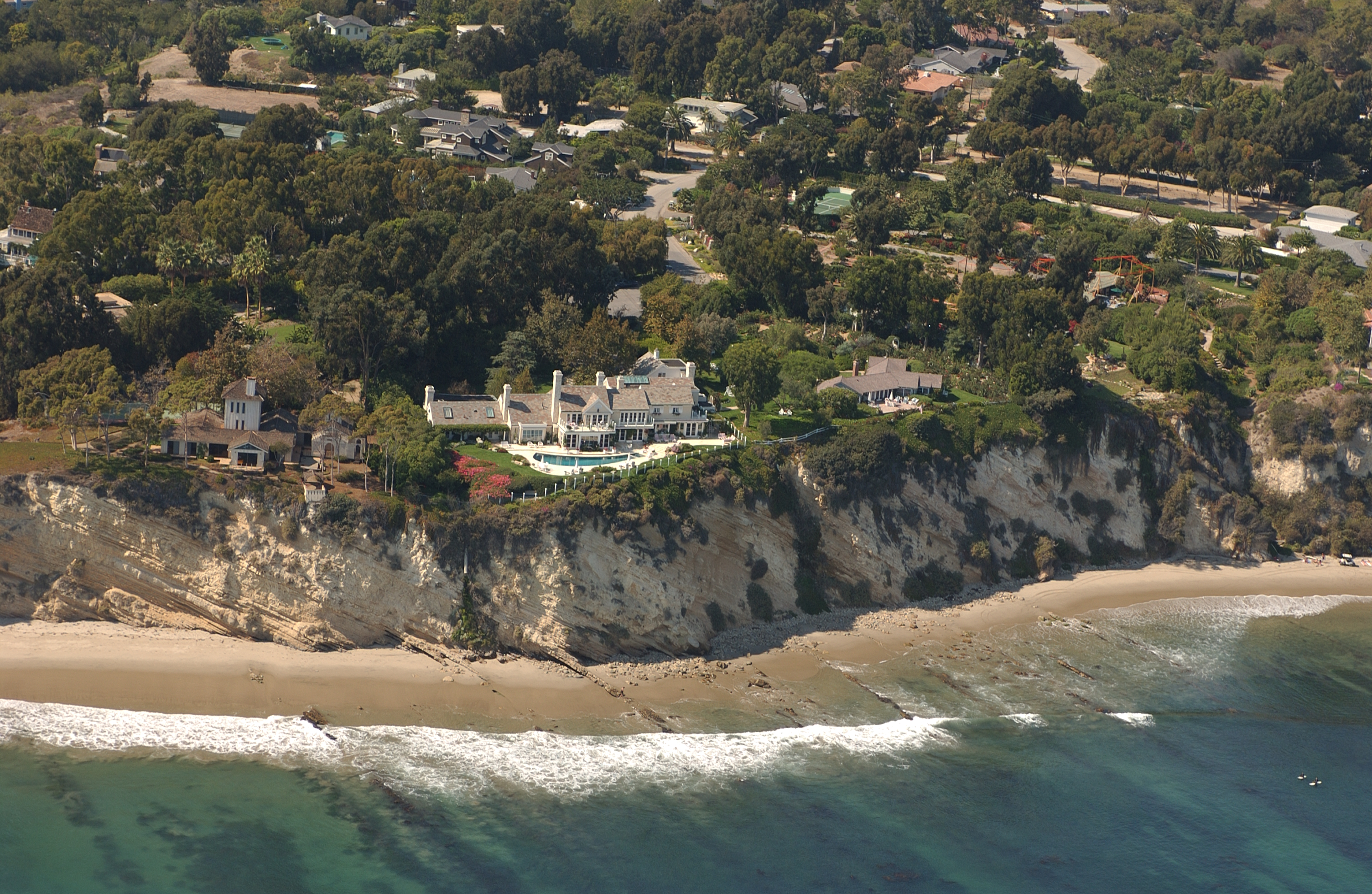
Gabrielle Adelman on:
[Wikipedia]
[Google]
[Amazon]
 The California Coastal Records Project, founded in 2002, documents the
California Coastal Records Project
Geography of California 2002 establishments in California Aerial photography Coastal erosion in the United States
 The California Coastal Records Project, founded in 2002, documents the
 California
California () is a U.S. state, state in the Western United States that lies on the West Coast of the United States, Pacific Coast. It borders Oregon to the north, Nevada and Arizona to the east, and shares Mexico–United States border, an ...
coastline with aerial photos
Aerial photography (or airborne imagery) is the taking of photographs from an aircraft or other airborne platforms. When taking motion pictures, it is also known as aerial videography.
Platforms for aerial photography include fixed-wing airc ...
taken from a helicopter flying parallel to the shore. Their webpage provides access to these images. One photo was taken every 500 feet. Each photo showed a few hundred yards of the coastline, with frames overlapping. The entire California coast is included, except sections of Vandenberg Air Force Base
Vandenberg may refer to:
* Vandenberg (surname), including a list of people with the name
* USNS ''General Hoyt S. Vandenberg'' (T-AGM-10), transport ship in the United States Navy, sank as an artificial reef in Key West, Florida
* Vandenberg S ...
(although some historical photos are included from an earlier survey in 1989). Most of the coast has been photographed several times, and the website has an interface for comparing photos taken during different years.
The project was an expansion of a 1997 effort to document the environmental degradation at San Simeon Point, California.
Kenneth and Gabrielle Adelman
Kenneth and Gabrielle Adelman were recipients of the 2004Ansel Adams Award for Conservation Photography The Ansel Adams Award for Photography, formally called Ansel Adams Award for Conservation Photography, named in honor of American photographer Ansel Adams, is a photography award administered by the Sierra Club. The award "honor photographers who ...
from the Sierra Club
The Sierra Club is an American environmental organization with chapters in all 50 U.S. states, Washington, D.C., Washington D.C., and Puerto Rico. The club was founded in 1892, in San Francisco, by preservationist John Muir. A product of the Pro ...
for their work on the project. The photographs were exhibited in 2003 at the Center for Land Use Interpretation
The Center for Land Use Interpretation (CLUI) is a Non-profit organization, non-profit research and education organization involved in exploring, examining, and understanding contemporary landscape issues in the United States. Founded in 1994, ...
, in a nearly ten-hour-long simulation of what they saw as they flew the length of the coast.
Streisand effect
Kenneth Adelman, the creator of the project, was sued in 2003 byBarbra Streisand
Barbara Joan "Barbra" Streisand ( ; born April 24, 1942) is an American singer, actress, songwriter, producer, and director. With a career spanning over six decades, she has achieved success across multiple fields of entertainment, being the ...
, who claimed that he had infringed upon her privacy by displaying a photograph of her Malibu home. The project countersued under the SLAPP
Strategic lawsuits against public participation (also known as SLAPP suits or intimidation lawsuits), or strategic litigation against public participation, are lawsuits intended to censor, intimidate, and silence critics by burdening them with ...
provisions of California law and prevailed in court. The lawsuit drew additional public attention to Streisand's home, giving name to the Streisand effect
The Streisand effect is an unintended consequences, unintended consequence of attempts to hide, remove, or Censorship, censor information, where the effort instead increases public awareness of the information.
The term was coined in 2005 by ...
: the phenomenon in which attempting to hide or censor information instead draws greater attention to the information.
Uses
Photos from this project have been used in scientific research, by news media, and by government agencies, as well as by individuals for their own enjoyment. * 150 photos included in ''The California Coast from the Air'' (2014) by Gary Griggs and Deepika Shrestha Ross. * Photos ofFort Funston
Fort Funston is a former Seacoast defense in the United States, harbor defense installation located on the West Side (San Francisco), West Side of San Francisco in the southwestern part of the city. Formerly known as the Lake Merced Milita ...
near San Francisco were used by the U.S. Geological Survey (USGS) to test a method of calculating the amount of coastal erosion.
Notes
References
{{Reflist, 2External links
California Coastal Records Project
Geography of California 2002 establishments in California Aerial photography Coastal erosion in the United States