Fyrish Monument on:
[Wikipedia]
[Google]
[Amazon]

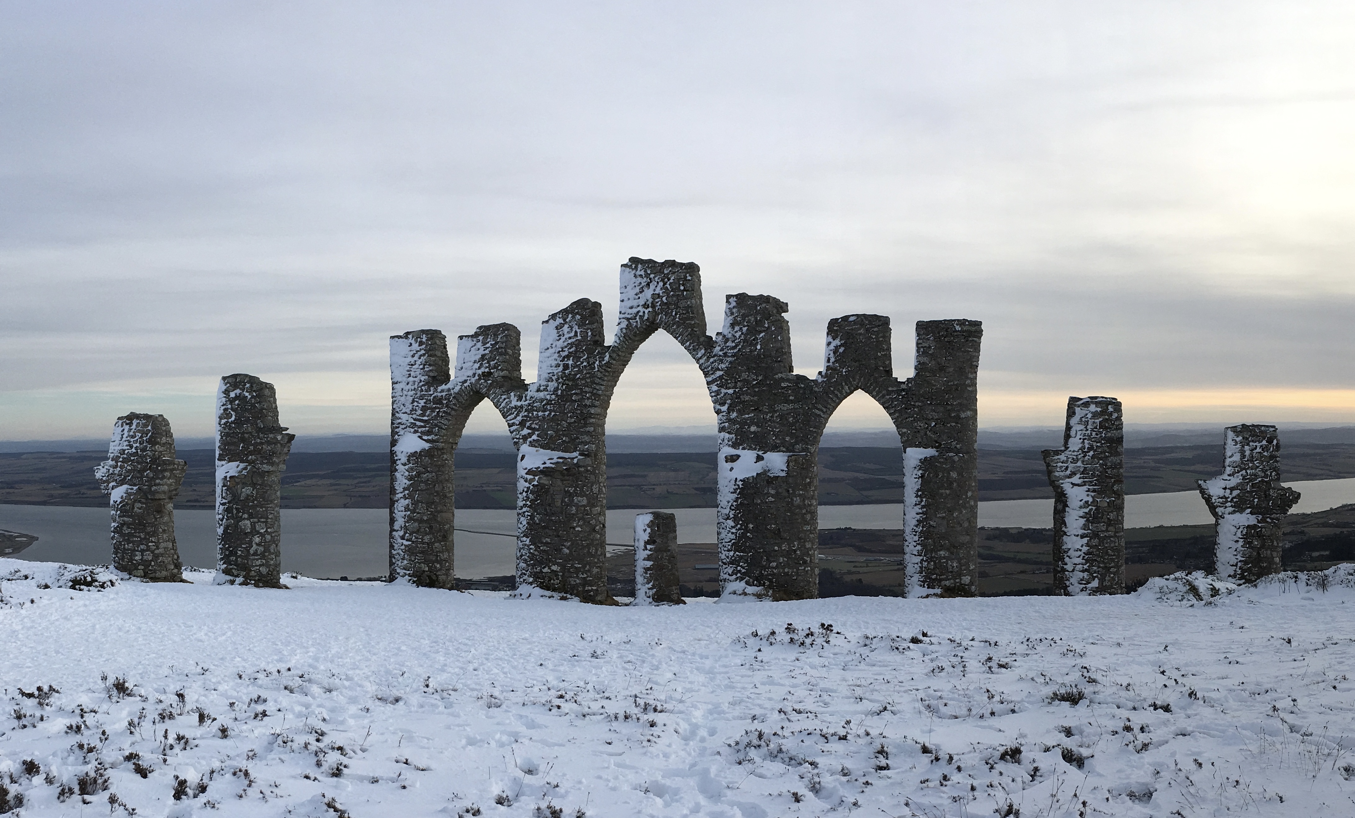
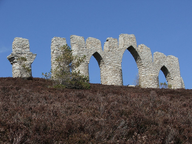
 The Fyrish Monument is a monument built in 1782 on Fyrish Hill (), in
https://web.archive.org/web/20061002181022/http://www.clanmunro.org.uk/merchandise_files/maps.htm
*Touring Guide Scotland, p. 151.
Map from Streetmap.co.uk
{{Webarchive, url=https://web.archive.org/web/20070930204846/http://www.streetmap.co.uk/newmap.srf?x=261500&y=870500&z=3&sv=261500,870500&st=4&ar=N&mapp=newmap.srf&searchp=newsearch.srf , date=30 September 2007
Route to the monument from Walkhighlands
3d model representing the monument
Buildings and structures in Highland (council area) Monuments and memorials in Scotland Ross and Cromarty Tourist attractions in Highland (council area) Category B listed buildings in Highland (council area) Folly buildings in Scotland

 The Fyrish Monument is a monument built in 1782 on Fyrish Hill (), in
 Fyrish
Fyrish is the name given to an ancient area of land found just north of Evanton, Ross-shire, Scotland.
The lands of Fyrish are now part of the Novar Estate. However, the lands of Fyrish once belonged to the Earl of Ross and which were forfeited ...
in Evanton
Evanton ( or ) is a small village in Easter Ross, in the Highland council area of Scotland. It lies between the River Sgitheach and the Allt Graad, is north of Inverness, some south-west of Alness, and northeast of Dingwall.
The village h ...
, near Alness
Alness (, ; ) is a town and civil parishes in Scotland, civil parish in Ross and Cromarty, Scotland. It lies near the mouth of the River Averon, near the Cromarty Firth, with the town of Invergordon to the east, and the village of Evanton to ...
, Easter Ross
Easter Ross () is a loosely defined area in the east of Ross, Highland, Scotland.
The name is used in the constituency name Caithness, Sutherland and Easter Ross, which is the name of both a British House of Commons constituency and a Scotti ...
, Scotland, on the orders of Sir Hector Munro, 8th of Novar
General Sir Hector Munro, 8th Laird of Novar, KB ( – 27 December 1805) was a British Army officer and politician who represented Inverness Burghs in the British House of Commons from 1768 to 1802.
Early military career in Scotland
He was ...
, a native lord of the area who had served in India
India, officially the Republic of India, is a country in South Asia. It is the List of countries and dependencies by area, seventh-largest country by area; the List of countries by population (United Nations), most populous country since ...
as a general. As the local population were being cleared off the land they had worked for centuries by the Lords of the Land, survival was a problem and so it was built to keep the locals in labour. It was said that Sir Hector rolled stones from the top of the hill to the bottom, thereby extending the amount of time worked and paying the labourers for additional hours.
It represents the Gate of Negapatam
Nagapattinam (''nākappaṭṭinam'', previously spelt Nagapatnam or Negapatam) is a town in the Indian state of Tamil Nadu and the administrative headquarters of Nagapattinam district. The town came to prominence during the period of Medieval ...
, a port in Madras
Chennai, also known as Madras ( its official name until 1996), is the capital and largest city of Tamil Nadu, the southernmost state of India. It is located on the Coromandel Coast of the Bay of Bengal. According to the 2011 Indian ce ...
, India, which General Munro took for the British in 1781. It is visible from almost anywhere in the parishes of Kiltearn
Kiltearn (Gaelic: ''Cill Tighearna'') is a parish in Ross and Cromarty, Scotland. It is in the Presbytery of Ross. The local landowners since the 11th century reign of Malcolm II have been the Clan Munro.
The principal settlement is the villag ...
and Alness
Alness (, ; ) is a town and civil parishes in Scotland, civil parish in Ross and Cromarty, Scotland. It lies near the mouth of the River Averon, near the Cromarty Firth, with the town of Invergordon to the east, and the village of Evanton to ...
.
The site of the monument provides an extensive view over the Cromarty Firth
The Cromarty Firth (; ; literally "kyles
and beyond, and traits
Trait may refer to:
* Phenotypic trait in biology, which involve genes and characteristics of organisms
* Genotypic trait, sometimes but not always presenting as a phenotypic trait
* Personality, traits that predict an individual's behavior.
** ...
of Cromarty") is an arm of the Moray Firth in Scotland.
Geography
The entrance to the Cromarty Firth is guarded by two precipitous headlands; the one on the north high and the one on the ...Ben Wyvis
Ben Wyvis () is a mountain in Easter Ross, in the northern Highlands of Scotland. It lies north-west of Dingwall, in the council area of Highland, and the county of Ross and Cromarty. Ben Wyvis is a large winding and undulating ridge r ...
can be seen clearly, especially impressive if snow-covered. A path to the top starts at a car park northeast of the hill at OS grid NH627715.
References
Sources
https://web.archive.org/web/20061002181022/http://www.clanmunro.org.uk/merchandise_files/maps.htm
*Touring Guide Scotland, p. 151.
External links
Map from Streetmap.co.uk
{{Webarchive, url=https://web.archive.org/web/20070930204846/http://www.streetmap.co.uk/newmap.srf?x=261500&y=870500&z=3&sv=261500,870500&st=4&ar=N&mapp=newmap.srf&searchp=newsearch.srf , date=30 September 2007
Route to the monument from Walkhighlands
3d model representing the monument
Buildings and structures in Highland (council area) Monuments and memorials in Scotland Ross and Cromarty Tourist attractions in Highland (council area) Category B listed buildings in Highland (council area) Folly buildings in Scotland