Freycinet Peninsula on:
[Wikipedia]
[Google]
[Amazon]
The Freycinet Peninsula is a large
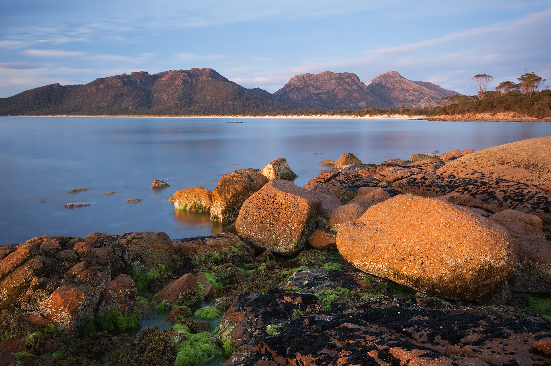
 The peninsula is a large, dramatic land formation carved into Tasmania's eastern coastline. Known for its pink
 The "Vanderlyn Island" was the last sighting of Australia by
Coles Bay Website
{{East Coast Tasmania , state=autocollapse Climbing areas of Australia Peninsulas of Tasmania Coastline of Tasmania Freycinet National Park Whaling stations in Australia Localities of Glamorgan–Spring Bay Council
peninsula
A peninsula is a landform that extends from a mainland and is only connected to land on one side. Peninsulas exist on each continent. The largest peninsula in the world is the Arabian Peninsula.
Etymology
The word ''peninsula'' derives , . T ...
located on the eastern coast of Tasmania
Tasmania (; palawa kani: ''Lutruwita'') is an island States and territories of Australia, state of Australia. It is located to the south of the Mainland Australia, Australian mainland, and is separated from it by the Bass Strait. The sta ...
, Australia. The peninsula is located north of Schouten Island
Schouten Island (formerly Schouten's Isle), part of the Schouten Island Group, is an island with an area of approximately lying close to the eastern coast of Tasmania, Australia, located south of the Freycinet Peninsula and is a part of Frey ...
and is contained within the Freycinet National Park.
The locality of Freycinet is in the local government area of Glamorgan–Spring Bay in the south-east region of Tasmania. The locality is about north-east of the town of Swansea
Swansea ( ; ) is a coastal City status in the United Kingdom, city and the List of urban areas in the United Kingdom, second-largest city of Wales. It forms a Principal areas of Wales, principal area, officially known as the City and County of ...
.
Features and location
 The peninsula is a large, dramatic land formation carved into Tasmania's eastern coastline. Known for its pink
 granite
Granite ( ) is a coarse-grained (phanerite, phaneritic) intrusive rock, intrusive igneous rock composed mostly of quartz, alkali feldspar, and plagioclase. It forms from magma with a high content of silica and alkali metal oxides that slowly coo ...
mountain range, The Hazards, and its sheltered, white sand beaches, the peninsula is the location for Freycinet National Park, the first national park
A national park is a nature park designated for conservation (ethic), conservation purposes because of unparalleled national natural, historic, or cultural significance. It is an area of natural, semi-natural, or developed land that is protecte ...
to be declared in Tasmania, along with Mt Field National Park. Also on the peninsula is the village of Coles Bay, the Friendly Beaches Reserve, and Wineglass and Honeymoon
A honeymoon is a vacation taken by newlyweds after their wedding to celebrate their marriage. Today, honeymoons are often celebrated in destinations considered exotic or romantic. In a similar context, it may also refer to the phase in a couple ...
bays. It covers an area of 65 square kilometres. Two sandpits connect the peninsula to the mainland. It is surrounded by Schouten Passage and Island on its southern tip and Oyster Bay on its western side.
Early history
 The "Vanderlyn Island" was the last sighting of Australia by
 Abel Tasman
Abel Janszoon Tasman (; 160310 October 1659) was a Dutch sea explorer, seafarer and exploration, explorer, best known for his voyages of 1642 and 1644 in the service of the Dutch East India Company (VOC). He was the first European to reach New ...
in 1642 before turning east to New Zealand.
The first landing by Europeans was by Captain Weatherhead of the transport ship on 27 July 1791. Due to the narrow northern isthmus
An isthmus (; : isthmuses or isthmi) is a narrow piece of land connecting two larger areas across an expanse of water by which they are otherwise separated. A tombolo is an isthmus that consists of a spit or bar, and a strait is the sea count ...
, Weatherhead and Tasman mistook it for an island. Nicholas Baudin
Nicolas Thomas Baudin (; 17 February 175416 September 1803) was a French people, French explorer, cartographer, naturalist and hydrographer, most notable for his explorations in Australia and the southern Pacific Ocean, Pacific. He carried a few ...
named the peninsula after French explorer Louis de Freycinet
Louis Claude de Saulces de Freycinet (7 August 1779 – 18 August 1841) was a French Navy officer. He circumnavigated the Earth, and in 1811 published the first map to show a full outline of the coastline of Australia.
Biography
He was born at M ...
. Baudin also named Cape Baudin, Cape Faure, Cape Forestier and Thouin Bay, although that bay is now known as Wineglass Bay.
Shore-based bay whaling stations operated on the peninsula in the 1820s and 1830s at Wineglass Bay, Refuge Bay, Bryans Beach and Coles Bay.
See also
* Protected areas of Tasmania *List of peninsulas
A peninsula ( from ''paene'' "almost" and ''insula'' "island") is a piece of land that is bordered mostly by water but connected to mainland. The surrounding water is usually understood to be continuous, though not necessarily named as such. A pe ...
References
Further reading
*External links
Coles Bay Website
{{East Coast Tasmania , state=autocollapse Climbing areas of Australia Peninsulas of Tasmania Coastline of Tasmania Freycinet National Park Whaling stations in Australia Localities of Glamorgan–Spring Bay Council