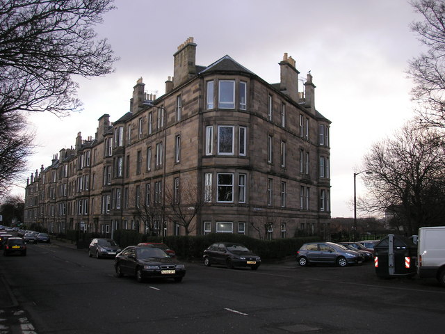
Ferry Road on:
[Wikipedia]
[Google]
[Amazon]
 Ferry Road is one of the major roads of
 Ferry Road is one of the major roads of
 Edinburgh
Edinburgh is the capital city of Scotland and one of its 32 Council areas of Scotland, council areas. The city is located in southeast Scotland and is bounded to the north by the Firth of Forth and to the south by the Pentland Hills. Edinburgh ...
, Scotland
Scotland is a Countries of the United Kingdom, country that is part of the United Kingdom. It contains nearly one-third of the United Kingdom's land area, consisting of the northern part of the island of Great Britain and more than 790 adjac ...
, deriving its name from being the road from Queensferry to Leith
Leith (; ) is a port area in the north of Edinburgh, Scotland, founded at the mouth of the Water of Leith and is home to the Port of Leith.
The earliest surviving historical references are in the royal charter authorising the construction of ...
. It runs from the eastern end of Davidson's Mains
Davidson's Mains is a former village and now a district in the north-west of Edinburgh, Scotland. It is adjacent to the districts of Barnton, Cramond, Silverknowes, Blackhall and Corbiehill/House O'Hill. It was absorbed into Edinburgh as p ...
village in the west, to Leith in the east, passing through Drylaw
Drylaw is an area in the north west of Edinburgh, the capital of Scotland, located between Blackhall, Edinburgh, Blackhall and Granton, Edinburgh, Granton. It forms the list of community council areas in Scotland, community of Drylaw–Telford. ...
, Crewe Toll
Crewe Toll is an area in Edinburgh, the Scottish capital.
The area takes its name from the Toll house which once stood at the junction of Ferry Road and Crewe Road North and South. The name Crewe, or a variation thereof (Creue, Crew or Crou), c ...
and Goldenacre
Goldenacre is an area in Edinburgh, Scotland, centred on the northern end of Inverleith Row. It lies on and to the south of Ferry Road, which forms the effective boundary with Trinity, Edinburgh, Trinity. It is part of the Inverleith Conservatio ...
on the way. It is classified as the A902 from Leith to Crewe Toll where the A902 continues as Telford Road.
Notable features along the route include, in the west, the former Northern General Hospital's site (now demolished for a supermarket, the Western General Hospital
The Western General Hospital (often abbreviated to simply ‘The Western General’) is a health facility at Craigleith, Edinburgh, Scotland. It is managed by NHS Lothian.
History
The hospital was designed by Peddie and Kinnear and opened as ...
is also nearby), the playing fields of Fettes College
Fettes College () is a co-educational private boarding and day school in Craigleith, Edinburgh, Scotland, with over two-thirds of its pupils in residence on campus. The school was originally a boarding school for boys only and became co-ed in ...
, Stewarts Melville and other private schools to the south, a geriatric home of the Salvation Army
The Salvation Army (TSA) is a Protestantism, Protestant Christian church and an international charitable organisation headquartered in London, England. It is aligned with the Wesleyan-Holiness movement. The organisation reports a worldwide m ...
, Goldenacre stadium etc. Drylaw Police Station is also situated on Ferry Road. Leith public library is located shortly before where Ferry Road meets North Junction Street and Great Junction Street
Streets in Edinburgh
{{Scotland-road-stub