Felbridge on:
[Wikipedia]
[Google]
[Amazon]
__NOTOC__
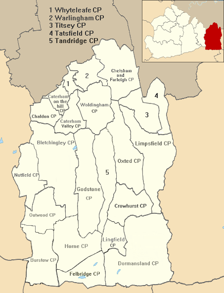
Felbridge is a village and

 Felbridge is centred south of
/ref> It occupies less than one eighth of its district in the extreme mid-south. The east of the village is often referred to as Felcourt. Hedgecourt lake is immediately northwest of the village centre in the heart of the civil parish, approximately in size. Elevations range between 115m AOB towards the south of the eastern boundary, fields adjoining Chartham Wood and similarly 102m AOB along West Park Road by the Effingham Park Hotel in the southwest, to 53m AOB along Felbridge Water between Felcourt and Newchapel, in the northeast of the parish, a tributary of the River Eden. The soil, part of a wide to band south of the


created by
St John's Felbridge
designed by William White and built in 1865. The construction is a fine example of the
Sussex Gospel Partnership
Vision of Britain
The
The average level of accommodation in the region composed of detached houses was 28%, the average that was apartments was 22.6%.
The proportion of households in the civil parish who owned their home outright compares to the regional average of 35.1%. The proportion who owned their home with a loan compares to the regional average of 32.5%. The remaining % is made up of rented dwellings (plus a negligible % of households living rent-free).
Felbridge & District History Group
{{Authority control Tandridge Civil parishes in Surrey
civil parish
In England, a civil parish is a type of administrative parish used for local government. It is a territorial designation which is the lowest tier of local government. Civil parishes can trace their origin to the ancient system of parishes, w ...
in the Tandridge district of Surrey
Surrey () is a Ceremonial counties of England, ceremonial county in South East England. It is bordered by Greater London to the northeast, Kent to the east, East Sussex, East and West Sussex to the south, and Hampshire and Berkshire to the wes ...
with a playing field within its focal area, narrowly in West Sussex
West Sussex is a Ceremonial counties of England, ceremonial county in South East England. It is bordered by Surrey to the north, East Sussex to the east, the English Channel to the south, and Hampshire to the west. The largest settlement is Cr ...
. Felbridge village forms a contiguous
Contiguity or contiguous may refer to:
*Contiguous data storage, in computer science
*Contiguity (probability theory)
*Contiguity (psychology)
*Contiguous distribution of species, in biogeography
*Geographic contiguity
Geographic contiguity is t ...
settlement with East Grinstead
East Grinstead () is a town in West Sussex, England, near the East Sussex, Surrey, and Kent borders, south of London, northeast of Brighton, and northeast of the county town of Chichester. Situated in the northeast corner of the county, bord ...
and had 829 homes and households at the time of the 2011 census. Domewood is part of Felbridge civil parish, which was created in 1953.
History
Early history
Until shortly after 1911, the area was part of the parish of Horne. No reference appears to a separate settlement being here in theDomesday Book
Domesday Book ( ; the Middle English spelling of "Doomsday Book") is a manuscript record of the Great Survey of much of England and parts of Wales completed in 1086 at the behest of William the Conqueror. The manuscript was originally known by ...
of 1086.
Post Reformation
James son of Edward Evelyn succeeded to the manors of Hedgecourt (and smallercarucate
The carucate or carrucate ( or ) was a medieval unit of land area approximating the land a plough team of eight oxen could till in a single annual season. It was known by different regional names and fell under different forms of tax assessment.
...
of Covelingeley) in the parish of Horne and the estate of Felbridge in 1751. Julia Evelyn Medley, his granddaughter by his first wife, who had married Charles Jenkinson, 3rd Earl of Liverpool
Charles Cecil Cope Jenkinson, 3rd Earl of Liverpool (29 May 1784 – 3 October 1851), styled The Honourable Charles Jenkinson between 1786 and 1828, was a British politician.
Background
Liverpool was the son of Charles Jenkinson, 1st Earl of ...
held this estate, after James's Evelyn wife's death, as late as 1841.
By 1911, whereabouts it lost much of its land, amid the economic change and social reforms of the age it became the property of the Sayer family. The last resident "lord of the manor" was Charles Henry Gatty FRSE
Fellowship of the Royal Society of Edinburgh (FRSE) is an award granted to individuals that the Royal Society of Edinburgh, Scotland's national academy of science and Literature, letters, judged to be "eminently distinguished in their subject". ...
FLS who died in 1903.
Geography

 Felbridge is centred south of
 Oxted
Oxted is a town and civil parish in the Tandridge District, Tandridge district of Surrey, England. It is at the foot of the North Downs, south-east of Croydon, west of Sevenoaks, and north of East Grinstead.
Oxted is a commuter town and Ox ...
, south of London
London is the Capital city, capital and List of urban areas in the United Kingdom, largest city of both England and the United Kingdom, with a population of in . London metropolitan area, Its wider metropolitan area is the largest in Wester ...
and ESE of Surrey's county town, Guildford
Guildford () is a town in west Surrey, England, around south-west of central London. As of the 2011 census, the town has a population of about 77,000 and is the seat of the wider Borough of Guildford, which had around inhabitants in . The nam ...
.Grid reference Finder measurement tools/ref> It occupies less than one eighth of its district in the extreme mid-south. The east of the village is often referred to as Felcourt. Hedgecourt lake is immediately northwest of the village centre in the heart of the civil parish, approximately in size. Elevations range between 115m AOB towards the south of the eastern boundary, fields adjoining Chartham Wood and similarly 102m AOB along West Park Road by the Effingham Park Hotel in the southwest, to 53m AOB along Felbridge Water between Felcourt and Newchapel, in the northeast of the parish, a tributary of the River Eden. The soil, part of a wide to band south of the
Greensand Ridge
The Greensand Ridge, also known as the Wealden Greensand, is an extensive, prominent, often wooded, mixed greensand/sandstone escarpment in south-east England. Forming part of the Weald, a former dense forest in Sussex, Surrey and Kent, it ...
, is of "slowly permeable loamy/clayey slightly acid but base-rich soil, however much of the southern half is free-draining slightly acid sandy/loamy soil" as this lies on the remaining gentle upland of Hastings Sand.
Localities
Domewood
Domewood is an area surrounded on two of its four sides bycopse
Coppicing is the traditional method in woodland management of cutting down a tree to a tree stump, stump, which in many species encourages new Shoot (botany), shoots to grow from the stump or roots, thus ultimately regrowing the tree. A forest ...
s; it faces, across its southern boundary road, Snow Hill (B2037) the Effingham Park Hotel and Golf Course, see Landmarks; and Snow Hill, a similarly semi-wooded neighbourhood interspersed with farms which is part of an area administered by Worth, West Sussex
Worth is either a civil parish in the Mid Sussex District of West Sussex, or a distinct but historically related village in Crawley.
Civil parish
Worth is a civil parish in the Mid Sussex District of West Sussex, a county in southeast England. ...
. Separating Domewood from the village centre are Hedgecourt Lake and small surrounding copses.
Wire Mill lake and inn
Wire Mill forms a separate area which is focussed on and around a short lane, Wire Mill Lane, which ends with the Wire Mill Inn, Toad Hall and Mill End House all overlooking a small weir which releases the water from the Wire Mill Lake.Landmarks


Felbridge County Primary School
This listed building marks a tapering triangular intersection between the village centre's longest streets, Copthorne Road and Crawley Down road that several times forms the West Sussex boundary.Mapcreated by
Ordnance Survey
The Ordnance Survey (OS) is the national mapping agency for Great Britain. The agency's name indicates its original military purpose (see Artillery, ordnance and surveying), which was to map Scotland in the wake of the Jacobite rising of ...
, courtesy of English Heritage
English Heritage (officially the English Heritage Trust) is a charity that manages over 400 historic monuments, buildings and places. These include prehistoric sites, a battlefield, medieval castles, Roman forts, historic industrial sites, Lis ...
In 1783 James Evelyn (descendant of John Evelyn
John Evelyn (31 October 162027 February 1706) was an English writer, landowner, gardener, courtier and minor government official, who is now best known as a diary, diarist. He was a founding Fellow of the Royal Society.
John Evelyn's Diary, ...
, the diarist and famous architectural, landscape and cultural figure in Britain) "chose a large house at Hedgecourt Common – arranging for 1½ acres around it to be enclosed and used as a school". The school opened on 4 November 1783 and was substantially enlarged in 1934.
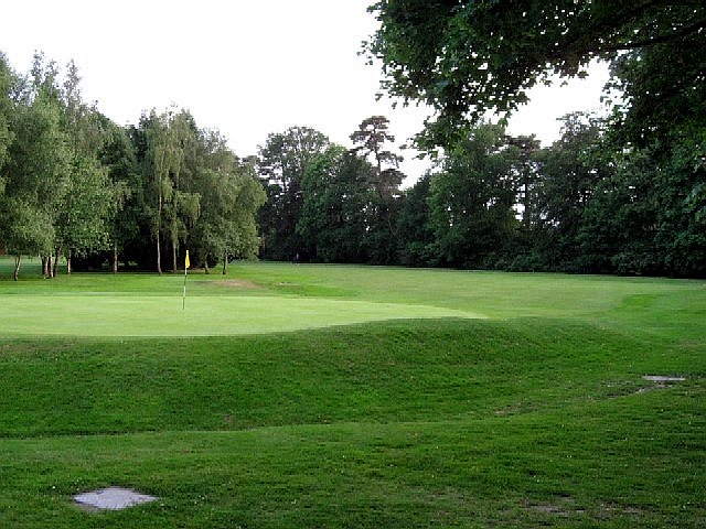
Effingham Park Hotel and Golf Course
This large, complex, building with part-rounded restaurant in a compact 9 hole golf course forms the southwest outcrop of the parish.St John the Divine parish church
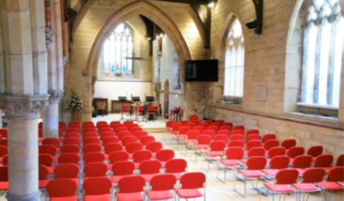
The only church in the village is theChurch of England parish church
A parish church in the Church of England is the church which acts as the religious centre for the people within each Church of England parish (the smallest and most basic Church of England administrative unit; since the 19th century sometimes ...
of St John the Divine, known aSt John's Felbridge
designed by William White and built in 1865. The construction is a fine example of the
Victorian Gothic
Gothic Revival (also referred to as Victorian Gothic or neo-Gothic) is an Architectural style, architectural movement that after a gradual build-up beginning in the second half of the 17th century became a widespread movement in the first half ...
style. An adjoining church hall was erected in 1965 and refurbished in 2012. The interior of the church was redesigned in 1972-74 and modernised in 2016. The evangelical
Evangelicalism (), also called evangelical Christianity or evangelical Protestantism, is a worldwide, interdenominational movement within Protestantism, Protestant Christianity that emphasizes evangelism, or the preaching and spreading of th ...
church is part of the Diocese of Southwark and is a member of thSussex Gospel Partnership
Whittington College
The sheltered housing consists of 56 homes, mainly two bedroom bungalows but also large apartments, surrounded by acres of parkland with an orchard, lake and woodland walks. They are managed by one of theLivery Companies
A livery company is a type of guild or professional association that originated in medieval times in London, England. Livery companies comprise London's ancient and modern trade associations and guilds, almost all of which are Style (form of a ...
of the City of London
The City of London, also known as ''the City'', is a Ceremonial counties of England, ceremonial county and Districts of England, local government district with City status in the United Kingdom, city status in England. It is the Old town, his ...
, the Mercers' Company
The Mercers' Company, or the Worshipful Company of Mercers, is a livery company of the City of London in the Great Twelve City Livery Companies, and ranks first in the order of precedence of the Companies. Mercer comes from the Latin for merch ...
. The college was founded under the will of Richard Whittington
Richard Whittington ( March 1423) of the parish of St Michael Paternoster Royal,Will of Richard Whittington: " I leave to my executors named below the entire tenement in which I live in the parish of St. Michael Paternoster Royal, Londo/ ...
as a college of priests and almshouse next to the church of St Michael Paternoster Royal in the City of London.
Transport
Road
Copthorne Road runs through the centre of the village and links onto the A22 nearEast Grinstead
East Grinstead () is a town in West Sussex, England, near the East Sussex, Surrey, and Kent borders, south of London, northeast of Brighton, and northeast of the county town of Chichester. Situated in the northeast corner of the county, bord ...
which is about to the southeast.
Rail
Felbridge's nearest railway stations are on the Oxted Line. East Grinstead railway station is southeast of the main road through the village centre; and north of Wire Mill Lake and the Eden Brook, more than thirty homes are nearer to Lingfield railway station to the northeast, which is two stations closer toLondon
London is the Capital city, capital and List of urban areas in the United Kingdom, largest city of both England and the United Kingdom, with a population of in . London metropolitan area, Its wider metropolitan area is the largest in Wester ...
.
Demography and housing
The area of the parish is . At theUnited Kingdom Census 2011
A Census in the United Kingdom, census of the population of the United Kingdom is taken every ten years. The 2011 census was held in all countries of the UK on 27 March 2011. It was the first UK census which could be completed online via the Inter ...
its population had risen from 2,039 (ten years before) to 2,096. Greater than the national and local averages, 52.5% of the population described their health as very good.
The civil parish was created in 1953, so the 1951 figure is that of the historic, undivided parish of Horne.The
University of Portsmouth
The University of Portsmouth (UoP) is a public university in Portsmouth, England. Comprising five Faculty (division), faculties, the university offers a wide range of academic disciplines. in 2022, with around 28,280 students enrolled in Unde ...
and othersReferences
External links
Felbridge & District History Group
{{Authority control Tandridge Civil parishes in Surrey