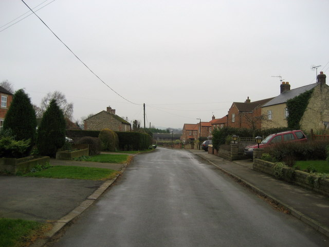
Exelby on:
[Wikipedia]
[Google]
[Amazon]
Exelby is a village in the county of  In the 1086 ''
North Yorkshire
North Yorkshire is a Ceremonial counties of England, ceremonial county in Northern England.The Unitary authorities of England, unitary authority areas of City of York, York and North Yorkshire (district), North Yorkshire are in Yorkshire and t ...
, England. It is south-east of Bedale
Bedale ( ), is a market town and civil parish in North Yorkshire, England. Bedale Beck is a tributary of the River Swale, which forms one of the Yorkshire Dales. The dale has a predominant agriculture sector and its related small traditional t ...
and west of the A1(M) motorway
A1(M) is the designation given to a series of four separate controlled-access highway, motorway sections in the UK. Each section is an upgrade to a section of the A1 road (Great Britain), A1, a major north–south road which connects Greater ...
and is part of the civil parish
In England, a civil parish is a type of administrative parish used for local government. It is a territorial designation which is the lowest tier of local government. Civil parishes can trace their origin to the ancient system of parishes, w ...
of Exelby, Leeming and Londonderry
Exelby, Leeming and Londonderry (formerly Exelby, Leeming and Newton) is a civil parish in the county of North Yorkshire, England. It contains three villages – Exelby, Leeming and Londonderry – and RAF Leeming Royal Air Force station. The ...
. The civil parish had a total of 2,788 residents at the time of the 2011 census, though Exelby had only 80 homes. The name of the village derives from Old Danish
The Danish language developed during the Middle Ages out of Old East Norse, the common predecessor of Danish and Swedish. It was a late form of common Old Norse. The Danish philologist Johannes Brøndum-Nielsen divided the history of Danish in ...
or Old Norse
Old Norse, also referred to as Old Nordic or Old Scandinavian, was a stage of development of North Germanic languages, North Germanic dialects before their final divergence into separate Nordic languages. Old Norse was spoken by inhabitants ...
and means ''Eskil's farm'' or ''Eskil's settlement''.
 In the 1086 ''
Domesday Book
Domesday Book ( ; the Middle English spelling of "Doomsday Book") is a manuscript record of the Great Survey of much of England and parts of Wales completed in 1086 at the behest of William the Conqueror. The manuscript was originally known by ...
'' Exelby is noted as Aschilebi, with only one man but 20 ploughlands, and in the North Riding
The North Riding of Yorkshire was a subdivision of Yorkshire, England, alongside York, the East Riding and West Riding. The riding's highest point was at Mickle Fell at .
From the Restoration it was used as a lieutenancy area, having b ...
's Land of Count Alan. In 1066 Merleswein the Sheriff was Lord of the Manor
Lord of the manor is a title that, in Anglo-Saxon England and Norman England, referred to the landholder of a historical rural estate. The titles date to the English Feudalism, feudal (specifically English feudal barony, baronial) system. The ...
, which by 1086 had been transferred to Robert of Moutiers, with Count Alan of Brittany as Tenant-in-chief
In medieval and early modern Europe, a tenant-in-chief (or vassal-in-chief) was a person who held his lands under various forms of feudal land tenure directly from the king or territorial prince to whom he did homage, as opposed to holding them ...
.
From 1974 to 2023 it was part of the district of Hambleton, it is now administered by the unitary North Yorkshire Council
North Yorkshire Council, known between 1974 and 2023 as North Yorkshire County Council, is the local authority for the non-metropolitan county of North Yorkshire, England. Since 2023 the council has been a unitary authority, being a county coun ...
.
The village lies on the B6285, which connects Bedale with Exelby, Theakston, Burneston
Burneston is a village and civil parish in North Yorkshire, England. According to the 2001 Census it had a population of 244, increasing to 311 at the 2011 Census. The village is close to the A1(M) road and is about south-east of Bedale.
H ...
and the A6055
The A6055 is a stretch of road in North Yorkshire that runs from Knaresborough to Boroughbridge, with a break, then starts up again at Junction 50 of the A1(M) to run parallel with A1(M) acting as a Local Access Road (LAR) going between Junctio ...
road just east of Burneston.
In October 2018 the residents of the village, along with other community investors, bought the closed village pub, The Green Dragon. It was revamped and renamed Exelby Green Dragon (EGD), reopening in December 2018. Since then a deli-cafe, high quality letting rooms and a lottery funded community garden (incorporating the pub garden) have been added. The pub also acts as a community hub, accommodating local groups and serving as a base for a folk club.
See also
*Listed buildings in Exelby, Leeming and Londonderry
Exelby, Leeming and Londonderry is a Civil parishes in England, civil parish in the county of North Yorkshire, England. It contains 15 Listed building#England and Wales, listed buildings that are recorded in the National Heritage List for Engla ...
References
External links
Villages in North Yorkshire {{NorthYorkshire-geo-stub