Eurytanes on:
[Wikipedia]
[Google]
[Amazon]
Evrytania ( ; ) is one of the


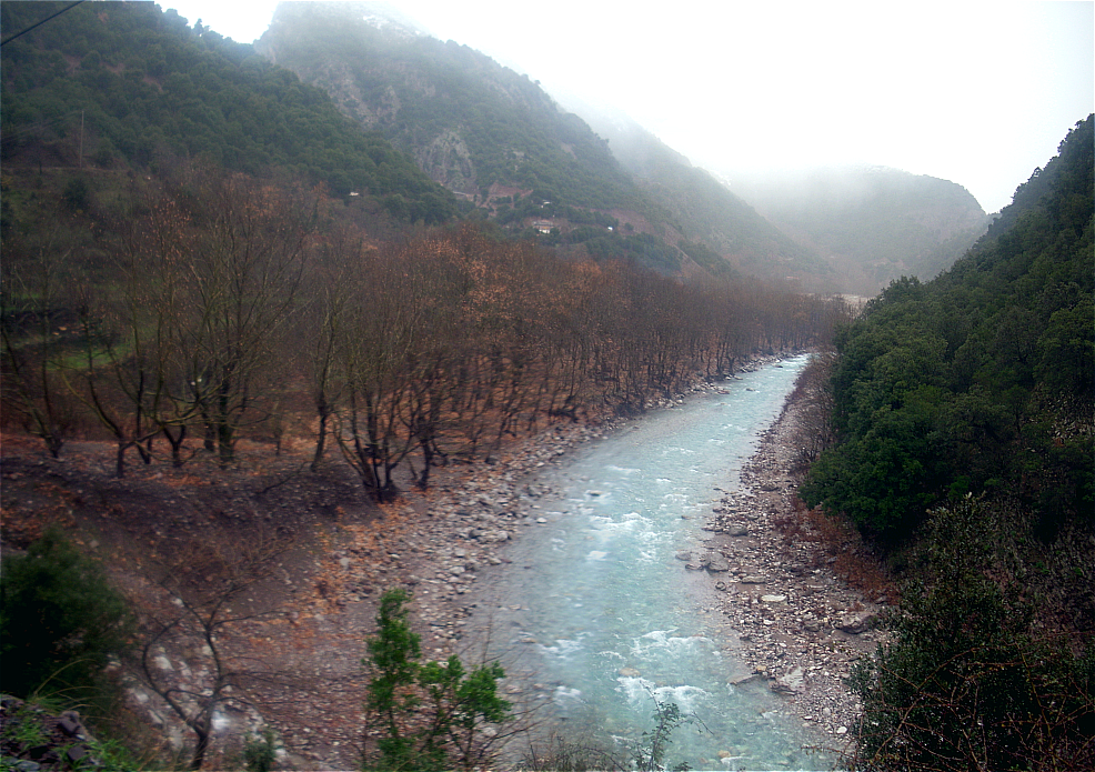
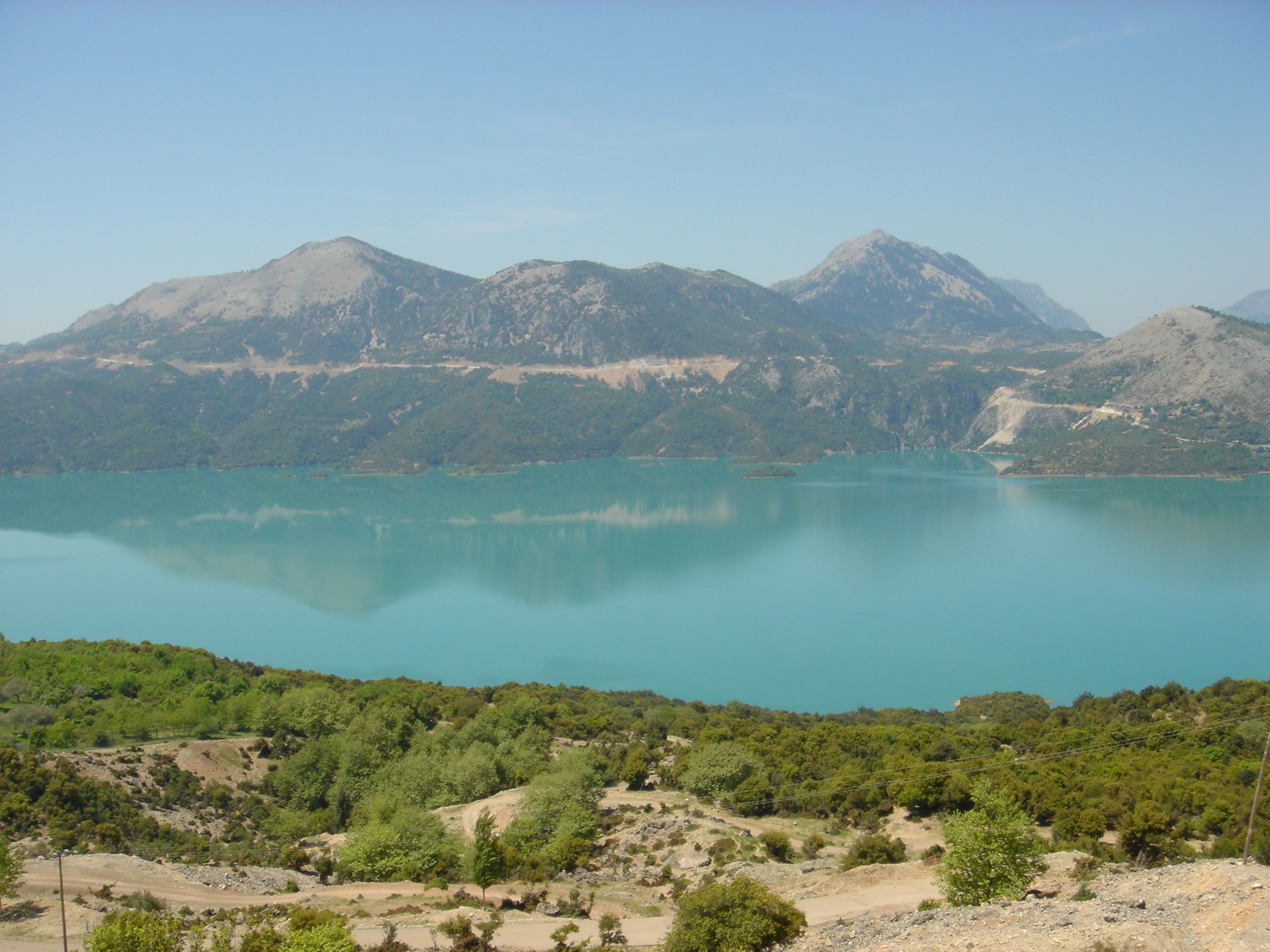
 Evrytania is almost entirely formed of mountains, including the
Dictionary of Greek and Roman Geography (1854)
/ref> () resided in the region. In the 2nd century BC it fell into Roman hands, and became part of the Roman province of
 The regional unit Evrytania is subdivided into 2 municipalities. These are (number as in the map in the infobox):
* Agrafa (2)
*
www.evrytania.grEvrytania
{{Prefectures of Greece Prefectures of Greece 1899 establishments in Greece Regional units of Central Greece
regional units of Greece
The 74 regional units of Greece (, ; singular , ) are the country's third-level administrative units (counting decentralized administrations as first-level). They are subdivisions of the country's 13 regions, and are further divided into munici ...
. It is part of the region
In geography, regions, otherwise referred to as areas, zones, lands or territories, are portions of the Earth's surface that are broadly divided by physical characteristics (physical geography), human impact characteristics (human geography), and ...
of Central Greece. Its capital is Karpenisi
Karpenisi (, ) is a town in central Greece. It is the capital of the regional unit of Evrytania. Karpenisi lies within the valley of the river Karpenisiotis (Καρπενησιώτης), a tributary of the Megdovas, in the southern part of the ...
(approx. 8,000 inhabitants).
Geography


Tymfristos
Tymfristos ( ) is a mountain in the eastern part of Evrytania and the western part of Phthiotis, Greece. The mountain is a part of the Pindus mountain range. The elevation of its highest peak, Velouchi (), is 2,315 m. The nearest mountains are K ...
and the Panaitoliko
Panaitoliko ( Greek: Παναιτωλικό) is a former municipality in Aetolia-Acarnania, West Greece, Greece. Since the 2011 local government reform it is part of the municipality Agrinio
Agrinio (Greek language, Greek: Αγρίνιο, ; Lat ...
in the south. Its rivers include the Acheloos in the west, Agrafiotis to the east, and Megdova in the east flowing down to the Ionian Sea
The Ionian Sea (, ; or , ; , ) is an elongated bay of the Mediterranean Sea. It is connected to the Adriatic Sea to the north, and is bounded by Southern Italy, including Basilicata, Calabria, Sicily, and the Salento peninsula to the west, ...
. It is one of the least populated regional units in Greece. The area borders Aetolia-Acarnania
Aetolia-Acarnania (, ''Aitoloakarnanía'', ) is one of the regional units of Greece. It is part of the geographic regions of Greece, geographic region of Central Greece (geographic region), Central Greece and the administrative regions of Greece, ...
to the west, southwest and south (west over the Acheloos river), Karditsa regional unit to the north, and Phthiotis
Phthiotis (, ''Fthiótida'' ; ancient Greek and Katharevousa: Φθιῶτις) is one of the regional units of Greece. It is part of the administrative region of Central Greece (administrative region), Central Greece. The capital is the city of La ...
to the east. Evrytania also features a famous skiing resort located near Karpenisi on the Tymfristos mountain.
Climate
Its climate is a mixture of Mediterranean and mountainous in the western portion. Much of the area receives snow in winter and is warm during the summer months.Transport
The Greek National Road 38 fromAgrinio
Agrinio (Greek language, Greek: Αγρίνιο, ; Latin: ''Agrinium'') is the largest city of the Aetolia-Acarnania regional units of Greece, regional unit of Greece and its largest municipality, with 89,691 inhabitants (2021) as well as the seco ...
to Lamia passes through the southern part of Evrytania and the town Karpenisi
Karpenisi (, ) is a town in central Greece. It is the capital of the regional unit of Evrytania. Karpenisi lies within the valley of the river Karpenisiotis (Καρπενησιώτης), a tributary of the Megdovas, in the southern part of the ...
. On the border with Phthiotis
Phthiotis (, ''Fthiótida'' ; ancient Greek and Katharevousa: Φθιῶτις) is one of the regional units of Greece. It is part of the administrative region of Central Greece (administrative region), Central Greece. The capital is the city of La ...
, the GR-38 passes through the 1.4 km-long Tymfristos Tunnel since 2004.
History
Evrytania dates to ancient times, the area was first settled around 6000 to 5000 BC. In classical antiquity, the Greek Eurytanes/ref> () resided in the region. In the 2nd century BC it fell into Roman hands, and became part of the Roman province of
Macedonia
Macedonia (, , , ), most commonly refers to:
* North Macedonia, a country in southeastern Europe, known until 2019 as the Republic of Macedonia
* Macedonia (ancient kingdom), a kingdom in Greek antiquity
* Macedonia (Greece), a former administr ...
. At the division of the Roman Empire in the 3rd century it joined the eastern part, also known as the Byzantine Empire
The Byzantine Empire, also known as the Eastern Roman Empire, was the continuation of the Roman Empire centred on Constantinople during late antiquity and the Middle Ages. Having survived History of the Roman Empire, the events that caused the ...
. In the aftermath of the Fourth Crusade
The Fourth Crusade (1202–1204) was a Latin Christian armed expedition called by Pope Innocent III. The stated intent of the expedition was to recapture the Muslim-controlled city of Jerusalem, by first defeating the powerful Egyptian Ayyubid S ...
in 1204 it became part of the Despotate of Epirus
The Despotate of Epirus () was one of the Greek Rump state, successor states of the Byzantine Empire established in the aftermath of the Fourth Crusade in 1204 by a branch of the Angelos dynasty. It claimed to be the legitimate successor of the ...
, which was conquered by the Ottoman Empire
The Ottoman Empire (), also called the Turkish Empire, was an empire, imperial realm that controlled much of Southeast Europe, West Asia, and North Africa from the 14th to early 20th centuries; it also controlled parts of southeastern Centr ...
around 1450. Unlike other parts of Greece at the time, while the eastern and the southern parts were definitively ruled by the Ottomans, the area around Agrafa managed to sustain complete autonomy due to the difficulties experienced in conquest of the region. After 400 years, Evrytania finally became part of Greece
Greece, officially the Hellenic Republic, is a country in Southeast Europe. Located on the southern tip of the Balkan peninsula, it shares land borders with Albania to the northwest, North Macedonia and Bulgaria to the north, and Turkey to th ...
following the Greek War of Independence
The Greek War of Independence, also known as the Greek Revolution or the Greek Revolution of 1821, was a successful war of independence by Greek revolutionaries against the Ottoman Empire between 1821 and 1829. In 1826, the Greeks were assisted ...
. As in all of Greece, the area was affected by World War II
World War II or the Second World War (1 September 1939 – 2 September 1945) was a World war, global conflict between two coalitions: the Allies of World War II, Allies and the Axis powers. World War II by country, Nearly all of the wo ...
, and later the Greek Civil War
The Greek Civil War () took place from 1946 to 1949. The conflict, which erupted shortly after the end of World War II, consisted of a Communism, Communist-led uprising against the established government of the Kingdom of Greece. The rebels decl ...
. Peace finally returned to Evrytania at the end of the 1940s and its economy expanded, though there was significant migration from the villages to cities.
Administration
 The regional unit Evrytania is subdivided into 2 municipalities. These are (number as in the map in the infobox):
* Agrafa (2)
*
The regional unit Evrytania is subdivided into 2 municipalities. These are (number as in the map in the infobox):
* Agrafa (2)
*Karpenisi
Karpenisi (, ) is a town in central Greece. It is the capital of the regional unit of Evrytania. Karpenisi lies within the valley of the river Karpenisiotis (Καρπενησιώτης), a tributary of the Megdovas, in the southern part of the ...
(1)
Prefecture
Evrytania was created as aprefecture
A prefecture (from the Latin word, "''praefectura"'') is an administrative jurisdiction traditionally governed by an appointed prefect. This can be a regional or local government subdivision in various countries, or a subdivision in certain inter ...
in 1947 out of the Aetolia-Acarnania
Aetolia-Acarnania (, ''Aitoloakarnanía'', ) is one of the regional units of Greece. It is part of the geographic regions of Greece, geographic region of Central Greece (geographic region), Central Greece and the administrative regions of Greece, ...
prefecture. As a part of the 2011 Kallikratis government reform, the regional unit Evrytania was created out of the former prefecture Evrytania (). The prefecture had the same territory as the present regional unit. At the same time, the municipalities were reorganised, according to the table below.
Notable people
* Pavlos Bakoyannis (1935-1989), Liberal Greek politician * Markos Giolias, artist * Demosthenis Goulas, artist * Stefanos Granitsas (1880-1915), artist, writer and journalist * Georgios Kafantaris (1873-1946), politician * Spyros Paliouras (1875-1957), a Greek artist and writer * Zacharias Papantoniou (1877-1940), artist, writer and journalist * Michael Stafylas (1920-2018), artist * Lefteris Theodorou, painter * Spyridon Papadimitriou, Greek Army General * Georgios Kondylis, Prime Minister of GreeceSee also
*List of settlements in Evrytania
This is a list of settlements in Evrytania, Greece.
* Agia Triada, Evrytania, Agia Triada
* Agia Vlacherna
* Agios Andreas
* Agios Charalampos, Evrytania, Agios Charalampos
* Agios Dimitrios, Evrytania, Agios Dimitrios
* Agios Nikolaos, Evrytania ...
* Evrytania (constituency)
References
External links
*Prefecture of Evrytania official websitewww.evrytania.gr
{{Prefectures of Greece Prefectures of Greece 1899 establishments in Greece Regional units of Central Greece