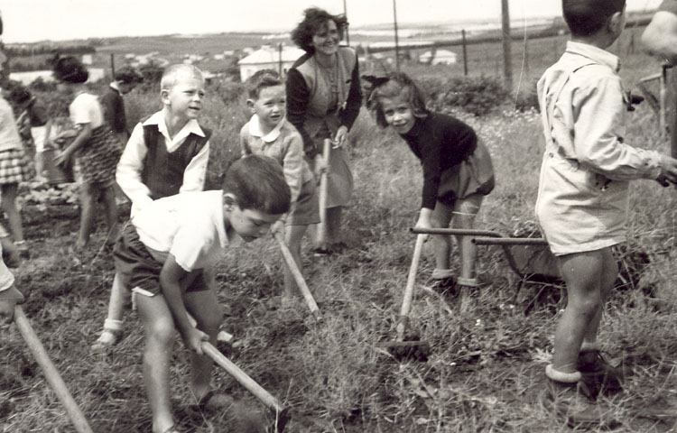
Ein Vered on:
[Wikipedia]
[Google]
[Amazon]
 Ein Vered () is a
Israel Tractor Museum
/ref>
 Ein Vered () is a
 moshav
A moshav (, plural ', "settlement, village") is a type of Israeli village or town or Jewish settlement, in particular a type of cooperative agricultural community of individual farms pioneered by the Labour Zionists between 1904 and 1 ...
in central Israel. Located in the Sharon plain, it falls under the jurisdiction of Lev HaSharon Regional Council
Lev HaSharon Regional Council () is a regional council in the Sharon region of the Central District of Israel.
History
The council was established in 1984, unifying Hadar HaSharon and Northern Sharon regional councils, and covers 18 villages wi ...
. In it had a population of .
History
Before the 20th century the area formed part of the Forest of Sharon. It was an openwoodland
A woodland () is, in the broad sense, land covered with woody plants (trees and shrubs), or in a narrow sense, synonymous with wood (or in the U.S., the '' plurale tantum'' woods), a low-density forest forming open habitats with plenty of sunli ...
dominated by Mount Tabor Oak, which extended from Kfar Yona
Kfar Yona () is a city in the Central District (Israel), Central District of Israel. It is located between the cities Netanya and Tulkarm, about 8 km east of Netanya in the central junction between Highway 6 (Israel), Highway 6 and Highway 4 ...
in the north to Ra'anana
Ra'anana () is an affluent city in the southern Sharon, Israel, Sharon Plain of the Central District (Israel), Central District of Israel. It was founded in 1922 as an American-Jewish settlement, 1 km south of the village of Tabsur, where a ...
in the south. The local inhabitants traditionally used the area for pasture, firewood and intermittent cultivation. The intensification of settlement and agriculture in the coastal plain
A coastal plain (also coastal plains, coastal lowland, coastal lowlands) is an area of flat, low-lying land adjacent to a sea coast. A fall line commonly marks the border between a coastal plain and an upland area.
Formation
Coastal plains can f ...
during Ottoman rule in the 19th century led to deforestation and subsequent environmental degradation
Environment most often refers to:
__NOTOC__
* Natural environment, referring respectively to all living and non-living things occurring naturally and the physical and biological factors along with their chemical interactions that affect an organism ...
.
Ein Vered was established in the southern Sharon in 1930, by South African Jewry on land purchased by the Jewish National Fund
The Jewish National Fund (JNF; , ''Keren Kayemet LeYisrael''; previously , ''Ha Fund HaLeumi'') is a non-profit organizationProfessor Alon Tal, The Mitrani Department of Desert Ecology, The Blaustein Institutes for Desert Research, Ben Gurion ...
, and named after Ayun el Werdat'' (Arabic for "the Springs of the Water Female Water Drawers"), the wells serving the area. It was originally an intensive farming community. In 1947 it had a population of 450.
Citrus groves, field crops, beehives and flowers were the principal branches of agriculture.
Landmarks
A Tractor Museum is located in Ein Vered./ref>
References
{{Lev HaSharon Regional Council Moshavim Populated places established in 1930 Jewish villages in Mandatory Palestine Populated places in Central District (Israel) 1930 establishments in Mandatory Palestine South African-Jewish culture in Israel