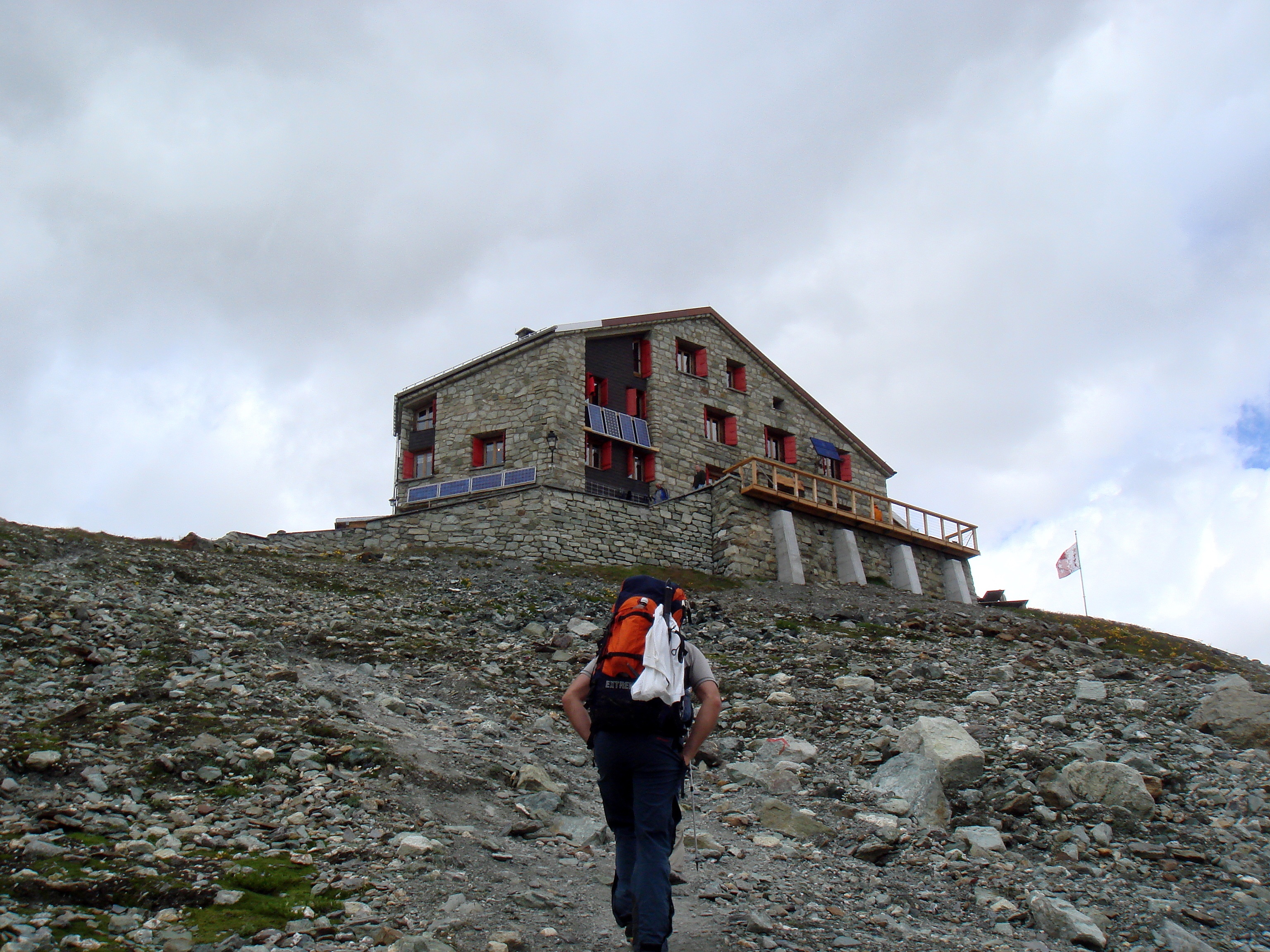
Dix Hut on:
[Wikipedia]
[Google]
[Amazon]
 The Dix Hut ( French: ''Cabane des Dix'') is a
 The Dix Hut ( French: ''Cabane des Dix'') is a
 mountain hut
A mountain hut is a building located at high elevation, in mountainous terrain, generally accessible only by foot, intended to provide food and shelter to mountaineering, mountaineers, climbing, climbers and Hiking, hikers. Mountain huts are us ...
of the Swiss Alpine Club
The Swiss Alpine Club (, , , ) is the largest mountaineering club in Switzerland. It was founded in 1863 in Olten and it is now composed of 110 sections with 174,726 members (2023). These include the Association of British Members of the Swiss ...
, located south of Hérémence in the canton of Valais
Valais ( , ; ), more formally, the Canton of Valais or Wallis, is one of the cantons of Switzerland, 26 cantons forming the Switzerland, Swiss Confederation. It is composed of thirteen districts and its capital and largest city is Sion, Switzer ...
. The hut lies above the Cheilon Glacier, at a height of 2,928 metres above sea level, approximately halfway between the Lac des Dix
Lac may refer to:
Places Africa
* Lac Region, a district in Chad
* Lac Prefecture, a district in Chad
America
*Rivière du Lac, a tributary of the Montmorency River, in Capitale-Nationale, Quebec, Canada
Europe
* Laç, a city in Albania
* Lac, ...
and the Mont Blanc de Cheilon
Mont Blanc de Cheilon (also spelled ''Mont Blanc de Seilon'') is a mountain of the Pennine Alps, located in the Swiss canton of Valais. The mountain lies between the valleys of Bagnes and Arolla. Culminating at 3,870 metres above sea level, it i ...
.
The Dix Hut is the starting point of the ascents of Mont Blanc de Cheilon, Pigne d'Arolla
Pigne d'Arolla (3,787 m) is a mountain in the Pennine Alps in Switzerland. The first ascent was made by A. W. Moore and Horace Walker with the guide Jakob Anderegg on 9 July 1865. It is commonly climbed as part of the Haute Route
The Haute ...
and La Luette. The shortest accesses to the hut are from Arolla
Arolla is a village in the municipality of Evolène in the Swiss canton of Valais. It is situated at the end of the Val d'Hérens, south of the cantonal capital, Sion.
Geography
Arolla is situated at 1998 m above sea level, at the foot of ...
(via the Chèvres/Riedmatten Pass) and from the Grande Dixence Dam.
References
*Swisstopo
Swisstopo is the official name for the Swiss Federal Office of Topography, Switzerland's national mapping agency.
The current name was made official in 2002. It had been used as the domain name for the homepage of the instituteswisstopo.admi ...
topographic maps
External links
* {{coord, 46, 00, 40, N, 7, 25, 04, E, region:CH-VS_type:landmark, display=title Mountain huts in Switzerland Buildings and structures in Valais Mountain huts in the Alps