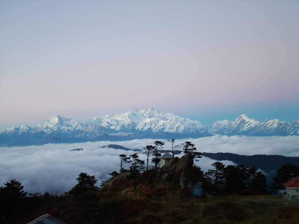
Darjeeling Himalayan Hill Region on:
[Wikipedia]
[Google]
[Amazon]
Darjeeling Himalayan hill region, also known as the Darjeeling Hills or Darjeeling Himalaya, is a mountainous area on the north-western side of the state of

West Bengal
West Bengal (; Bengali language, Bengali: , , abbr. WB) is a States and union territories of India, state in the East India, eastern portion of India. It is situated along the Bay of Bengal, along with a population of over 91 million inhabi ...
in India
India, officially the Republic of India, is a country in South Asia. It is the List of countries and dependencies by area, seventh-largest country by area; the List of countries by population (United Nations), most populous country since ...
. This region belongs to the Eastern Himalaya
]
The Eastern Himalayas extend from eastern Nepal across Northeast India, Bhutan, the Tibet Autonomous Region to Yunnan in China and northern Myanmar. The climate of this region is influenced by the monsoon of South Asia from June to September. It ...
range. The Darjeeling district except the Siliguri subdivision and the entire Kalimpong district constitute this region. It arises abruptly from the Terai region. The region slopes from a south to north direction. The river Teesta divides the region in two parts — the region to the east of Teesta and the region to the west of Teesta.
Hills to the west of Teesta
This is the highest region of the Darjeeling Himalayan Hill Region. Two distinct ranges are visible here — the Singalila range and the Darjeeling-Kurseong range.Singalila range
The Singalila range is on the western limit of the region and separatesNepal
Nepal, officially the Federal Democratic Republic of Nepal, is a landlocked country in South Asia. It is mainly situated in the Himalayas, but also includes parts of the Indo-Gangetic Plain. It borders the Tibet Autonomous Region of China Ch ...
from West Bengal. Singalila National Park is situated here. The four highest peaks of this range are:
# Phalut (3,595 m)
#Sandakphu
Sandakphu or Sandakpur at is a mountain peak in the Singalila Ridge on the border between India and Nepal. It is the highest point of the ridge and of the state of West Bengal, India. The peak is located at the edge of the Singalila Nation ...
(3,630 m) — the highest point of West Bengal
# Tonglu (3,036 m)
#Sabargram (3,543 m)
See: Singalila Ridge

Darjeeling-Kurseong range
Two notable peaks of this range are Tiger Hill and Senchal.Hills to the east of Teesta
The Chola range is situated on theSikkim
Sikkim ( ; ) is a States and union territories of India, state in northeastern India. It borders the Tibet Autonomous Region of China in the north and northeast, Bhutan in the east, Koshi Province of Nepal in the west, and West Bengal in the ...
-Bhutan
Bhutan, officially the Kingdom of Bhutan, is a landlocked country in South Asia, in the Eastern Himalayas between China to the north and northwest and India to the south and southeast. With a population of over 727,145 and a territory of , ...
border. The highest peak is Wrishila. Kalimpong district is situated in this region. Neora Valley National Park is located here.
Rivers
Some notable rivers of this region are Mechi, Balason, Rammam, Rangeet, Teesta, and Jaldhaka. Teesta river is a 309 km (192 mi) long river flowing through the Indian states of West Bengal and Sikkim through Bangladesh before emptying into the Brahmaputra River.References
* Basu, S.R.; Moulik, D. 2002. ''Madhyamik Bhugol''. ''Prantik'', Kolkata. * Barun Roy, "Rediscovering Shangri La - The Story of the Himalayas", Mandalay Book (2006) * Khawas, V. "Environment and rural development in Darjeeling Himalaya: Issues and concerns", http://www.mtnforum.org/oldocs/189.pdf {{West Bengal Gorkhaland Landforms of West Bengal Geography of Darjeeling district