Crantock on:
[Wikipedia]
[Google]
[Amazon]
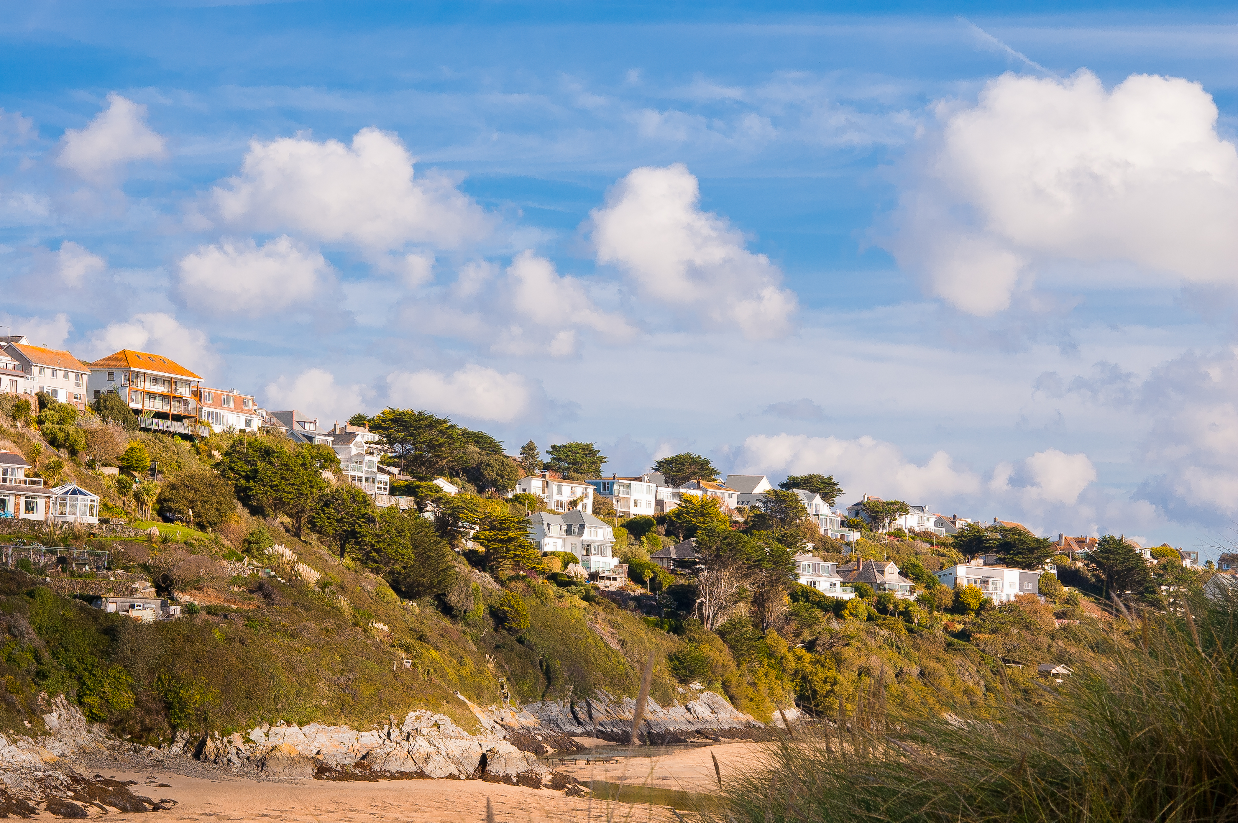
Crantock () is a coastal

 Like several other sandy beaches in the Newquay area, Crantock Beach is popular for
DMOZ page for Crantock
{{authority control Villages in Cornwall Civil parishes in Cornwall Populated coastal places in Cornwall Beaches of Cornwall Surfing locations in Cornwall
civil parish
In England, a civil parish is a type of administrative parish used for local government. It is a territorial designation which is the lowest tier of local government. Civil parishes can trace their origin to the ancient system of parishes, w ...
and village in Cornwall
Cornwall (; or ) is a Ceremonial counties of England, ceremonial county in South West England. It is also one of the Celtic nations and the homeland of the Cornish people. The county is bordered by the Atlantic Ocean to the north and west, ...
, England, two miles (3 km) southwest of Newquay
Newquay ( ; ) is a town on the north coast in Cornwall, England, United Kingdom. It is a civil parishes in England, civil parish, seaside resort, regional centre for aerospace industries with an airport and a spaceport, and a fishing port on t ...
.
In 460, a group of Irish hermits founded an oratory there. The village lies to the south of the River Gannel
The River Gannel (, meaning '' lovage river'') rises in the village of Indian Queens in mid Cornwall, England, United Kingdom. It flows north under Trevemper Bridge and becomes a tidal estuary, the Gannel (, meaning ''the Channel''), that divi ...
, which forms the boundary between the parishes of Newquay
Newquay ( ; ) is a town on the north coast in Cornwall, England, United Kingdom. It is a civil parishes in England, civil parish, seaside resort, regional centre for aerospace industries with an airport and a spaceport, and a fishing port on t ...
and Crantock. The River Gannel is tidal and ferries operate on a seasonal basis from Fern Pit to Crantock Beach. The River Gannel runs along Crantock Beach and joins the Celtic Sea
The Celtic Sea is the area of the Atlantic Ocean off the southern coast of Ireland bounded to the north by St George's Channel, Saint George's Channel; other limits include the Bristol Channel, the English Channel, and the Bay of Biscay, as wel ...
. The village can be reached from the A3075 road via the junction at Trevemper. The hamlets of Treninnick and West Pentire are in the parish.
Large parts of the parish are now in the ownership of the National Trust
The National Trust () is a heritage and nature conservation charity and membership organisation in England, Wales and Northern Ireland.
The Trust was founded in 1895 by Octavia Hill, Sir Robert Hunter and Hardwicke Rawnsley to "promote the ...
, including West Pentire headland which is a Site of Special Scientific Interest
A Site of Special Scientific Interest (SSSI) in Great Britain, or an Area of Special Scientific Interest (ASSI) in the Isle of Man and Northern Ireland, is a conservation designation denoting a protected area in the United Kingdom and Isle ...
noted for its wild flowers and rare plants.
History and antiquities
''The Gannel Estuary, Cornwall: Archaeological and Historical Assessment,'' published by the ''Cornwall Archaeological Unit'' concluded that human activity around the Gannel could be dated to theMesolithic
The Mesolithic (Ancient Greek language, Greek: μέσος, ''mesos'' 'middle' + λίθος, ''lithos'' 'stone') or Middle Stone Age is the Old World archaeological period between the Upper Paleolithic and the Neolithic. The term Epipaleolithic i ...
period. The earliest development in the area is Treringey Round, a roughly-rectangular area enclosed by bank 1 metre high and an outer ditch 1.3 metres deep. It is of unknown pre-historic date. Treringey Round is located at the end of an ancient route at the head of the (then) navigable Gannel estuary.
The older part of Crantock village is situated around its church which is dedicated to St Carantoc, founder of the village. At one time the parish was known as ''Langurroc'' which translates as – ''The Dwelling of Monks''. There is a Langurroc Road in the village. Langurroc was infamously (among locals) covered up in a sandstorm and may well lie beneath the sand dunes which back Crantock Beach.
St Carantoc's Church was founded in Norman times and was originally cruciform, but was reconstructed in the 14th and 15th centuries: restoration was carried out during the period 1899–1902 by E. H. Sedding, who died in 1921 and is buried in the churchyard. The font
In metal typesetting, a font is a particular size, weight and style of a ''typeface'', defined as the set of fonts that share an overall design.
For instance, the typeface Bauer Bodoni (shown in the figure) includes fonts " Roman" (or "regul ...
is Norman and the rood screen
The rood screen (also choir screen, chancel screen, or jubé) is a common feature in late medieval church architecture. It is typically an ornate partition between the chancel and nave, of more or less open tracery constructed of wood, stone, o ...
is much restored. The church was collegiate from ca. 1236 to the Reformation
The Reformation, also known as the Protestant Reformation or the European Reformation, was a time of major Theology, theological movement in Western Christianity in 16th-century Europe that posed a religious and political challenge to the p ...
.
Village hall and annual events
The local village hall has recently undergone a transformation, with money from the National Lottery, the awarding of which was featured on ITV's ''Westcountry Live'' television programme. The playing field on which the hall is situated was also given a new lease of life and now includes a basketball hoop, climbing facilities, and cricket and football pitches. The village hall is now three times larger than it was and was the centrepiece of 2007's annual "Jazz in the Park". The village also hosts a street fair known as the "Crantock Summer Fiesta" which has a coconut shy, tombola, raffle and many other stalls. In 2006, the village held its second annual ''"big bale push"'' involving locals pushing tightly packed straw cylinders around the roads of the village, which are closed for the event. The first event raised over £800 and in the ensuing years the total has grown to over £50,000 which has been donated to key charities close to the heart of the local community.Beaches

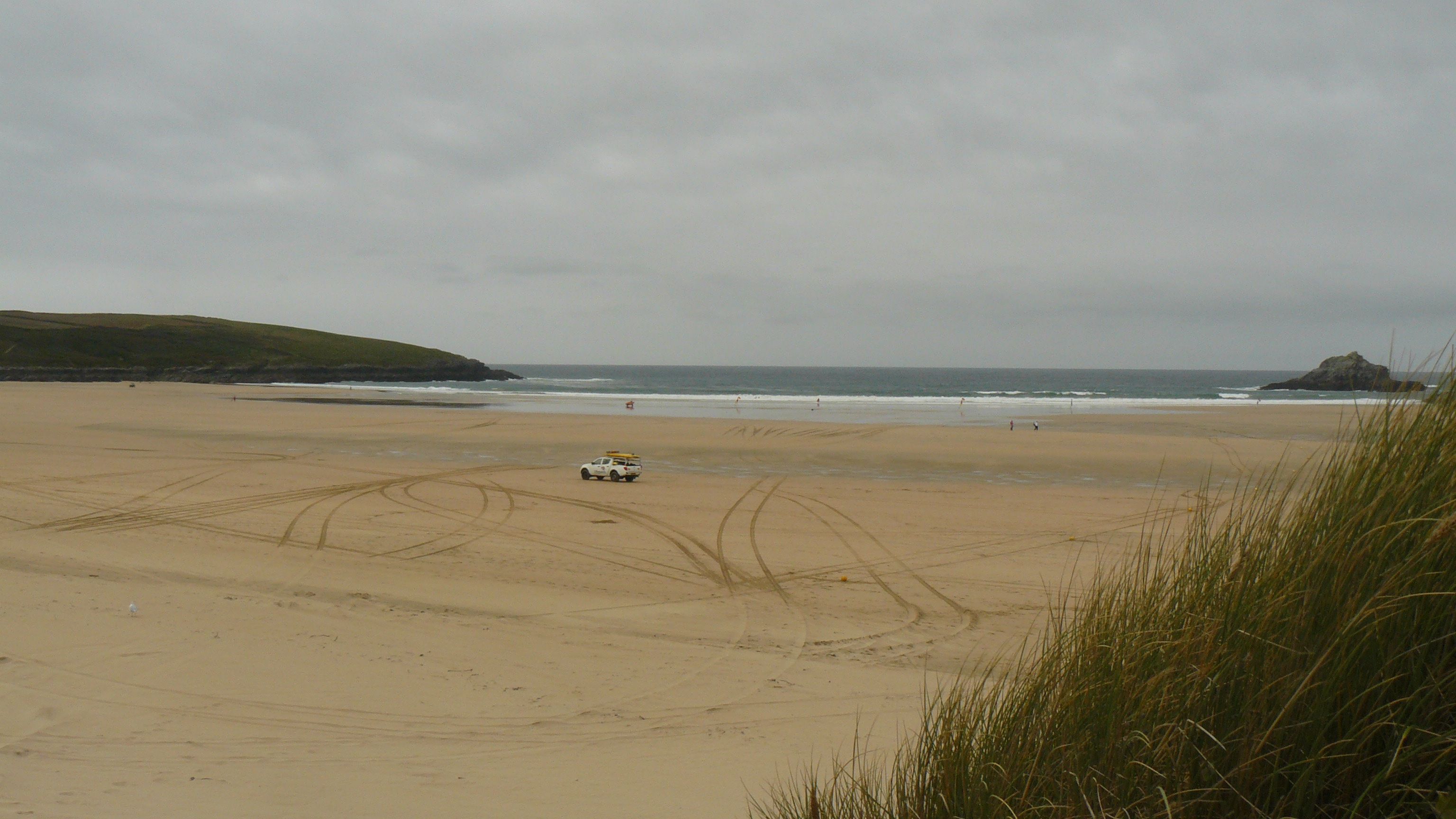
 Like several other sandy beaches in the Newquay area, Crantock Beach is popular for
 surfing
Surfing is a surface water sport in which an individual, a surfer (or two in tandem surfing), uses a board to ride on the forward section, or face, of a moving wave of water, which usually carries the surfer towards the shore. Waves suita ...
. There are car parks at Crantock Beach and West Pentire. The beach is backed by sand dunes
A dune is a landform composed of wind- or water-driven sand. It typically takes the form of a mound, ridge, or hill. An area with dunes is called a dune system or a dune complex. A large dune complex is called a dune field, while broad, flat ...
. In 2014 storms caused the collapse of a retaining wall which caused the River Gannel to change course, meandering across the beach. This has resulted in erosion of the base of sand dunes, with the danger of collapse. Since January 2016 the Gannel estuary, including the beach, as far as the tidal limit, has been part of the Newquay and the Gannel Marine Conservation Zone
A Marine Conservation Zone (MCZ) is a type of marine nature reserve in United Kingdom, UK waters. They were established under the Marine and Coastal Access Act 2009, Marine and Coastal Access Act (2009) and are areas designated with the aim to prot ...
, and the headland, above the beach, at West Pentire is a Site of Special Scientific Interest
A Site of Special Scientific Interest (SSSI) in Great Britain, or an Area of Special Scientific Interest (ASSI) in the Isle of Man and Northern Ireland, is a conservation designation denoting a protected area in the United Kingdom and Isle ...
. In June 2023 part of the beach was closed after the collapse of a section of the 65ft (20m) high dunes.
Rock carving
At the left hand side of the beach, low tide reveals a carving into a rock, showing a picture of a woman's face, and the inscription "Mar not my face but let me be, Secure in this lone cave by the sea, Let the wild waves around me roar, Kissing my lips for evermore". Supposedly, in the early 20th century a woman was horse riding along Crantock Beach. She and her horse were cut off as the tide came in and the rough seas swept them away, drowning them both. Her distraught lover carved a poem into a rock in a cave on the beach, along with a portrait of his lost love and her horse. The carvings are said to be the work of a local man, Joseph Prater. It is unclear who Joseph Prater was. The brothers Joseph and William Prater are known to be two members of an artistic family who rented a couple of studio huts on the cliff top above Crantock beach. Another candidate for the artwork is Joseph Henry Prater who worked and lived as a dairyman on his father’s farm just above the cave. The identity of the woman depicted in the carving is also not known, though an Ethel de Medina Greenstreet nee Spender, a journalist, drowned on Crantock Beach in 1904. One source attributes the carving of the horse to be the work of a local man, James Dyer, who created the carving in the 1940s.Coastal footpath
The coastal footpath skirts all along the west side of the parish. Walking from Crantock the path leads to a sandy cove called Porth Joke, also known as "Polly Joke". Its name comes from the Cornish "''porth lojowek''" meaning "cove abounding in vegetation". In later Cornish this became ''Por Lejowak''. This cove is entirely surrounded by National Trust land and has been virtually unchanged over the centuries. Further along the coast path is the village ofHolywell
Holywell may refer to:
England
* Holywell, Bedfordshire
* Holywell, Cambridgeshire
* Holywell, Cornwall
* Holywell, Dorset
* Holywell, Eastbourne, East Sussex
* Holywell, Gloucestershire, a List of United Kingdom locations: Ho-Hoo#Hol, location in ...
, with a larger sandy beach at Holywell Bay.
Twinning
* Karanteg, Brittany, FranceSee also
Places also associated with St Carantoc include: * St Carantoc's Church, Crantock * Carhampton, Somerset *Llangrannog
Llangrannog (; sometimes spelt as Llangranog) is a village and Community (Wales), community in Ceredigion, Wales, southwest of New Quay. It lies in the narrow valley of the River Hawen, which falls as a waterfall near the middle of the villag ...
, Ceredigion
Ceredigion (), historically Cardiganshire (, ), is a Principal areas of Wales, county in the West Wales, west of Wales. It borders Gwynedd across the River Dyfi, Dyfi estuary to the north, Powys to the east, Carmarthenshire and Pembrokeshire t ...
, Wales
* Carantec, Finistère, Brittany, France
References
* Henderson, Charles (1928) ''St Carantoc'' * Doble, G. H. (1965) ''The Saints of Cornwall'', Part 4. Truro: Dean and Chapter * Bowen, E. G. (1969) ''Saints, Seaways and Settlements in the Celtic Lands''. Cardiff: University of Wales PressExternal links
DMOZ page for Crantock
{{authority control Villages in Cornwall Civil parishes in Cornwall Populated coastal places in Cornwall Beaches of Cornwall Surfing locations in Cornwall