Coyote Gulch on:
[Wikipedia]
[Google]
[Amazon]
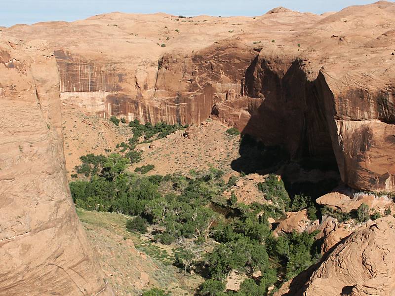
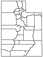
 Coyote Gulch is a tributary of the Escalante River, located in
 The main canyon of Coyote Gulch can be accessed by one of several trailheads located along the Hole-in-the-Rock Road (HITRR). The HITRR is an unpaved road that heads southeast into the Grand Staircase–Escalante National Monument, branching off Utah Scenic Byway 12 about east of Escalante. The Red Well trailhead is at the end of a short spur road off the HITRR, and leads into the main channel near its junction with Big Hollow Wash. The trail into Hurricane Wash starts just off the HITRR. A trailhead located near some stock watering tanks along Fortymile Ridge Roadanother spur of the HITRRcan be used for a cross-country route to the middle of Coyote Gulch. This route involves a rather steep climb over slick rock. A trailhead at the end of the Fortymile Ridge Road leads to the junction of Coyote Gulch, the Escalante River, and Stevens Canyon. This route involves squeezing through a crack in the rim of the canyonreferred to as the Crack-in-the-Wall routeand then descending down the face of a high sand dune.
 The northernmost branch of Coyote Gulchcalled the Dry Forkis one of the most popular destinations in the area. A short spur road leads off from the Hole-in-the-Rock Road to a trailhead above the
File:Coyote Natural Bridge, UT.jpg, Coyote Natural Bridge
File:StevensArchUT.jpg, Stevens Arch
File:PeekaBoo.jpg, Peek-a-Boo Gulch
Grand Staircase-Escalante National Monument
TopoQuest Map
{{authority control Canyons and gorges of Utah Rivers of Utah Tributaries of the Colorado River in Utah Grand Staircase–Escalante National Monument Glen Canyon National Recreation Area Rivers of Garfield County, Utah Rivers of Kane County, Utah Geologic formations of Utah Geologic formations with imbedded sand dunes
 Coyote Gulch is a tributary of the Escalante River, located in
 Garfield
''Garfield'' is an American comic strip created by Jim Davis (cartoonist), Jim Davis. Originally published locally as ''Jon'' in 1976 (later changed to ''Garfield'' in 1977), then in nationwide Print syndication, syndication from 1978, it chro ...
and Kane Counties in southern Utah
Utah is a landlocked state in the Mountain states, Mountain West subregion of the Western United States. It is one of the Four Corners states, sharing a border with Arizona, Colorado, and New Mexico. It also borders Wyoming to the northea ...
, in the western United States. Over long,"Canyons of the Escalante", Trails Illustrated Map (1994), Coyote Gulch exhibits many of the geologic features found in the Canyons of the Escalante, including high vertical canyon walls, narrow slot canyon
A slot canyon is a long, narrow channel or drainageway with sheer rock walls that are typically eroded into either sandstone or other sedimentary rock. A slot canyon has depth-to-width ratios that typically exceed 10:1 over most of its length and ...
s, domes, arches, and natural bridges. The upper sections of Coyote Gulch are located within the Grand Staircase–Escalante National Monument
The Grand Staircase–Escalante National Monument (GSENM) is a United States national monument protecting the Grand Staircase, the Kaiparowits Plateau, and the Canyons of the Escalante (Escalante River) in southern Utah. It was established in 19 ...
, while its lower sections are located in the Glen Canyon National Recreation Area.
The headwaters of Coyote Gulch originates along a segment of the Straight Cliffs Formation
The Straight Cliffs Formation is a stratigraphic unit in the Kaiparowits Plateau of south central Utah. It is Late Cretaceous (latest Turonian – early Campanian) in age and contains fluvial (river systems), paralic (swamps and lagoons), and m ...
which is the eastern edge of the Kaiparowits Plateau. Intermittent streams flowing down the Straight Cliffs merge to form larger branches, including ''Dry Fork'', ''Big Hollow'', the main branch of Coyote Gulch, and Hurricane Wash. The combined flow from these branches has carved a canyon
A canyon (; archaic British English spelling: ''cañon''), gorge or chasm, is a deep cleft between escarpments or cliffs resulting from weathering and the erosive activity of a river over geologic time scales. Rivers have a natural tendency t ...
up to deep into sandstone layers before meeting the Escalante River.
Canyon access
 The main canyon of Coyote Gulch can be accessed by one of several trailheads located along the Hole-in-the-Rock Road (HITRR). The HITRR is an unpaved road that heads southeast into the Grand Staircase–Escalante National Monument, branching off Utah Scenic Byway 12 about east of Escalante. The Red Well trailhead is at the end of a short spur road off the HITRR, and leads into the main channel near its junction with Big Hollow Wash. The trail into Hurricane Wash starts just off the HITRR. A trailhead located near some stock watering tanks along Fortymile Ridge Roadanother spur of the HITRRcan be used for a cross-country route to the middle of Coyote Gulch. This route involves a rather steep climb over slick rock. A trailhead at the end of the Fortymile Ridge Road leads to the junction of Coyote Gulch, the Escalante River, and Stevens Canyon. This route involves squeezing through a crack in the rim of the canyonreferred to as the Crack-in-the-Wall routeand then descending down the face of a high sand dune.
Features
The sandy streambed of Coyote Gulch, typically just a few inches/centimeters deep, provides a path for wading through the trees and vegetation lining the bottom of the canyon. Near the middle of the main canyon's length isJacob Hamblin
Jacob Hamblin (April 2, 1819 – August 31, 1886) was a Western pioneer, a missionary for the Church of Jesus Christ of Latter-day Saints (LDS Church), and a diplomat to various Native American tribes of the Southwest and Great Basin. He a ...
Archalso known as Lobo Archwhich is large enough to reach under an overhang on the opposite side of the canyon. Further downstream within the canyon is ''Coyote Natural Bridge'' a small hole carved in a large sandstone fin. Still further downstream is ''Cliff Arch'', a jug-handle style arch in the north wall of the canyon. Finally, just outside the mouth of the canyon and high above the Escalante River is ''Stevens Arch'' with an opening approximately wide.
There are also numerous small waterfalls and cascades in the canyon between Jacob Hamblin Arch and the confluence with the Escalante River. Some of these waterfalls can be easily climbed, but others must be bypassed.
Dry Fork
 The northernmost branch of Coyote Gulchcalled the Dry Forkis one of the most popular destinations in the area. A short spur road leads off from the Hole-in-the-Rock Road to a trailhead above the
 wash
Wash or the Wash may refer to:
Industry and sanitation
* WASH or WaSH, "water, sanitation and hygiene", three related public health issues
* Wash (distilling), the liquid produced by the fermentation step in the production of distilled beverages
...
. A brief descent to the canyon floor leads to several tributary slot canyon
A slot canyon is a long, narrow channel or drainageway with sheer rock walls that are typically eroded into either sandstone or other sedimentary rock. A slot canyon has depth-to-width ratios that typically exceed 10:1 over most of its length and ...
s. The Dry Fork is an excellent example of how occasional flash floods over long periods of time have carved narrow grooves into the Navajo Sandstone. Approximately deep, the Dry Fork slot can be followed upstream for several hundred yards/meters. Just downstream from the mouth of the Dry Fork is Peekaboo Gulch which has carved an even narrower channel into the sandstone, leading to a tube that empties into the dry wash of the main streambed. Further downstream, Spooky Gulch is over deep, but the channel rarely widens to more than , forcing hikers to remove their backpacks and walk sideways. Finally, even further downstream in the main wash, Brimstone Gulch is the last named slot canyon in the Dry Fork area and is even narrower than Spooky Gulch, eventually reaching a width that is impassable to all hikers except animals smaller than mice and insects.
Gallery
See also
*List of canyons and gorges in Utah
This is a partial list of canyons in the U.S. state of Utah along with any rivers, roads, and other features (such as rail lines) that pass through them.
See also
External links
{{DEFAULTSORT:Canyons and gorges in Utah
Canyons and g ...
* List of rivers of Utah
This is a list of rivers in the U.S. state of Utah in the United States, sorted by drainage basin, watershed.
Colorado River
The Colorado River is a major river in the Western United States, emptying into the Gulf of California. Rivers are liste ...
References
Further reading
* "Hiking the Escalante", by Rudi Lambrechtse (1985), * "Canyon Hiking Guide to the Colorado Plateau", by Michael R. Kelsey (1995), * "Canyoneering 3: Loop Hikes in Utah's Escalante"' by Steve Allen (1997),External links
Grand Staircase-Escalante National Monument
TopoQuest Map
{{authority control Canyons and gorges of Utah Rivers of Utah Tributaries of the Colorado River in Utah Grand Staircase–Escalante National Monument Glen Canyon National Recreation Area Rivers of Garfield County, Utah Rivers of Kane County, Utah Geologic formations of Utah Geologic formations with imbedded sand dunes