Colsterdale on:
[Wikipedia]
[Google]
[Amazon]
Colsterdale is the valley of the River Burn, a tributary of the  Although Colsterdale is not in
 Colsterdale was historically divided between the parishes of
River Ure
The River Ure in North Yorkshire, England is approximately long from its source to the point where it becomes the River Ouse. It is the principal river of Wensleydale, which is the only major dale now named after a village rather than its ...
, in the Yorkshire Dales
The Yorkshire Dales is an upland area of the Pennines in the historic county of Yorkshire, England, most of it in the Yorkshire Dales National Park created in 1954.
The Dales comprise river valleys and the hills rising from the Vale of York ...
in North Yorkshire
North Yorkshire is the largest ceremonial county (lieutenancy area) in England, covering an area of . Around 40% of the county is covered by national parks, including most of the Yorkshire Dales and the North York Moors. It is one of four cou ...
, England. It gives its name to a hamlet and civil parish
In England, a civil parish is a type of Parish (administrative division), administrative parish used for Local government in England, local government. It is a territorial designation which is the lowest tier of local government below district ...
in the upper part of the dale, about west of Masham
Masham ( ) is a market town and civil parish in the Harrogate district of North Yorkshire, England. It had a population of 1,205 at the 2011 census.
Etymology
In Wensleydale, on the western bank of the River Ure, the name derives from the An ...
. The population of the civil parish was estimated at 20 in 2010. The lower part of the dale around the hamlet of Gollinglith Foot
Gollinglith Foot (), historically also spelt Gownley Foot, is a hamlet in the civil parish of Healey in the Harrogate district of North Yorkshire, England. It lies on the River Burn near the foot of Colsterdale.
It takes its name from the moo ...
is in the civil parish of Healey. The area is in Harrogate district
The Borough of Harrogate is a local government district with borough status in North Yorkshire, England. Its population at the census of 2011 was 157,869. Its council is based in the town of Harrogate, but it also includes surrounding towns ...
.
 Although Colsterdale is not in
 Nidderdale
Nidderdale, historically also known as Netherdale, is one of the Yorkshire Dales (although outside the Yorkshire Dales National Park) in North Yorkshire, England. It is the upper valley of the River Nidd, which flows south underground and then ...
, it lies within the Nidderdale Area of Outstanding Natural Beauty.
Colsterdale is part of the privately owned Swinton Estate.
The Colsterdale towers are towers built between 1895 and 1911 to conduct surveys.
History
The name, first recorded in 1281, means "coalman valley". There was a coal mine here in the 14th century. Colsterdale was historically divided between the parishes of
 East Witton
East Witton is a village and civil parish in Wensleydale in North Yorkshire, England. It lies south of Leyburn, in the Richmondshire district. Richard Whiteley is buried there; he and his partner, Kathryn Apanowicz, lived in the village.
Th ...
and Masham in the North Riding of Yorkshire. The upper part of the inhabited dale, above Gollinglith Foot, was a detached part
An enclave is a territory (or a small territory apart of a larger one) that is entirely surrounded by the territory of one other state or entity. Enclaves may also exist within territorial waters. ''Enclave'' is sometimes used improperly to deno ...
of the parish of East Witton (from 1866 a detached part of the civil parish of East Witton Without), but in 1886 was transferred to the civil parish of Healey with Sutton, and in 1894 was created a separate civil parish. In 1934 of the uninhabited Masham Moor (including the uninhabited part of Colsterdale), an area common to the parishes of Masham and East Witton, was added to the civil parish of Colsterdale. The lower part of the dale became part of the civil parish of Healey with Sutton (known as Healey from 1934) in 1866.
During the First World War
World War I (28 July 1914 11 November 1918), often abbreviated as WWI, was one of the deadliest global conflicts in history. Belligerents included much of Europe, the Russian Empire, the United States, and the Ottoman Empire, with fig ...
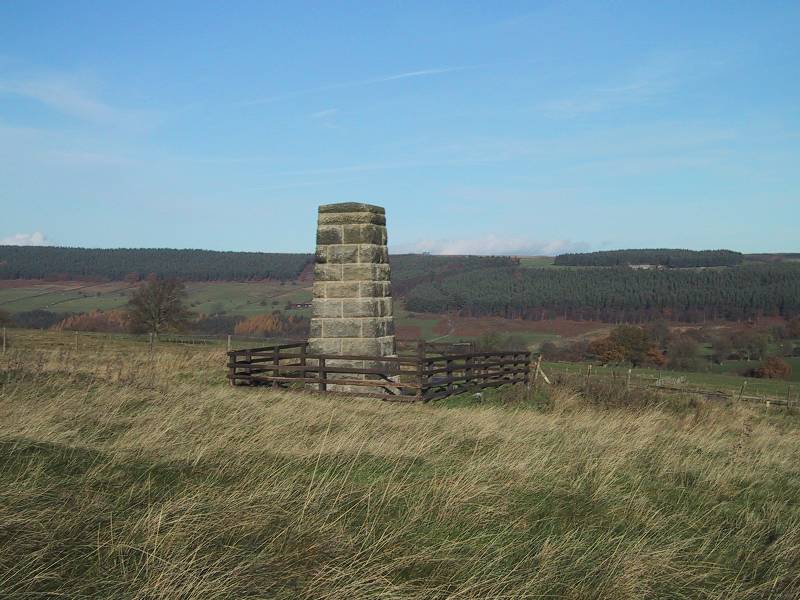
Colsterdale was the site of a training camp for the Leeds Pals. There is now a memorial to the Leeds Pals in the dale, erected in 1935. The camp later became a Prisoner of War camp
A prisoner-of-war camp (often abbreviated as POW camp) is a site for the containment of enemy fighters captured by a belligerent power in time of war.
There are significant differences among POW camps, internment camps, and military priso ...
for German Officers.
The parish now shares a grouped parish council, known as Fearby, Healey and District Parish Council, with Ellingstring, Fearby, Healey and Ilton cum Pott
Ilton is a village and civil parish in Somerset, England, situated south-east of Taunton, and north of Ilminster in the South Somerset district. The village has a population of 854. The parish includes the hamlets of Ilford and Cad G ...
.
References
External links
Villages in North Yorkshire Civil parishes in North Yorkshire Yorkshire Dales {{harrogate-geo-stub